MyTopo
Larose Louisiana US Topo Map
Couldn't load pickup availability
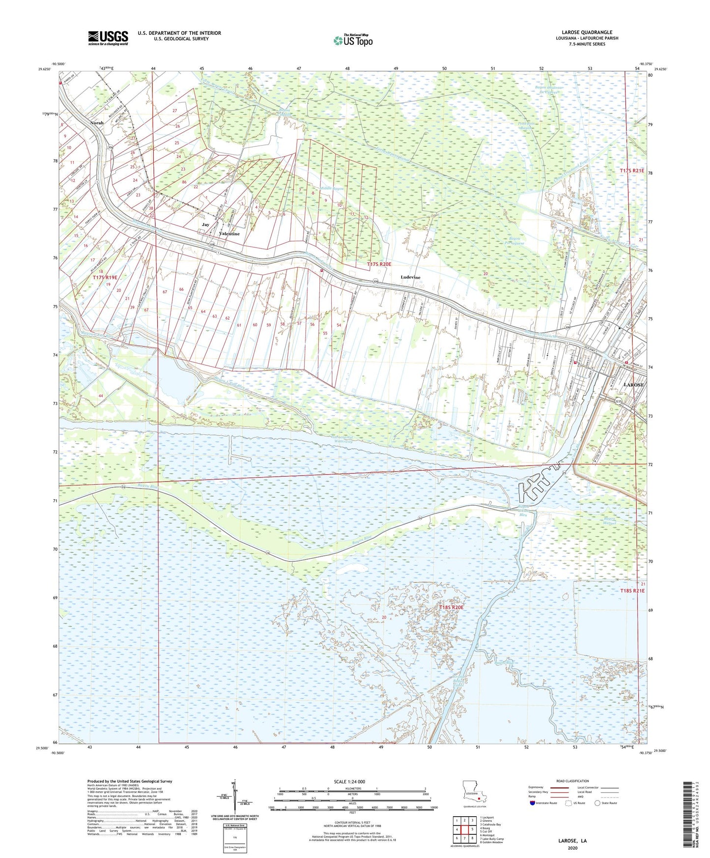
2024 topographic map quadrangle Larose in the state of Louisiana. Scale: 1:24000. Based on the newly updated USGS 7.5' US Topo map series, this map is in the following counties: Lafourche. The map contains contour data, water features, and other items you are used to seeing on USGS maps, but also has updated roads and other features. This is the next generation of topographic maps. Printed on high-quality waterproof paper with UV fade-resistant inks.
Quads adjacent to this one:
West: Bourg
Northwest: Lockport
North: Gheens
Northeast: Catahoula Bay
East: Cut Off
Southeast: Golden Meadow
South: Lake Bully Camp
Southwest: Montegut
This map covers the same area as the classic USGS quad with code o29090e4.
Contains the following named places: Bayou Coquille, Bayou L'Eau Bleu, Bayou Manuel, Bayou Portuguese, Canal Blue, Canal Tisamond Foret, Forty Arpent Canal, Grand Bois Gas Field, Holy Rosary Catholic School, Hospital Bayou, Jay, KBAU-FM (Galliano), KCIL-FM (Houma), Lafourche Fire District 3 East Larose Station, Lafourche Parish, Lafourche Parish Fire District 3 North Larose Station, Lafourche Parish Library Larose Branch, Larose, Larose Census Designated Place, Larose Post Office, Lockport Fire Department Valentine Station, Lockport Volunteer Fire Department 308 Station, Ludevine, Middle Bayou, Norah, North Larose Elementary School, Our Lady of the Rosary Catholic Church, Parish Governing Authority District 10, Parish Governing Authority District 7, Pointe Aux Chenes State Wildlife Management Area, Seventh District School, Valentine, Ward Nine