MyTopo
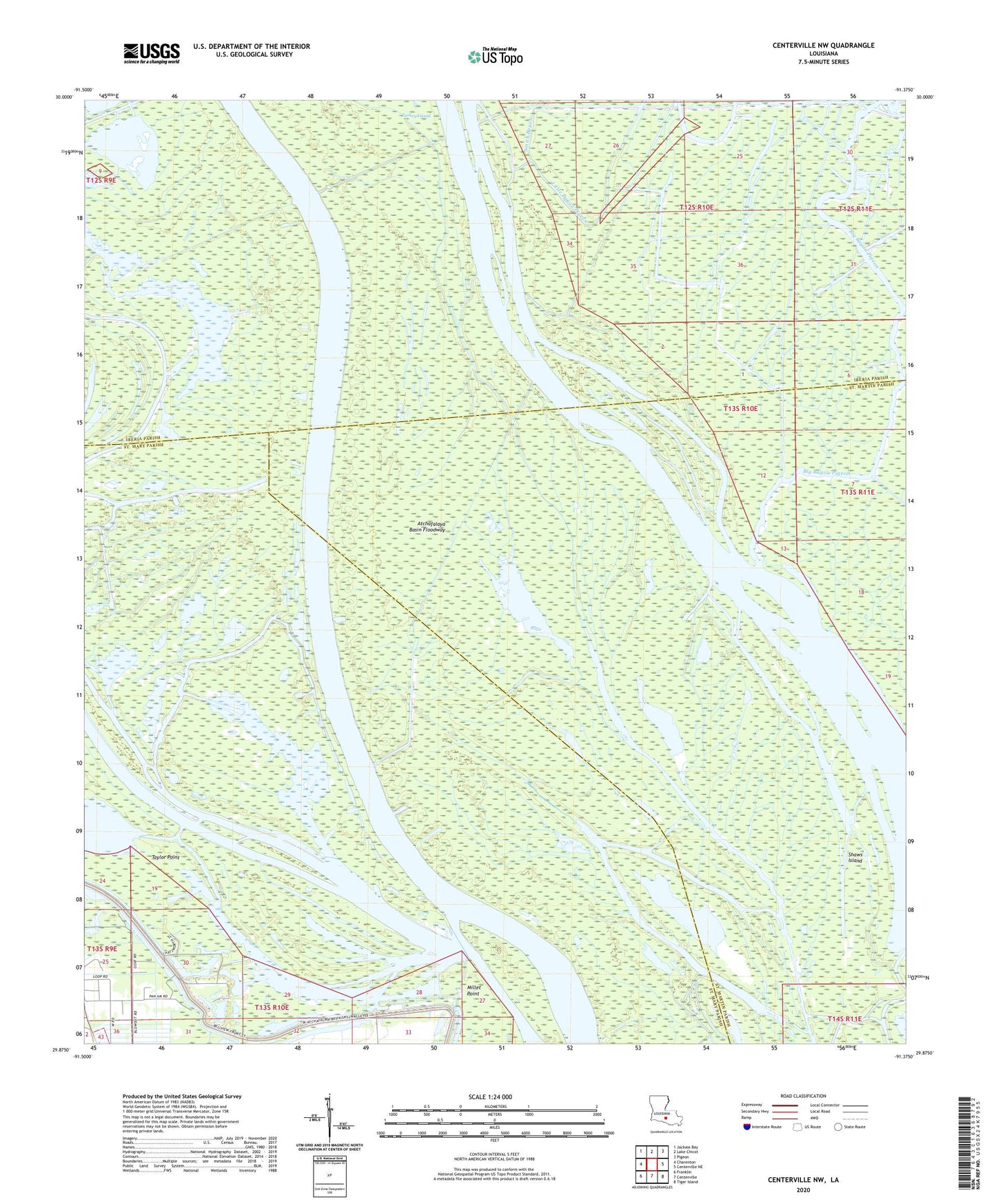
Centerville NW Louisiana US Topo Map
Couldn't load pickup availability
2024 topographic map quadrangle Centerville NW in the state of Louisiana. Scale: 1:24000. Based on the newly updated USGS 7.5' US Topo map series, this map is in the following counties: St. Mary, Iberia, St. Martin. The map contains contour data, water features, and other items you are used to seeing on USGS maps, but also has updated roads and other features. This is the next generation of topographic maps. Printed on high-quality waterproof paper with UV fade-resistant inks.
Quads adjacent to this one:
West: Charenton
Northwest: Jackass Bay
North: Lake Chicot
Northeast: Pigeon
East: Centerville NE
Southeast: Tiger Island
South: Centerville
Southwest: Franklin
This map covers the same area as the classic USGS quad with code o29091h4.
Contains the following named places: Attakapas Island State Wildlife Managment Area, Bayou Grue, Big Bayou Pigeon, Charenton Oil and Gas Field, Grand Lake, Hooppole Bayou, Keelboat Pass, Little Bayou Pigeon, Mecom Cut, Millet Point, Myette Point Church, Myette Point Oil and Gas Field, Parish Governing Authority District 11, Shaws Island, Smith Bayou, Taylor Point