MyTopo
Charenton Louisiana US Topo Map
Couldn't load pickup availability
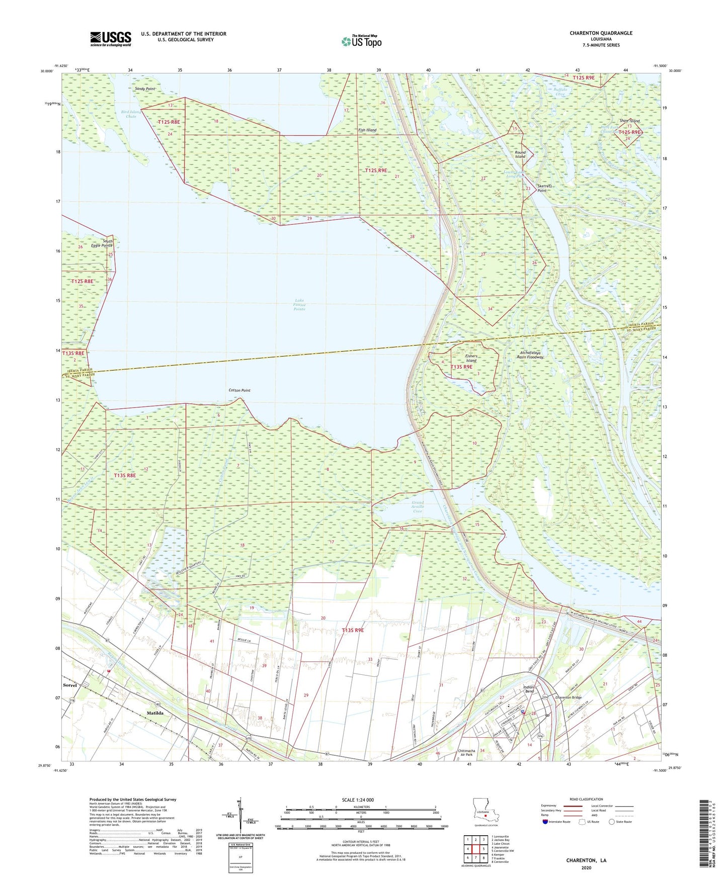
2024 topographic map quadrangle Charenton in the state of Louisiana. Scale: 1:24000. Based on the newly updated USGS 7.5' US Topo map series, this map is in the following counties: St. Mary, Iberia. The map contains contour data, water features, and other items you are used to seeing on USGS maps, but also has updated roads and other features. This is the next generation of topographic maps. Printed on high-quality waterproof paper with UV fade-resistant inks.
Quads adjacent to this one:
West: Jeanerette
Northwest: Loreauville
North: Jackass Bay
Northeast: Lake Chicot
East: Centerville NW
Southeast: Centerville
South: Franklin
Southwest: Kemper
This map covers the same area as the classic USGS quad with code o29091h5.
Contains the following named places: Bayou Gravenburg, Bayou Jean Lewis, Big Pass, Bird Island Chute, Buffalo Cove, Charenton, Charenton - Chitimacha Volunteer Fire Department, Charenton Bridge, Charenton Drainage and Navigation Canal, Charenton Post Office, Chitimacha Air Park, Chitimacha Reservation, Chitimacha Tribal Police Department, Chitimacha Tribal School, Cotton Canal, Cotton Point, Cypremort Post Office, Filly Bayou, Fish Island, Fishers Island, Grand Avoille Cove, Immaculate Conception Church, Indian Bend, Jeanerette Oil and Gas Field, Lake Fausse Pointe, Little Lake Long, Little Pass, Little Pass Baptist Church, Lower Lake Long Pass, Mary Hines Elementary School, Matilda, Mile Point Bayou, Mount Pleasant Church, Netpinunsh, Peche Coulee, Round Island, Saint Mary Parish Volunteer Fire Department Sorrel Community Sub Station 2, Saint Matthews Baptist Church, Saint Moses Baptist Church, Sandy Point, Shaw Island, Skerrett Point, Sorrel, Sorrel Census Designated Place, South Eagle Pointe, Victory Tabernacle, Ward One, West Fork Chicot Pass