MyTopo
Colfax Louisiana US Topo Map
Couldn't load pickup availability
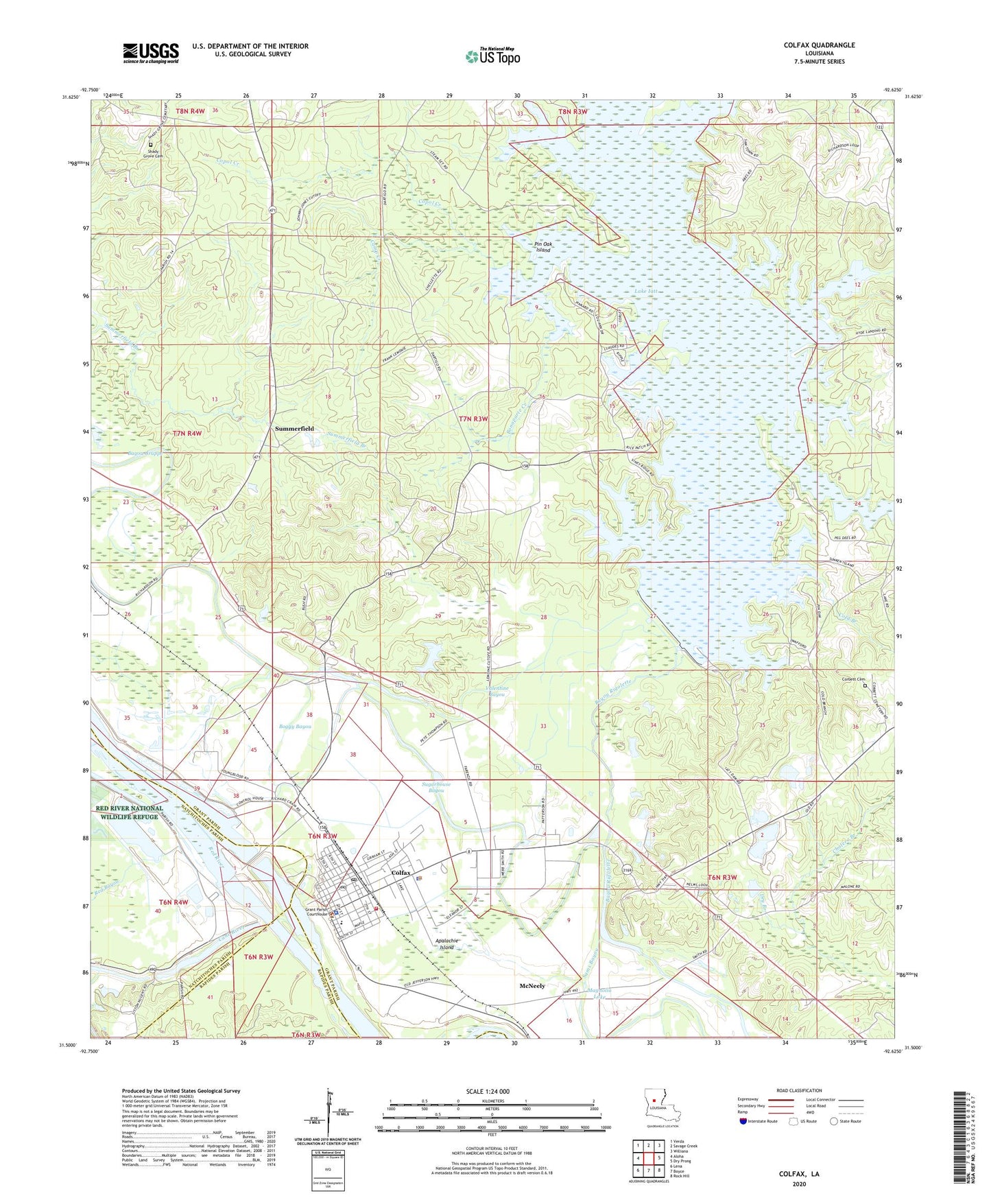
2024 topographic map quadrangle Colfax in the state of Louisiana. Scale: 1:24000. Based on the newly updated USGS 7.5' US Topo map series, this map is in the following counties: Grant, Natchitoches, Rapides. The map contains contour data, water features, and other items you are used to seeing on USGS maps, but also has updated roads and other features. This is the next generation of topographic maps. Printed on high-quality waterproof paper with UV fade-resistant inks.
Quads adjacent to this one:
West: Aloha
Northwest: Verda
North: Savage Creek
Northeast: Williana
East: Dry Prong
Southeast: Rock Hill
South: Boyce
Southwest: Lena
This map covers the same area as the classic USGS quad with code o31092e6.
Contains the following named places: Apalachie Island, Boggy Bayou, Bonaparte Creek, Camp Creek, Cane River, Cold Branch, Colfax, Colfax Elementary School, Colfax Ferry, Colfax Oil Field, Colfax Police Department, Colfax Post Office, Copol Creek, Corbett Cemetery, Dry Branch, Faranzie Baptist Church, Flag Lake, Givens, Grant Parish Fire District 1, Grant Parish Sheriffs Office, Hutnance School, Iatt Lake Dam, Jarrett School, Lake Iatt, Lee Chapel, Lutesville Gravel Pit, Magnolia Lake, McNeely, Mount Pilgrim Rest Baptist Church, Parish Governing Authority District 2, Phillips, Pin Oak Island, Red Bayou, Rock Hill Oil Field, Shady Grove Cemetery, Shady Grove School, Sugarhouse Bayou, Summerfield, Summerfield Branch, The Rock, Three Branches Creek, Town of Colfax, Valentine Bayou, Ward One, Ward Six, Zion Hill Church, ZIP Code: 71417