MyTopo
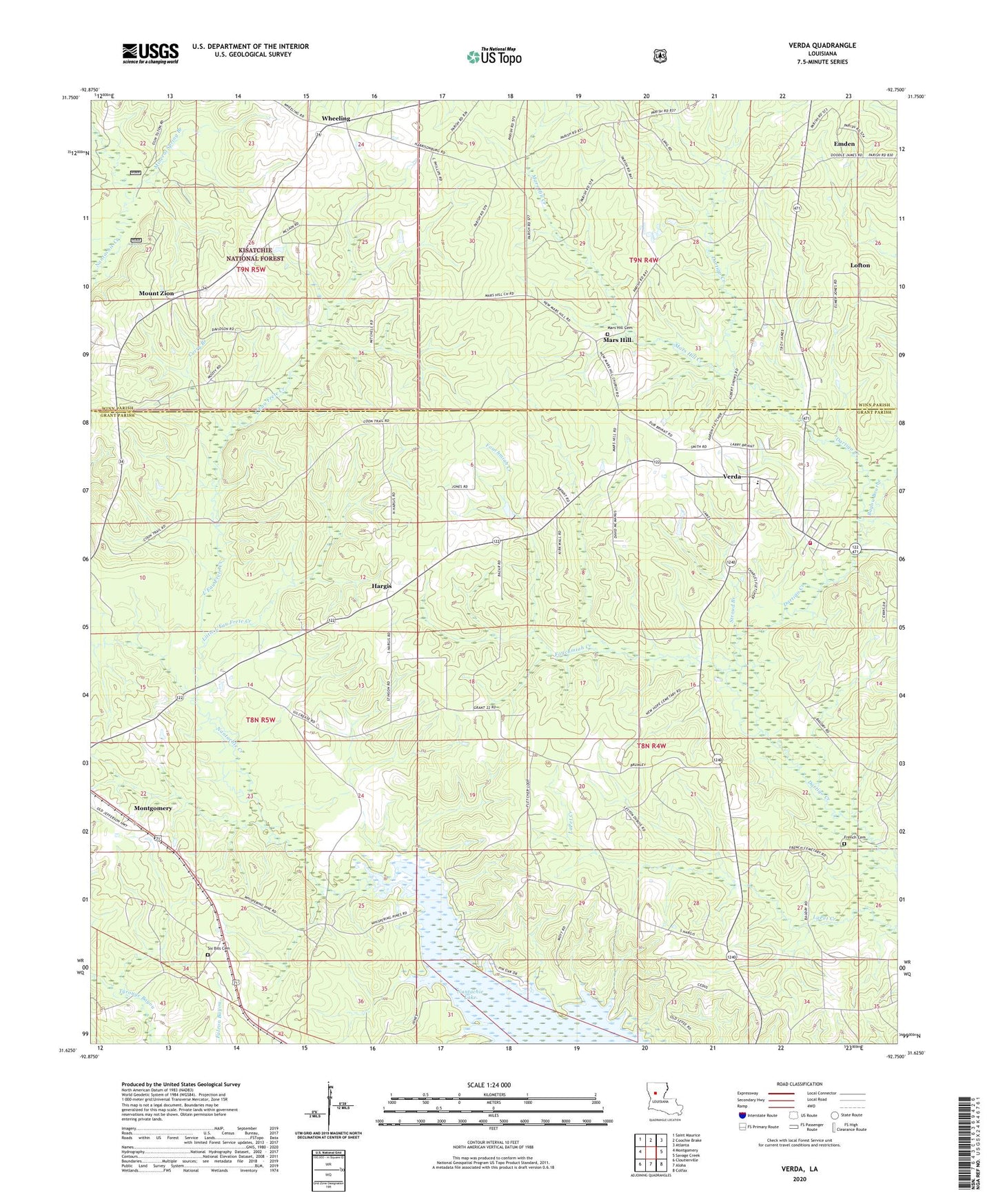
Verda Louisiana US Topo Map
Couldn't load pickup availability
Also explore the Verda Forest Service Topo of this same quad for updated USFS data
2024 topographic map quadrangle Verda in the state of Louisiana. Scale: 1:24000. Based on the newly updated USGS 7.5' US Topo map series, this map is in the following counties: Grant, Winn. The map contains contour data, water features, and other items you are used to seeing on USGS maps, but also has updated roads and other features. This is the next generation of topographic maps. Printed on high-quality waterproof paper with UV fade-resistant inks.
Quads adjacent to this one:
West: Montgomery
Northwest: Saint Maurice
North: Coochie Brake
Northeast: Atlanta
East: Savage Creek
Southeast: Colfax
South: Aloha
Southwest: Cloutierville
This map covers the same area as the classic USGS quad with code o31092f7.
Contains the following named places: Bayou Bourbe, Curry Branch, Emden, First Baptist Church of Verda, Fouchmiah Creek, French Cemetery, Hargis, Lanes Store, L'Eau Frete Creek, Little L'Eau Frete Creek, Lofton, Louisiana Noname 84 Dam, Mars Hill, Mars Hill Cemetery, Mars Hill Church, Mars Hill Creek, Mineral Spring Branch, Mount Zion, Mount Zion Church, New Hope Church, New Verda, Parish Governing Authority District 1, Six Bits Cemetery, Stroud Branch, Union Grove Church, Union Hill Church, Verda, Verda Elementary School, Verda Post Office, Verda Volunteer Fire Department, Ward Seven, Wetzlar, Wheeling, ZIP Codes: 71404, 71454