
MyTopo
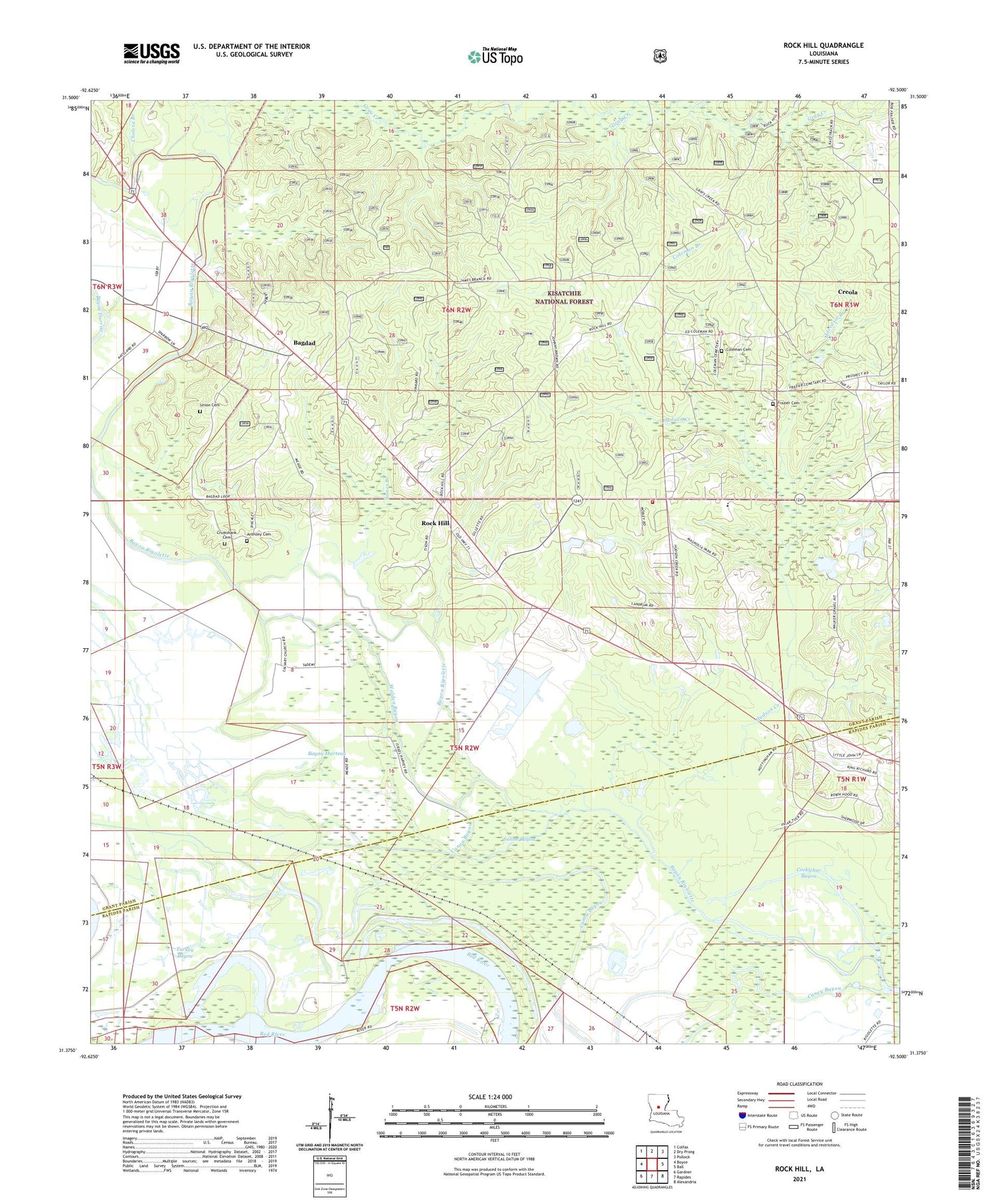
Rock Hill Louisiana US Topo Map
Couldn't load pickup availability
Also explore the Rock Hill Forest Service Topo of this same quad for updated USFS data
2024 topographic map quadrangle Rock Hill in the state of Louisiana. Scale: 1:24000. Based on the newly updated USGS 7.5' US Topo map series, this map is in the following counties: Grant, Rapides. The map contains contour data, water features, and other items you are used to seeing on USGS maps, but also has updated roads and other features. This is the next generation of topographic maps. Printed on high-quality waterproof paper with UV fade-resistant inks.
Quads adjacent to this one:
West: Boyce
Northwest: Colfax
North: Dry Prong
Northeast: Pollock
East: Ball
Southeast: Alexandria
South: Rapides
Southwest: Gardner
This map covers the same area as the classic USGS quad with code o31092d5.
Contains the following named places: Anthony Cemetery, Avoca Plantation, Bagdad, Bayou Marteau, Bethlehem Church, Calvary Church, Caney Bayou, Chandler Creek, Cholera Branch, Cocklebur Bayou, Coleman Branch, Coleman Cemetery, Creola, Crossroads Church, Cruikshank Cemetery, Frazier Cemetery, Gray Creek, Greens Mill, Harrison Camp, Hudson Creek, Hudson Creek Baptist Church, Hudson Creek Volunteer Fire Department District 6, James Branch, Jordan Creek, Magnolia Park, Mead, Mitchell Lake Dam, Moccasin Branch, Morris, Mount Pleasant School, New Prospect Church, Omega Plantation, Parish Governing Authority District 4, Parish Governing Authority District 5, Parley Black Lake, Prospect Church, Prospect School, Rock Hill, Rock Hill Census Designated Place, Saline Bayou, Santiago, South Grant Elementary School, Turkey Bayou, Union Cemetery, Walden Bayou, Ward Two, Woodland Church


