MyTopo
Colquitt Louisiana US Topo Map
Couldn't load pickup availability
Also explore the Colquitt Forest Service Topo of this same quad for updated USFS data
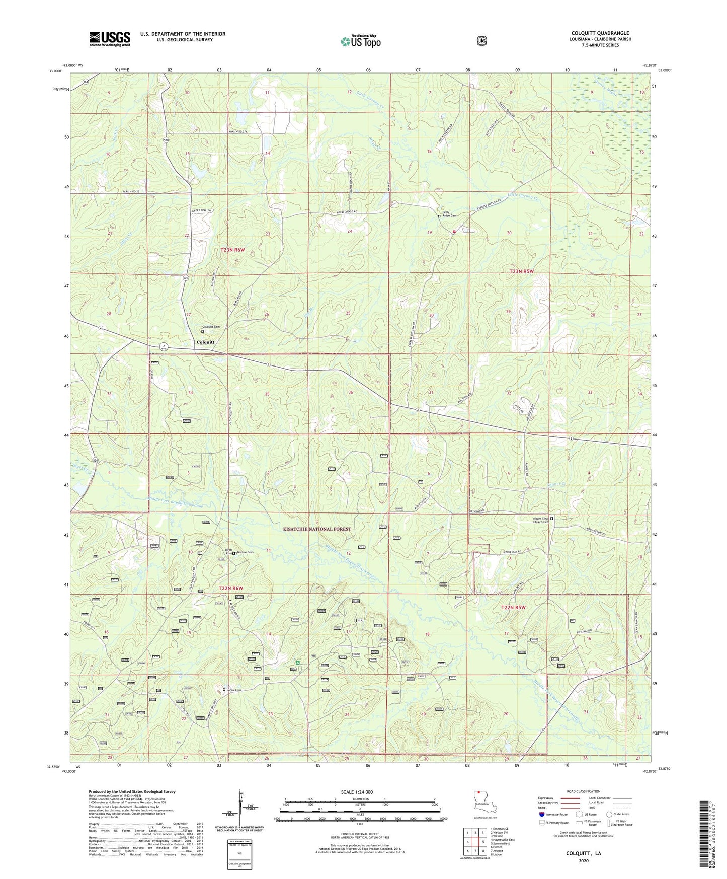
2024 topographic map quadrangle Colquitt in the state of Louisiana. Scale: 1:24000. Based on the newly updated USGS 7.5' US Topo map series, this map is in the following counties: Claiborne. The map contains contour data, water features, and other items you are used to seeing on USGS maps, but also has updated roads and other features. This is the next generation of topographic maps. Printed on high-quality waterproof paper with UV fade-resistant inks.
Quads adjacent to this one:
West: Haynesville East
Northwest: Emerson SE
North: Wesson SW
Northeast: Wesson
East: Summerfield
Southeast: Lisbon
South: Arizona
Southwest: Homer
This map covers the same area as the classic USGS quad with code o32092h8.
Contains the following named places: Antioch Oil and Gas Field, Claiborne Parish Fire District 6 Baileytown Station, Colquitt, Colquitt Cemetery, Colquitt Oil Field, Doe Branch, Monk Cemetery, Mount Sinai Church, Mount Sinai Oil Field, Mount Sinai School, Northwest Antioch Gas Field, Saint Paul Church, Speers Pond Dam, Steep Creek, Summerfield Oil Field, Tiger Creek, Turkey Pot Campground