MyTopo
Summerfield Louisiana US Topo Map
Couldn't load pickup availability
Also explore the Summerfield Forest Service Topo of this same quad for updated USFS data
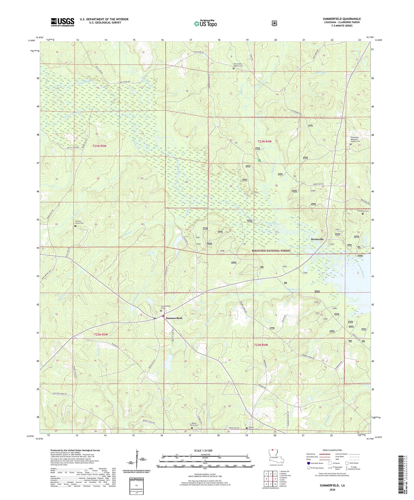
2024 topographic map quadrangle Summerfield in the state of Louisiana. Scale: 1:24000. Based on the newly updated USGS 7.5' US Topo map series, this map is in the following counties: Claiborne. The map contains contour data, water features, and other items you are used to seeing on USGS maps, but also has updated roads and other features. This is the next generation of topographic maps. Printed on high-quality waterproof paper with UV fade-resistant inks.
Quads adjacent to this one:
West: Colquitt
Northwest: Wesson SW
North: Wesson
Northeast: Junction City
East: Lillie
Southeast: Bernice
South: Lisbon
Southwest: Arizona
This map covers the same area as the classic USGS quad with code o32092h7.
Contains the following named places: Alford Creek, Barber Creek, Claiborne Parish Fire District 6 Summerfield Station, Corney Dam, Corney Lake, Dowdy Branch, Dry Creek, Fellowship School, Greer Creek, Hebron, Hebron Church, Hickory Grove Cemetery, Leadbetter Creek, Lisbon Gas Field, Little Corney Creek, Mount Calm Church, Mount Calm School, New Home School, Parish Governing Authority District 1, Rocky Hill Lookout Tower, Scottsville, Southwest Lillie Oil Field, Spring Grove School, Sugar Creek, Sugar Creek Camp, Summerfield, Summerfield High School, Summerfield Post Office, Tanner Creek, Three Creeks, Ward Nine, Ward One, ZIP Code: 71079