MyTopo
Deer Park Louisiana US Topo Map
Couldn't load pickup availability
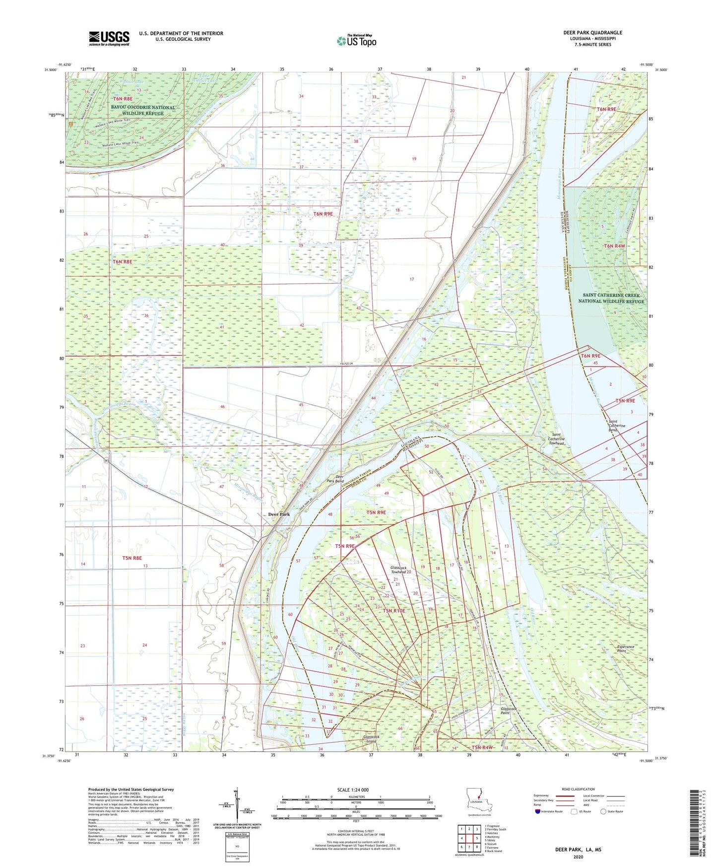
2024 topographic map quadrangle Deer Park in the states of Louisiana, Mississippi. Scale: 1:24000. Based on the newly updated USGS 7.5' US Topo map series, this map is in the following counties: Concordia, Adams. The map contains contour data, water features, and other items you are used to seeing on USGS maps, but also has updated roads and other features. This is the next generation of topographic maps. Printed on high-quality waterproof paper with UV fade-resistant inks.
Quads adjacent to this one:
West: Monterey
Northwest: Frogmore
North: Ferriday South
Northeast: Natchez
East: Sibley
Southeast: Buck Island
South: Fairview
Southwest: Slocum
Contains the following named places: Ashley Landing, Ashley Plantation, Bougere Church, Briar Landing, Briars Chute, Briers, Catherine Bend Revetment, Deer Park, Deer Park Bend, Deer Park Bend Revetment, Deer Park Oil Field, Esperance Point, Esperance Point Oil Field, Fish Pond Landing, Fish Pond Plantation, Ford Landing, Gilham Sawmill Spur, Glasscock Towhead, Glasscock Towhead Oil Field, Mississippi Bayou, Moro Landing, Moro Plantation, Morville Landing, Morville Plantation, Morville Revetment, North Esperance Oil Field, Old River, Saint Catherine Towhead, Saint James Church, Southwest Deer Park Oil Field, Stonefield Church, Surgent Ashley Plantation, Union Church, Wallace Lake, Warnicott, Warnicott Landing, Warnicott Oil Field