MyTopo
Fairview Louisiana US Topo Map
Couldn't load pickup availability
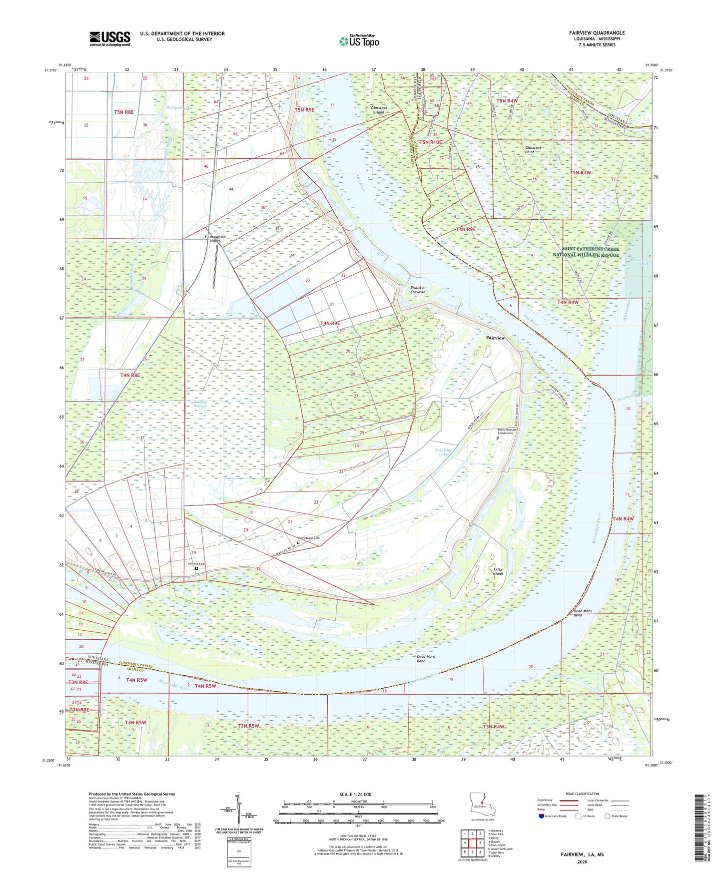
2024 topographic map quadrangle Fairview in the states of Louisiana, Mississippi. Scale: 1:24000. Based on the newly updated USGS 7.5' US Topo map series, this map is in the following counties: Concordia, Adams. The map contains contour data, water features, and other items you are used to seeing on USGS maps, but also has updated roads and other features. This is the next generation of topographic maps. Printed on high-quality waterproof paper with UV fade-resistant inks.
Quads adjacent to this one:
West: Slocum
Northwest: Monterey
North: Deer Park
Northeast: Sibley
East: Buck Island
Southeast: Lessley
South: Lake Mary
Southwest: Lower Sunk Lake
Contains the following named places: Alloway Landing, Arnot, Ashland, Ashland Cemetery, Bougere Church, Bougere Oil Field, Bougere Swamps, Brabston, Brabston Crevasse, Brabston Oil Field, Cerro Gordo Landing, Crosby, Dead Mans Bend, East Slocum Oil Field, Eureka Landing, Excelsior Lake, Excelsior Plantation, F L Braughton Airport, Fairview, Fairview Landing, Fairview Oil Field, Fritz Island, Fritz Island Dikes, Gaines Landing, Glasscock, Glasscock Cutoff, Glasscock Cutoff Revetment, Glasscock Island, Glasscock Island Oil Field, Glasscock Point, Holmesberry Ferry, Home Place Plantation, Homeplace Cemetery, Jackson Point Landing, Long Lake, McComb Lake, Mount Zion Church, North Bougere Oil Field, Palmetto Plantation, Point Pleasant Cemeteries, Point Pleasant Church, Roseland Oil Field, Roseland Plantation, Saint Pauls Church, Shiloh Church, Sunflower Church, Supervisor District 1, Washout Bayou, ZIP Code: 71373