MyTopo
Monterey Louisiana US Topo Map
Couldn't load pickup availability
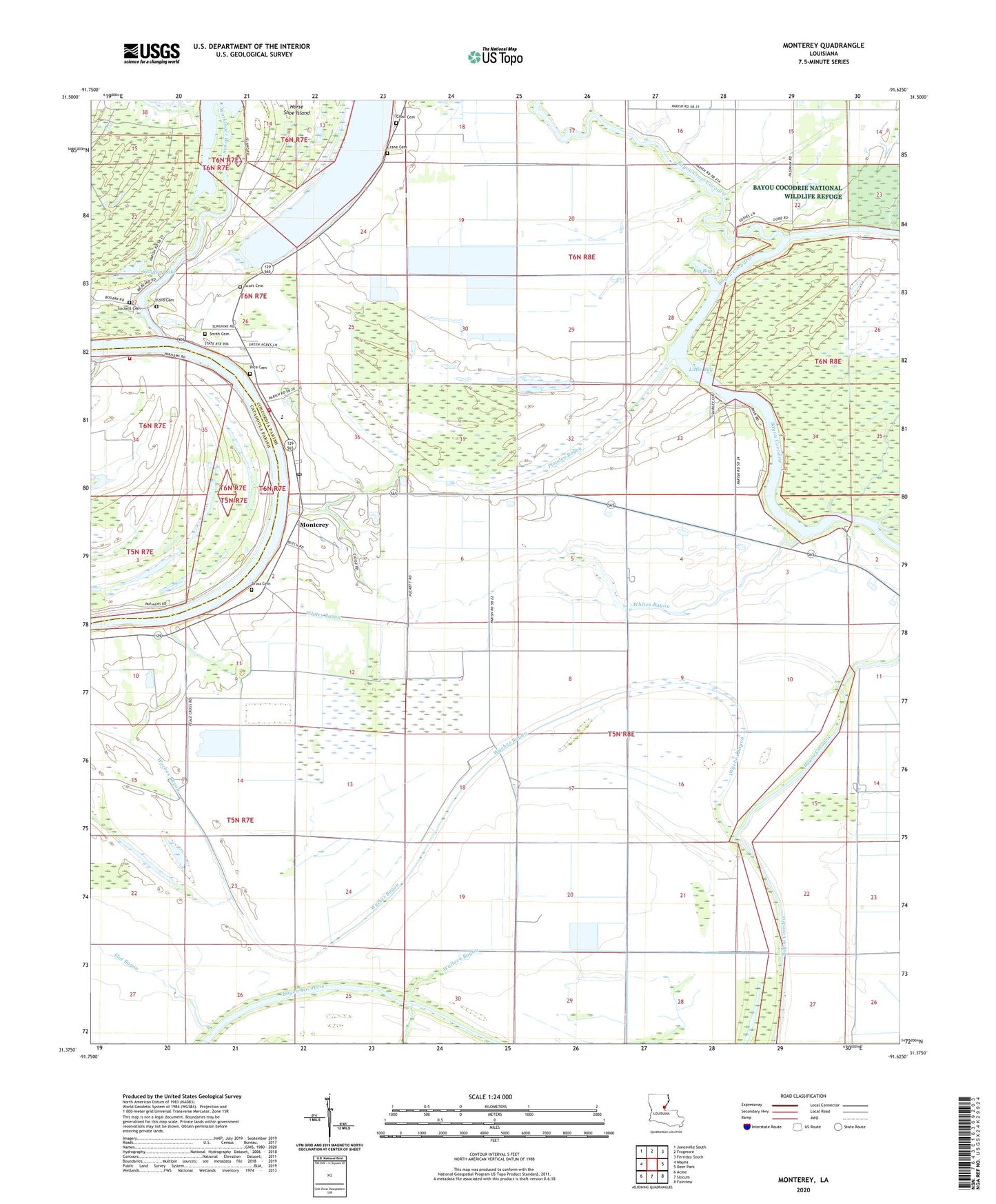
2024 topographic map quadrangle Monterey in the state of Louisiana. Scale: 1:24000. Based on the newly updated USGS 7.5' US Topo map series, this map is in the following counties: Concordia, Catahoula. The map contains contour data, water features, and other items you are used to seeing on USGS maps, but also has updated roads and other features. This is the next generation of topographic maps. Printed on high-quality waterproof paper with UV fade-resistant inks.
Quads adjacent to this one:
West: Mayna
Northwest: Jonesville South
North: Frogmore
Northeast: Ferriday South
East: Deer Park
Southeast: Fairview
South: Slocum
Southwest: Acme
This map covers the same area as the classic USGS quad with code o31091d6.
Contains the following named places: Bayou Cross Cocodrie, Big Bay, Central High School, Church of Christ, Clayton Lake, Concordia Parish, Crane Cemetery, Cross Cemetery, East Kincaid Bayou Oil Field, First Baptist Church, Flat Bayou, Ford Cemetery, Horse Shoe Island, Kenyon Bayou, Lismore Landing Oil Field, Little Bay, Long Lake, Luckett Cemetery, Monterey, Monterey Census Designated Place, Monterey Church, Monterey High School, Monterey Post Office, Monterey Volunteer Fire Department, North Bayou Cocodrie Oil Field, North Whites Bayou Oil Field, Northeast Bayou Cocodrie Oil Field, Northwest Bayou Cocadrie Oil Field, Parhams Volunteer Fire Department, Plouden Bayou, Quinn Bayou Oil Field, Rice Cemetery, Scott Cemetery, Smith Cemetery, South Monterey Oil Field, South Quinn Bayou Oil Field, Temple Church of Monterey, Wallace Bayou, Whites Bayou, Workinger Bayou, Wyches Bayou, Wyches Bayou Oil Field