MyTopo
Bernice Louisiana US Topo Map
Couldn't load pickup availability
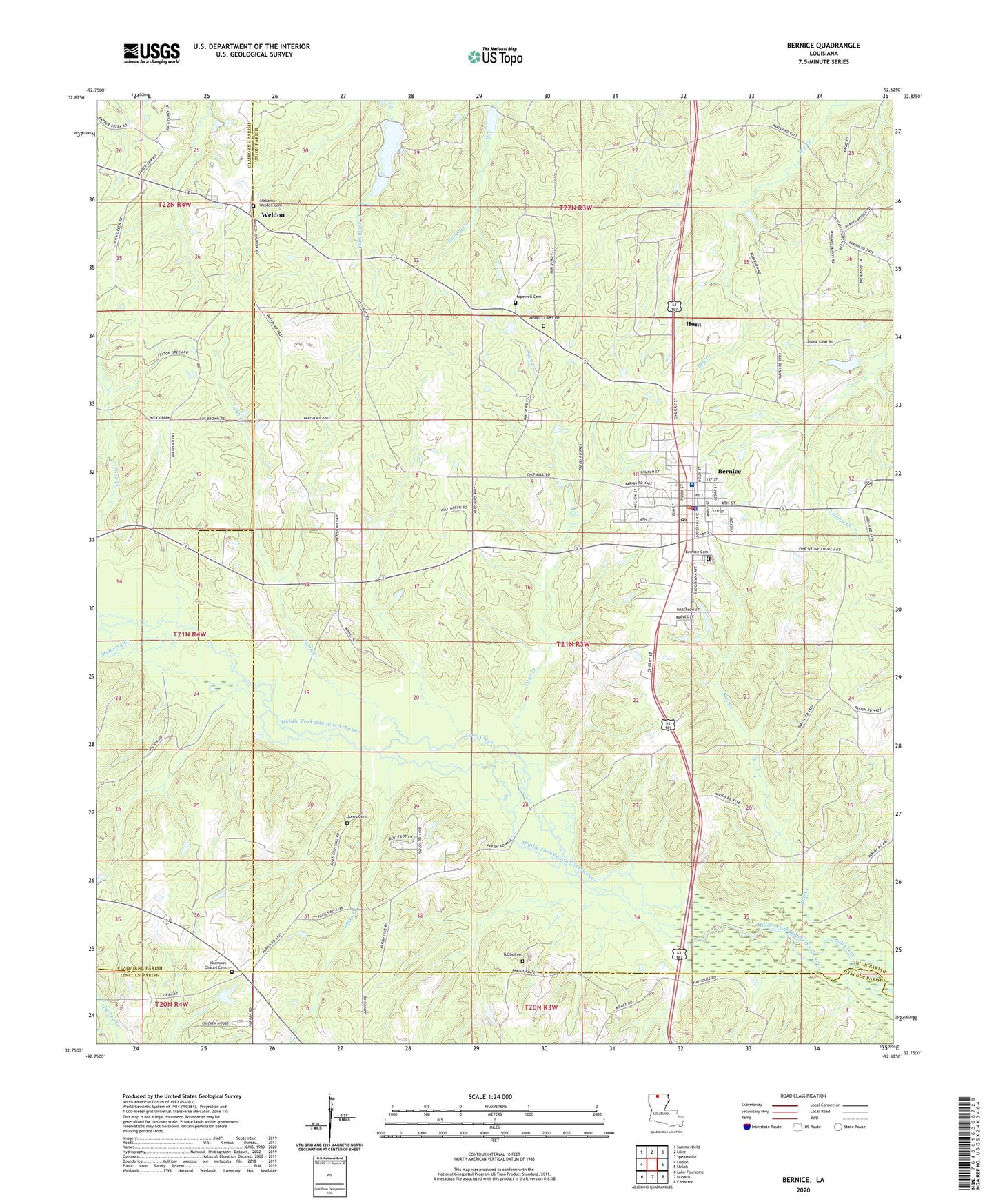
2024 topographic map quadrangle Bernice in the state of Louisiana. Scale: 1:24000. Based on the newly updated USGS 7.5' US Topo map series, this map is in the following counties: Union, Claiborne, Lincoln. The map contains contour data, water features, and other items you are used to seeing on USGS maps, but also has updated roads and other features. This is the next generation of topographic maps. Printed on high-quality waterproof paper with UV fade-resistant inks.
Quads adjacent to this one:
West: Lisbon
Northwest: Summerfield
North: Lillie
Northeast: Spearsville
East: Shiloh
Southeast: Cedarton
South: Dubach
Southwest: Lake Foursome
This map covers the same area as the classic USGS quad with code o32092g6.
Contains the following named places: Alabama Methodist Church, Alabama-Weldon Cemetery, Bernice, Bernice Cemetery, Bernice High School, Bernice Police Department, Bernice Post Office, Bernice Volunteer Fire Department, Bull Creek, Bull Creek Gas Field, Cane Creek, Cane Ridge, Harmony Chapel Cemetery, Harmony Chapel United Methodist Church, Hopewell Cemetery, Hunt, Jones Cemetery, Jones Creek, Lindsay Dam, Lindsays Pond, Lynn Creek, Lynn Creek Gas Field, Mount Olive Cemetery, Mount Olive Oil and Gas Field, Mount Tabor School, Mulberry Creek, New Bethel Church, New Land Church, Nick Creek, Pine Grove Church, Pisgah, Pisgah Church, Reeves Memorial Medical Center, Town of Bernice, Tubbs Cemetery, Weldon, Weldon Baptist Church, ZIP Code: 71222