MyTopo
Shiloh Louisiana US Topo Map
Couldn't load pickup availability
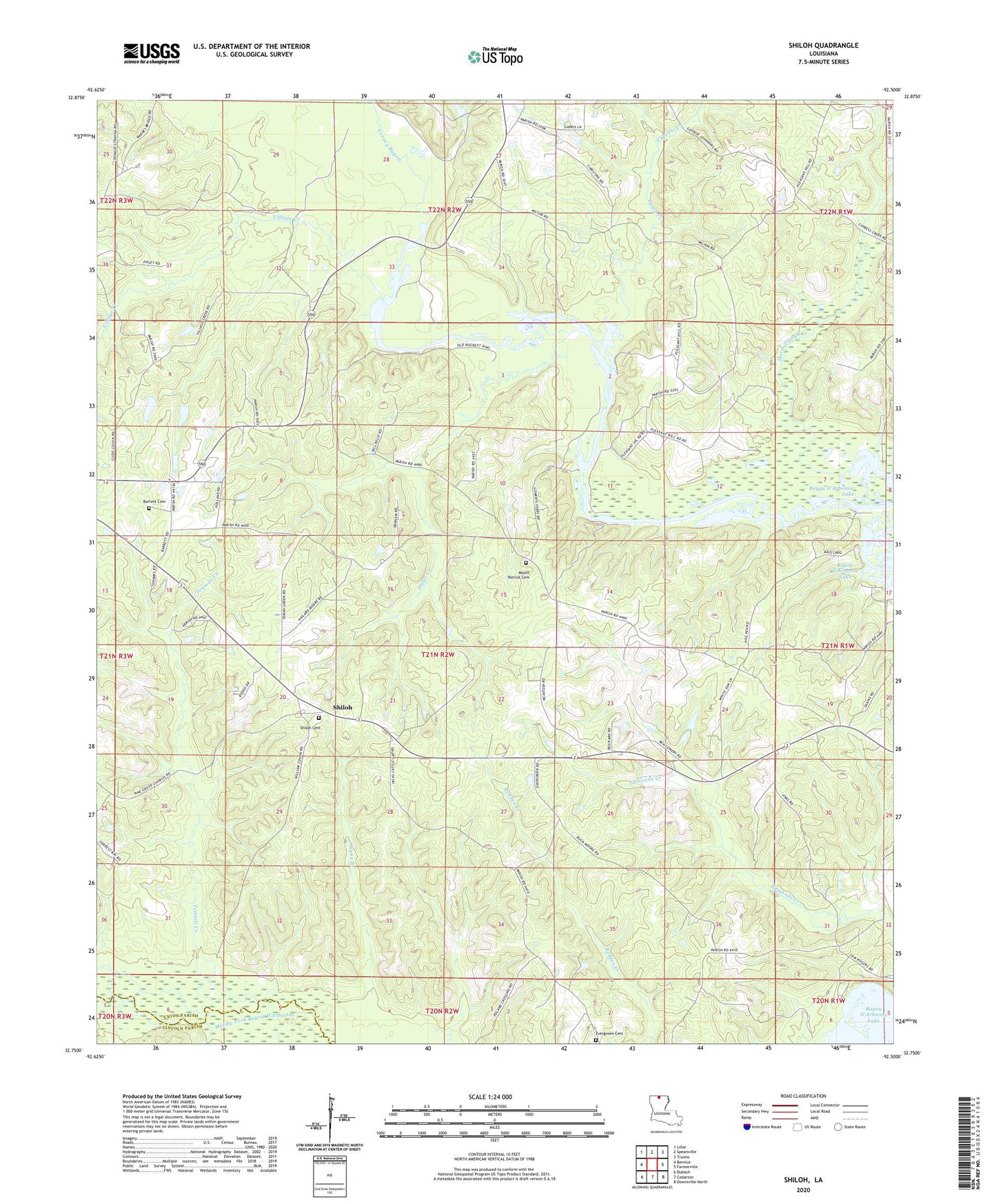
2024 topographic map quadrangle Shiloh in the state of Louisiana. Scale: 1:24000. Based on the newly updated USGS 7.5' US Topo map series, this map is in the following counties: Union, Lincoln. The map contains contour data, water features, and other items you are used to seeing on USGS maps, but also has updated roads and other features. This is the next generation of topographic maps. Printed on high-quality waterproof paper with UV fade-resistant inks.
Quads adjacent to this one:
West: Bernice
Northwest: Lillie
North: Spearsville
Northeast: Truxno
East: Farmerville
Southeast: Downsville North
South: Cedarton
Southwest: Dubach
This map covers the same area as the classic USGS quad with code o32092g5.
Contains the following named places: Barrett Cemetery, Bernice Oil and Gas Field, Camp Creek, Clayton, Cypress Creek, Evergreen, Evergreen Cemetery, Friendship School, Horse Trough Creek, Lowrys Ferry, Mount Patrick Cemetery, Mount Sterling Church, Parish Governing Authority District 4, Patrick Church, Pleasant Hill Church, Potter Creek, Shiloh, Shiloh Cemetery, Shiloh Gas Field, Tenmile Creek, Village Creek, Ward Four, Wynn Branch