MyTopo
Laurel Hill Louisiana US Topo Map
Couldn't load pickup availability
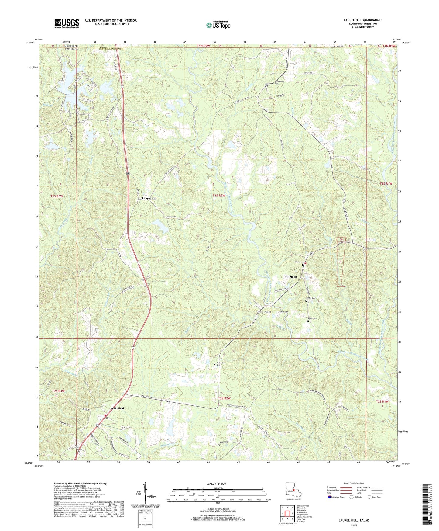
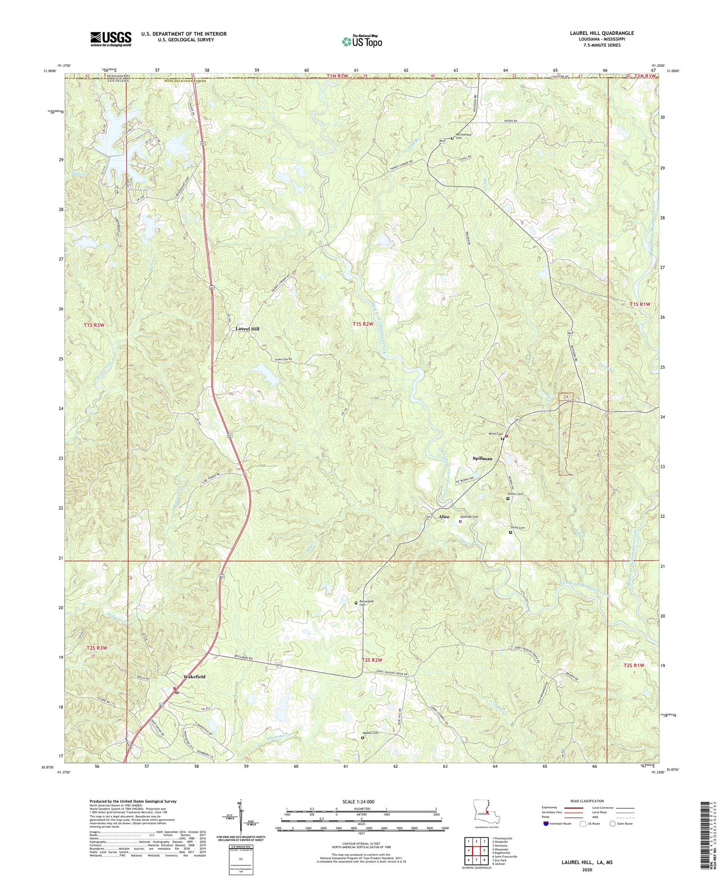
2024 topographic map quadrangle Laurel Hill in the state of Louisiana. Scale: 1:24000. Based on the newly updated USGS 7.5' US Topo map series, this map is in the following counties: West Feliciana, Wilkinson. The map contains contour data, water features, and other items you are used to seeing on USGS maps, but also has updated roads and other features. This is the next generation of topographic maps. Printed on high-quality waterproof paper with UV fade-resistant inks.
Quads adjacent to this one:
West: Weyanoke
Northwest: Pinckneyville
North: Woodville
Northeast: Newtonia
East: Rogillioville
Southeast: Jackson
South: Elm Park
Southwest: Saint Francisville
Contains the following named places: Alice, Austin Cemetery, Beech Grove Church, Beechgrove Dam, Cedar Grove Church, Converse, Cornor, Cypress Creek, District B, Dry Creek, First Pentecostal Church, Lake Rosemound, Lake Rosemound Dam, Lake Rosemound Gas Field, Laurel Hill, Laurel Hill Plantation, Lemon Lake Dam, McCausland Cemetery, McGehee, Middle Fork Thompson Creek, Mill Creek, Minor Town Cemetery, New Hope Church, Parish Governing Authority District 5, Parish Governing Authority District 6, Pleasant Green Church, Polk-Rosenwald School, Richardson Cemetery, Rosemound Church, Saint Johns Episcopal Church, Saint Mary Church, Sand Branch, Sherobee Church, Sinclair Lake Dam, Smith Cemetery, Spillman, Spillman Cemetery, Spillman Volunteer Fire Department, Wakefield, Wakefield Post Office, Wakefield Volunteer Fire Department, Walker Cemetery, Ward Four, Waterhole Branch, Woodlawn Plantation