MyTopo
Hathaway Louisiana US Topo Map
Couldn't load pickup availability
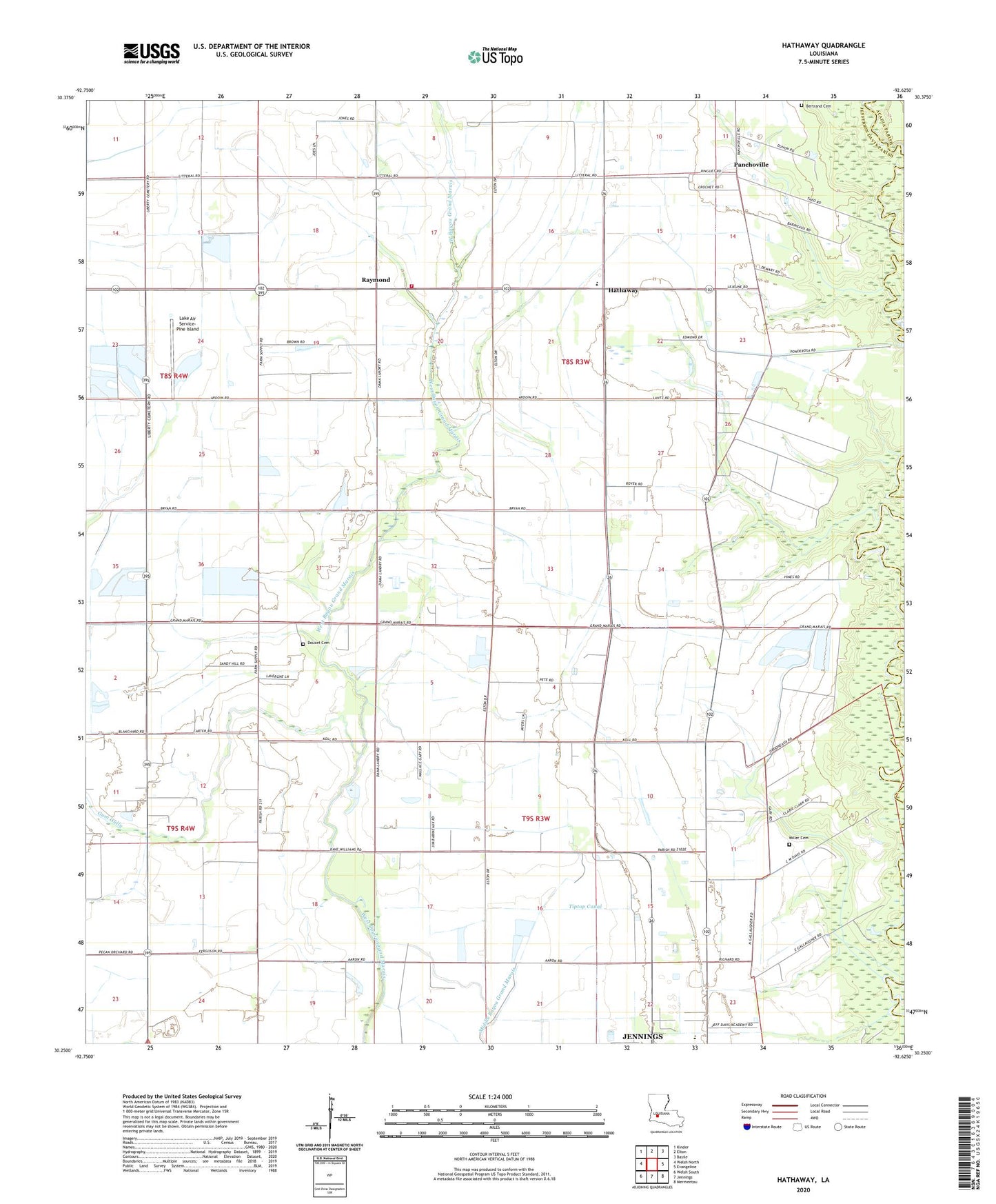
2024 topographic map quadrangle Hathaway in the state of Louisiana. Scale: 1:24000. Based on the newly updated USGS 7.5' US Topo map series, this map is in the following counties: Jefferson Davis, Acadia. The map contains contour data, water features, and other items you are used to seeing on USGS maps, but also has updated roads and other features. This is the next generation of topographic maps. Printed on high-quality waterproof paper with UV fade-resistant inks.
Quads adjacent to this one:
West: Welsh North
Northwest: Kinder
North: Elton
Northeast: Basile
East: Evangeline
Southeast: Mermentau
South: Jennings
Southwest: Welsh South
This map covers the same area as the classic USGS quad with code o30092c6.
Contains the following named places: Academy Mobile Village, Bertrand Cemetery, Bethel Baptist Church, Bethel Christian School, Doucet Cemetery, East Roanoke Gas Field, Grand Canal, Gum Gully, Hathaway, Hathaway Fire Department, Hathaway High School, Koll Airport, Lake Air Service-Pine Island, Miller Cemetery, Panchoville, Parish Governing Authority District 8, Raymond, Raymond United Methodist Church, Roanoke Oil and Gas Field, Saint Lawrence Catholic Church, Tiptop Canal, Ward Three, ZIP Codes: 70546, 70581