MyTopo
Welsh North Louisiana US Topo Map
Couldn't load pickup availability
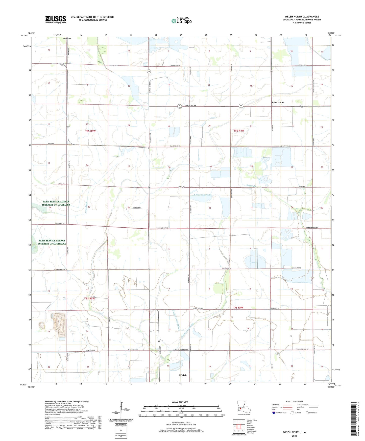
2024 topographic map quadrangle Welsh North in the state of Louisiana. Scale: 1:24000. Based on the newly updated USGS 7.5' US Topo map series, this map is in the following counties: Jefferson Davis. The map contains contour data, water features, and other items you are used to seeing on USGS maps, but also has updated roads and other features. This is the next generation of topographic maps. Printed on high-quality waterproof paper with UV fade-resistant inks.
Quads adjacent to this one:
West: Fenton
Northwest: Indian Village
North: Kinder
Northeast: Elton
East: Hathaway
Southeast: Jennings
South: Welsh South
Southwest: Lacassine
This map covers the same area as the classic USGS quad with code o30092c7.
Contains the following named places: Jefferson Davis Parish, North Welsh Gas Field, Parish Governing Authority District 12, Pine Island, Ward Five, ZIP Code: 70591