MyTopo
Eunice North Louisiana US Topo Map
Couldn't load pickup availability
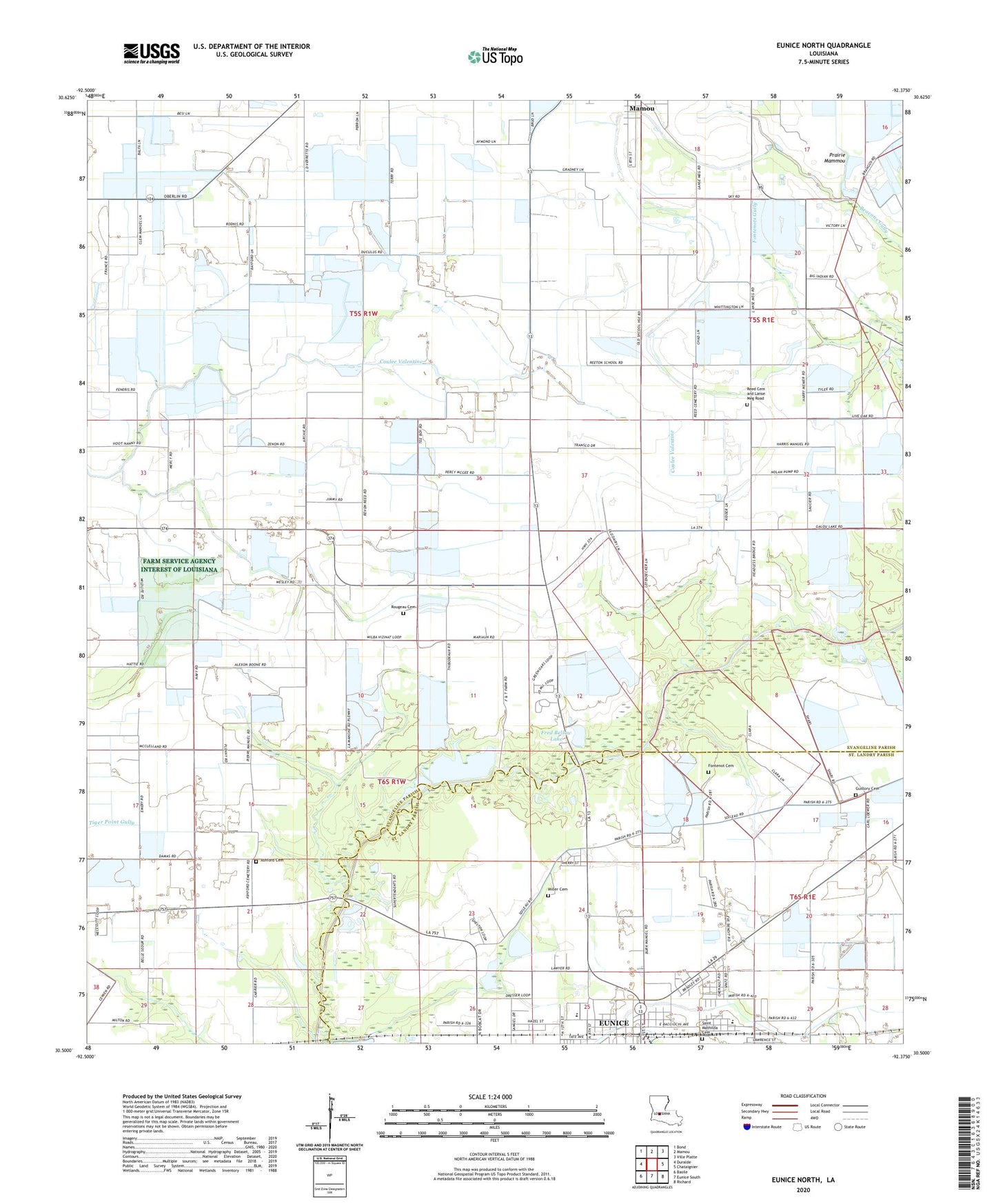
2024 topographic map quadrangle Eunice North in the state of Louisiana. Scale: 1:24000. Based on the newly updated USGS 7.5' US Topo map series, this map is in the following counties: Evangeline, St. Landry. The map contains contour data, water features, and other items you are used to seeing on USGS maps, but also has updated roads and other features. This is the next generation of topographic maps. Printed on high-quality waterproof paper with UV fade-resistant inks.
Quads adjacent to this one:
West: Duralde
Northwest: Bond
North: Mamou
Northeast: Ville Platte
East: Chataignier
Southeast: Richard
South: Eunice South
Southwest: Basile
This map covers the same area as the classic USGS quad with code o30092e4.
Contains the following named places: All God's Children Day Care and Learning Center, Ashford Cemetery, Beacons Gully Gas Field, Cliffs Pond Dam, Country Day Nursery School, East Elementary School, East Fenris Gas Field, F and F Mobile Home Park, Fenris, Fenris Oil and Gas Field, First United Pentecostal Church, Fontenot Cemetery, Fred Bellow Lake, Fred Bellow Lake Dam, Glendale Elementary School, Guillory Cemetery, Lakeview Park, Ledouxs Pond Dam, Miller Cemetery, North Eunice Baptist Mission Church, North Eunice Gas Field, Parish Governing Authority District 12, Parish Governing Authority District 6, Redland, Reed Cemetery and Lanse Meg Road, Rougeau Cemetery, Saint Luke Baptist Church, ZIP Code: 70554