MyTopo
Chataignier Louisiana US Topo Map
Couldn't load pickup availability
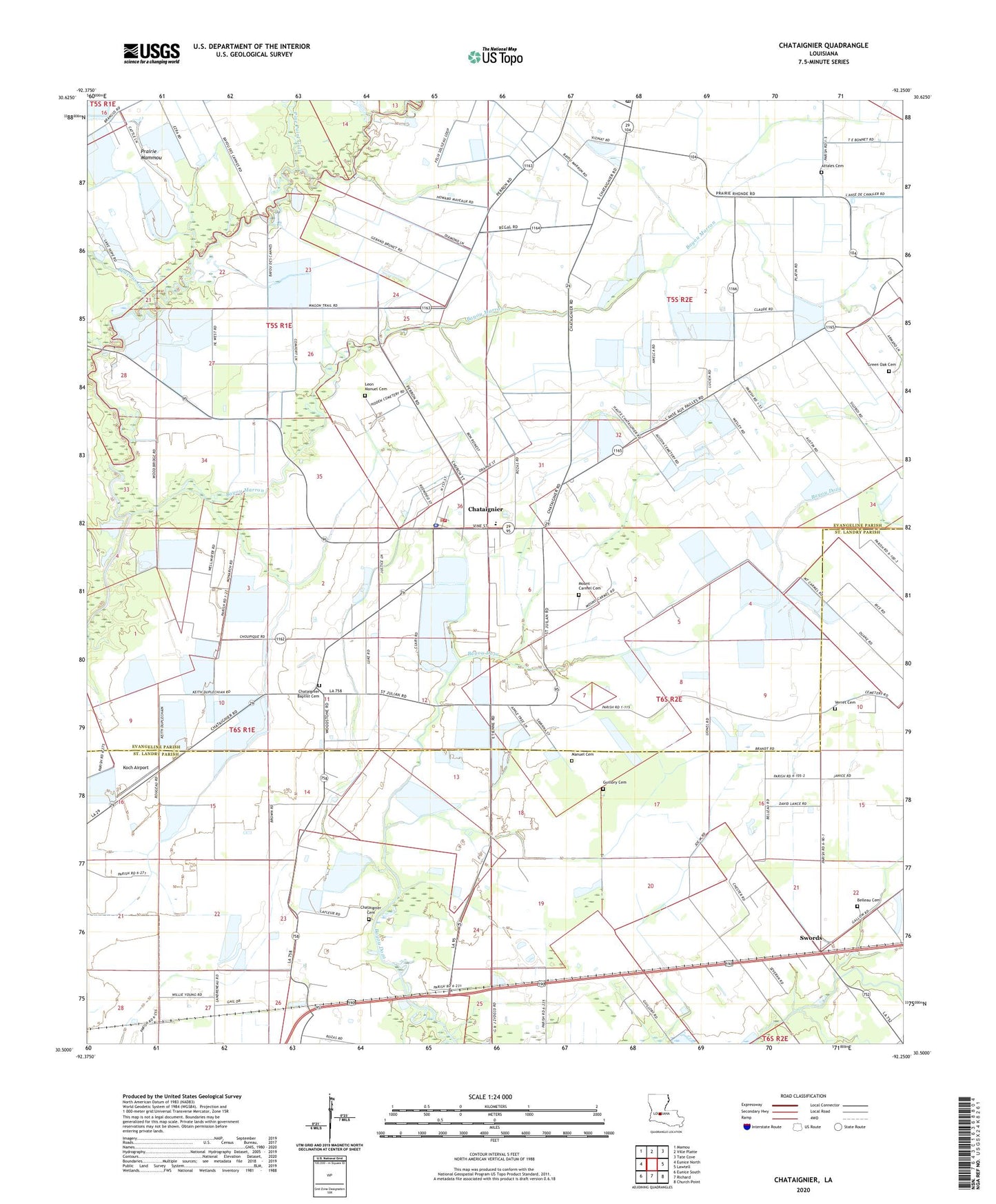
2024 topographic map quadrangle Chataignier in the state of Louisiana. Scale: 1:24000. Based on the newly updated USGS 7.5' US Topo map series, this map is in the following counties: Evangeline, St. Landry. The map contains contour data, water features, and other items you are used to seeing on USGS maps, but also has updated roads and other features. This is the next generation of topographic maps. Printed on high-quality waterproof paper with UV fade-resistant inks.
Quads adjacent to this one:
West: Eunice North
Northwest: Mamou
North: Ville Platte
Northeast: Tate Cove
East: Lawtell
Southeast: Church Point
South: Richard
Southwest: Eunice South
This map covers the same area as the classic USGS quad with code o30092e3.
Contains the following named places: Attales Cemetery, Bayou Choupique, Bayou Marron, Beacons Gully, Belleau Cemetery, Carver Elementary School, Chatagnier Volunteer Fire Department, Chataignier, Chataignier Baptist Cemetery, Chataignier Cemetery, Chataignier Church, Chataignier Elementary School, Chataignier Gas Field, Chataignier Landing Strip, Evangeline Parish Library Chataignier Branch, First Baptist Church, Fontenots Gully, Green Oak Cemetery, Guillory Cemetery, KIHG-FM (Mamou), Koch Airport, Lake Hope Recreational Park, Leon Manuel Cemetery, Linzay Downs Racetrack, Macedonia Church, Manuel Cemetery, Mount Carmel Cemetery, New Zion Church, North Savoy Oil Field, Our Lady of Mount Carmel Catholic Church, Parish Governing Authority District 1, Pine Point Gully, Saint Joseph Baptist Church, Saint Julien Chapel, Saint Mary Church, Saint Thomas Church, Savoy, Savoy Oil and Gas Field, Swords, Verret Cemetery, Village of Chataignier, ZIP Code: 70524