MyTopo
Lower Sunk Lake Louisiana US Topo Map
Couldn't load pickup availability
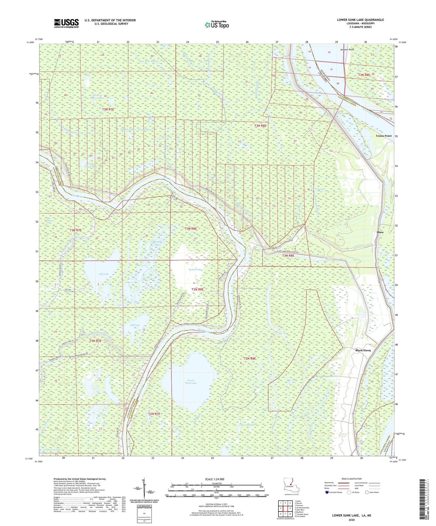
2024 topographic map quadrangle Lower Sunk Lake in the state of Louisiana. Scale: 1:24000. Based on the newly updated USGS 7.5' US Topo map series, this map is in the following counties: Concordia, Avoyelles, Adams, Wilkinson. The map contains contour data, water features, and other items you are used to seeing on USGS maps, but also has updated roads and other features. This is the next generation of topographic maps. Printed on high-quality waterproof paper with UV fade-resistant inks.
Quads adjacent to this one:
West: Ile Natchitoches
Northwest: Acme
North: Slocum
Northeast: Fairview
East: Lake Mary
Southeast: Fort Adams
South: Turnbull Island
Southwest: Big Bend
Contains the following named places: Achiquot Bay, Alligator Bayou, Bayou Cache - Cache, Bayou Cocodrie, Bayou Cocodrie Drainage Structure, Bayou de la Baie Sec, Bayou des Sots, Bayou Milligan, Bayou Milligan Oil Field, Bayou Natchitoches, Bee Bayou, Black Hawk, Black Hawk Plantation, Bougere Bend Revetment, Catfish Bayou, Chaney Lakes, Chaney Lakes Oil Field, Cocodrie Church, Cross Lake, Devils Swamp, Dismal Swamp, Dobbs Bay, Dry Cypress Lake, Durham Prong, Fools Bay, Goose Lake, Goose Lake Oil Field, Grand Cutoff Bayou, Grand Lake, Grassy Lake, Green Bayou, Hog Pen Lake, Jeff Lake, Lac A'Sostien, Lac Bayou des Sots, Little Cutoff, Live Oak Plantation, Lost Lake, Lower Sunk Lake, Lower Sunk Lake Oil Field, Pat Lake Bayou, Pleasand Green Church, Pleasant Green School, Red River Bay, Red River Bay Oil Field, Saint Thomas Church, Saint Thomas School, Shaw, Shaw Oil Field, Shaw Plantation, Shaw School, Silver Lakes, Smith Bay, Union Point, Union Point Oil Field, Union Point Plantation, Upper Sunk Lake, Whiskey Bayou Lakes, ZIP Code: 71316