MyTopo
Fairview Alpha Louisiana US Topo Map
Couldn't load pickup availability
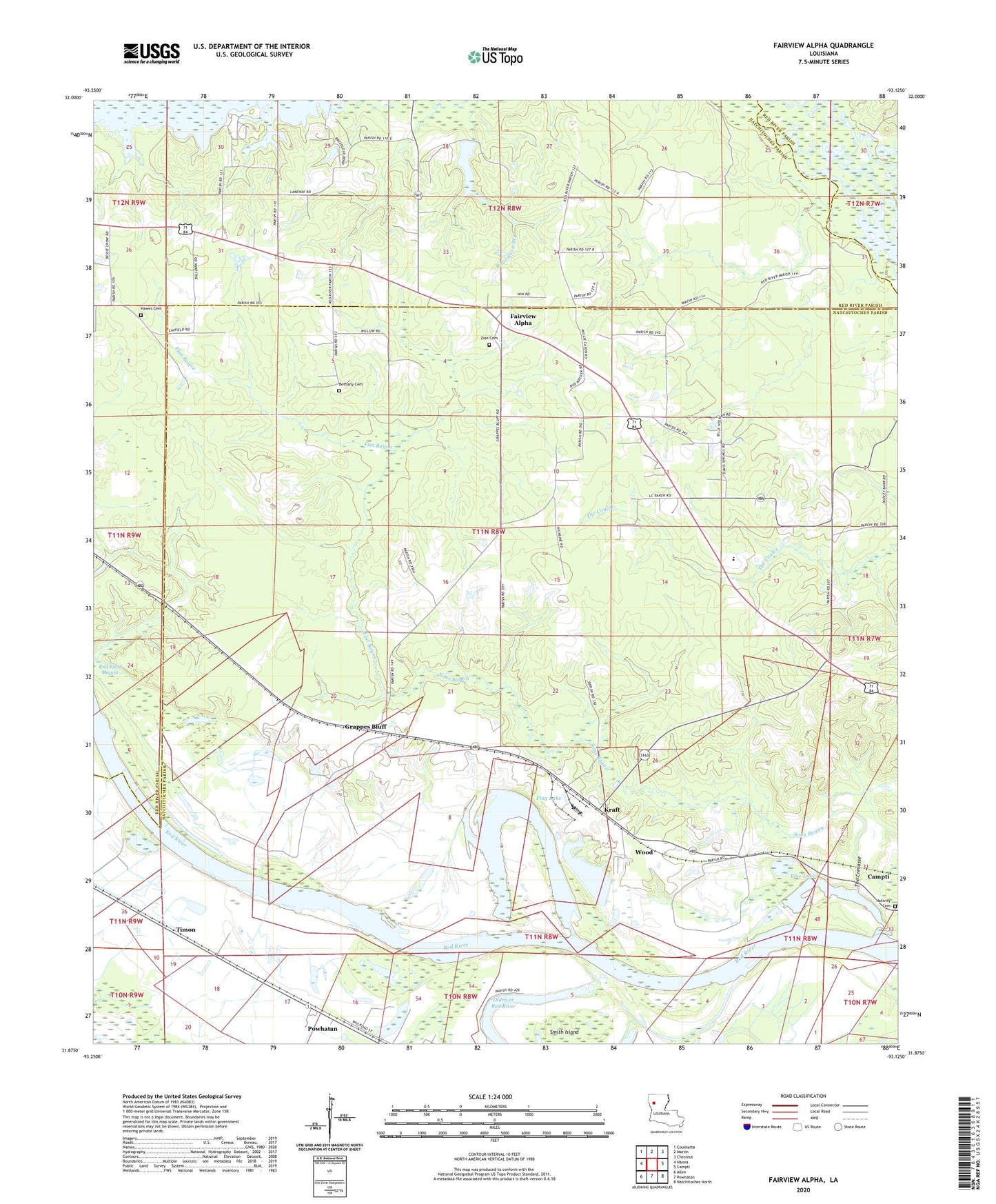
2024 topographic map quadrangle Fairview Alpha in the state of Louisiana. Scale: 1:24000. Based on the newly updated USGS 7.5' US Topo map series, this map is in the following counties: Natchitoches, Red River. The map contains contour data, water features, and other items you are used to seeing on USGS maps, but also has updated roads and other features. This is the next generation of topographic maps. Printed on high-quality waterproof paper with UV fade-resistant inks.
Quads adjacent to this one:
West: Hanna
Northwest: Coushatta
North: Martin
Northeast: Chestnut
East: Campti
Southeast: Natchitoches North
South: Powhatan
Southwest: Allen
This map covers the same area as the classic USGS quad with code o31093h2.
Contains the following named places: Alpha Gas Field, Bethany Cemetery, Bethany Church, Blue Lake, Bright Morning Star Church, Calvary Church, Crain Lake, Davis Spring Church, Fairview Alpha, Fairview Alpha Elementary School, Fairview Church, Flag Lake, Flat Bayou, Grappes Bluff, Hawes Cemetery, Kraft, Lake Poule d'eau, Parish Governing Authority District 1, Parish Governing Authority District 8, Powhatan Gas Field, Red Field Bayou, Sims Bayou, Smith Island, The Crevasse, Timon, Wood, Zion Cemetery, Zion Church, Zion Hill Church