MyTopo
Hanna Louisiana US Topo Map
Couldn't load pickup availability
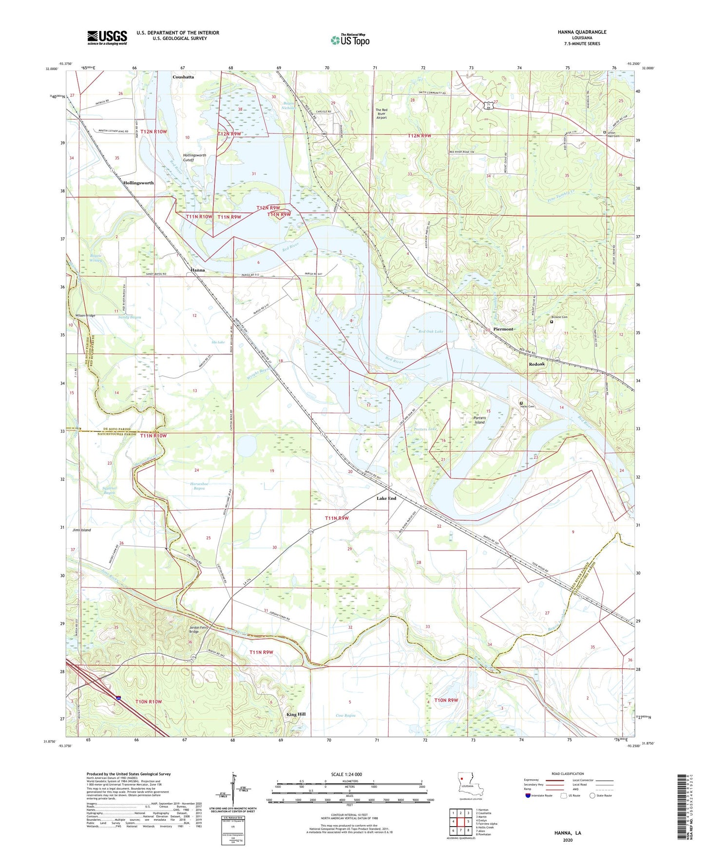
2024 topographic map quadrangle Hanna in the state of Louisiana. Scale: 1:24000. Based on the newly updated USGS 7.5' US Topo map series, this map is in the following counties: Red River, Natchitoches, De Soto. The map contains contour data, water features, and other items you are used to seeing on USGS maps, but also has updated roads and other features. This is the next generation of topographic maps. Printed on high-quality waterproof paper with UV fade-resistant inks.
Quads adjacent to this one:
West: Evelyn
Northwest: Harmon
North: Coushatta
Northeast: Martin
East: Fairview Alpha
Southeast: Powhatan
South: Allen
Southwest: Hollis Creek
This map covers the same area as the classic USGS quad with code o31093h3.
Contains the following named places: Ajax Church, Bayou Lumbra, Bayou Nicholas, Bayou Winsey, Bethlehem Church, Black Bayou, Boggy Lake, Browne Cemetery, Bull Lake, Cumberland Church, Haley Cemetery, Hanna, Hanna Post Office, Hollingsworth, Hollingsworth Cutoff, Horseshoe Bayou, Ida Lake, Indian Bayou, Jims Island, Jordon Ferry, Jordon Ferry Bridge, King Hill, KRRP-AM (Coushatta), KSBH-FM (Coushatta), Lake End, Lake End Oil Field, Mount Olive Church, New Hope Church, Old Lake, Parish Governing Authority District 5, Parish Governing Authority District 6, Piermont, Pine Tumbly Creek, Porters Island, Porters Lake, Red Oak Lake, Red Oak Oil and Gas Field, Redoak, Redoak Church, Russell B. Long Lock and Dam, Sandy Bayou, Squirrel Bayou, The Red River Airport, Three Pine School, Union Hall Cemetery, Union Hall Church, Ward Five, Wilson Bridge, Wright Bayou