MyTopo
Coushatta Louisiana US Topo Map
Couldn't load pickup availability
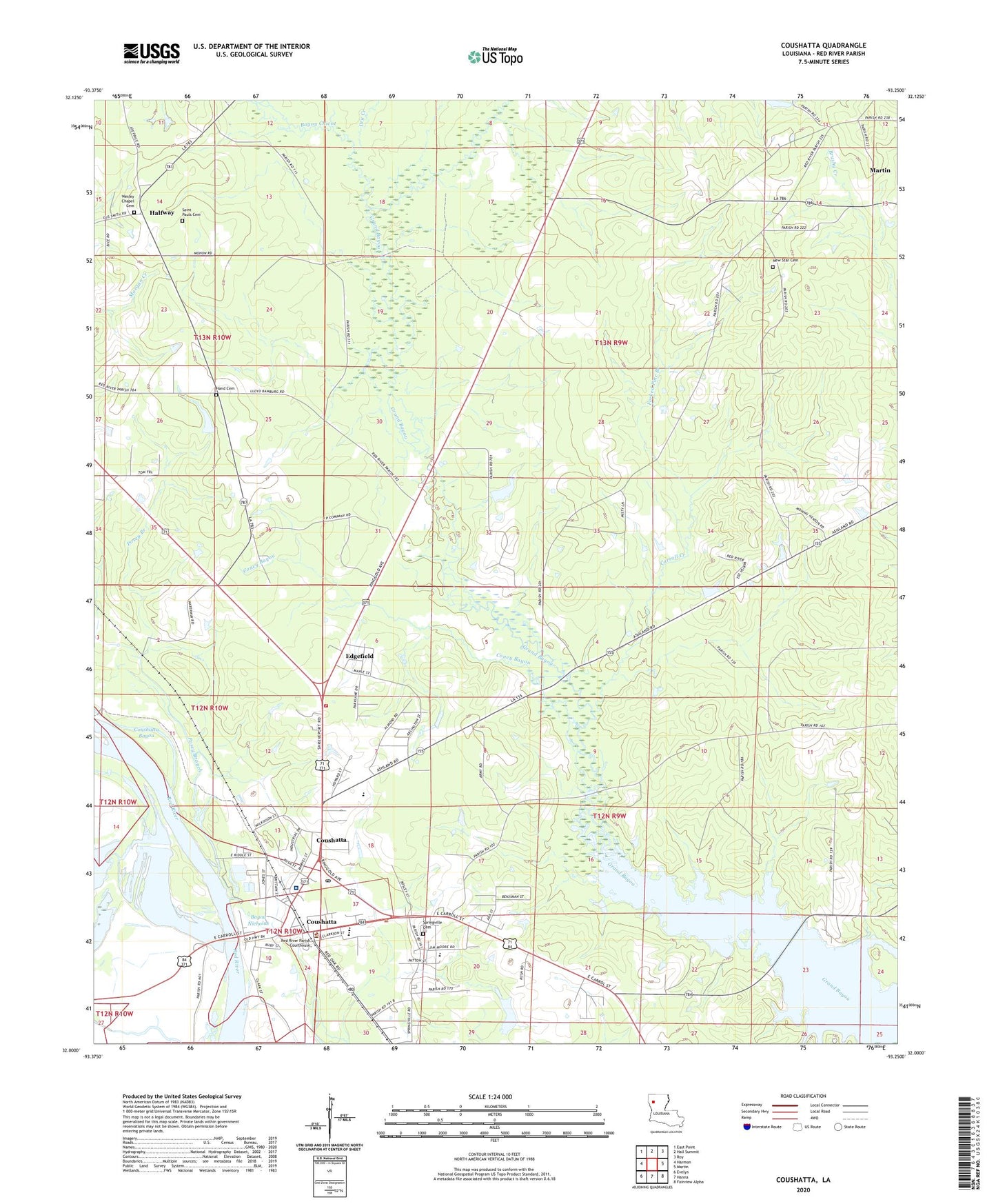
2024 topographic map quadrangle Coushatta in the state of Louisiana. Scale: 1:24000. Based on the newly updated USGS 7.5' US Topo map series, this map is in the following counties: Red River. The map contains contour data, water features, and other items you are used to seeing on USGS maps, but also has updated roads and other features. This is the next generation of topographic maps. Printed on high-quality waterproof paper with UV fade-resistant inks.
Quads adjacent to this one:
West: Harmon
Northwest: East Point
North: Hall Summit
Northeast: Roy
East: Martin
Southeast: Fairview Alpha
South: Hanna
Southwest: Evelyn
This map covers the same area as the classic USGS quad with code o32093a3.
Contains the following named places: Adcock Pond Dam, Apostolic Church, Bayou Chicot, Beacon Church, Carrol Creek Church, Carroll Creek, Christus Coushatta Health Care Center, Church of Christ, Coney Bayou, Coushatta, Coushatta Country Club, Coushatta Elementary School, Coushatta Oil Field, Dry Creek, Edgefield, Elizabeth Church, Forked Pine Branch, Grover Lane Church, Halfway, Hamilton Church, Hammell, Hand Cemetery, Hand Pond Dam, Jerusalem Church, Liberty Hill Church, Magnolia Church, Martin Church, New Star Cemetery, New Star Church, Parish Governing Authority District 7, Posey Branch, Red River Elementary School, Red River Fire Protection District, Red River High School, Red River Junior High School, Red River Parish, Red River Parish Courthouse, Red River Parish Sheriff's Office, Saint Marys Church, Saint Pauls Cemetery, Saint Pauls Church, Specialty Rehabilitation Hospital, Springville Cemetery, Springville Educational Center School, Stevens Plantation, Town of Coushatta, Village of Edgefield, Ward Eight, Ward Seven, Ward Six, Ward Two, Wesley Chapel Cemetery, Wesleyan Church, ZIP Code: 71019