MyTopo
Haynesville West Louisiana US Topo Map
Couldn't load pickup availability
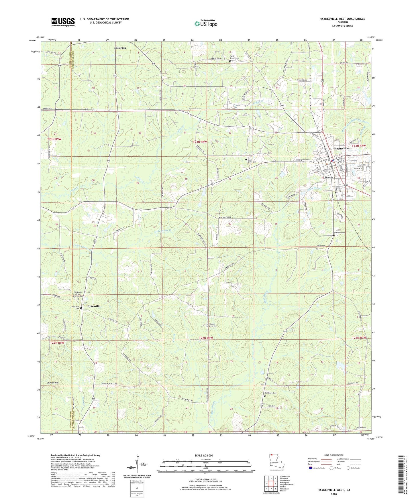
2024 topographic map quadrangle Haynesville West in the state of Louisiana. Scale: 1:24000. Based on the newly updated USGS 7.5' US Topo map series, this map is in the following counties: Claiborne, Webster. The map contains contour data, water features, and other items you are used to seeing on USGS maps, but also has updated roads and other features. This is the next generation of topographic maps. Printed on high-quality waterproof paper with UV fade-resistant inks.
Quads adjacent to this one:
West: Shongaloo
Northwest: Walkerville
North: Emerson
Northeast: Emerson SE
East: Haynesville East
Southeast: Homer
South: Blackburn
Southwest: Leton
This map covers the same area as the classic USGS quad with code o32093h2.
Contains the following named places: Blackburn Gas Field, Claiborne Mercantile Dam, Cow Creek, Dykesville, East Dykesville Gas Field, Haynesville, Haynesville Airport, Haynesville Elementary School, Haynesville Junior High School, Haynesville Junior Senior High School, Haynesville Oil and Gas Field, Haynesville Police Department, Haynesville Volunteer Fire Department, KLVU-AM (Haynesville), KWHN-FM (Haynesville), Lake Miller Dam, Norton Corner, Oak Grove School, Oaks Oil and Gas Field, Old Town Cemetery, Parish Governing Authority District 4, Pleasant Grove School, Sand Hill School, Shady Grove Cemetery, Spring Branch, Taylor Cemetery, Town of Haynesville, Ward Chapel Cemetery, Ward Chapel School, Ward Three