MyTopo
Ile Natchitoches Louisiana US Topo Map
Couldn't load pickup availability
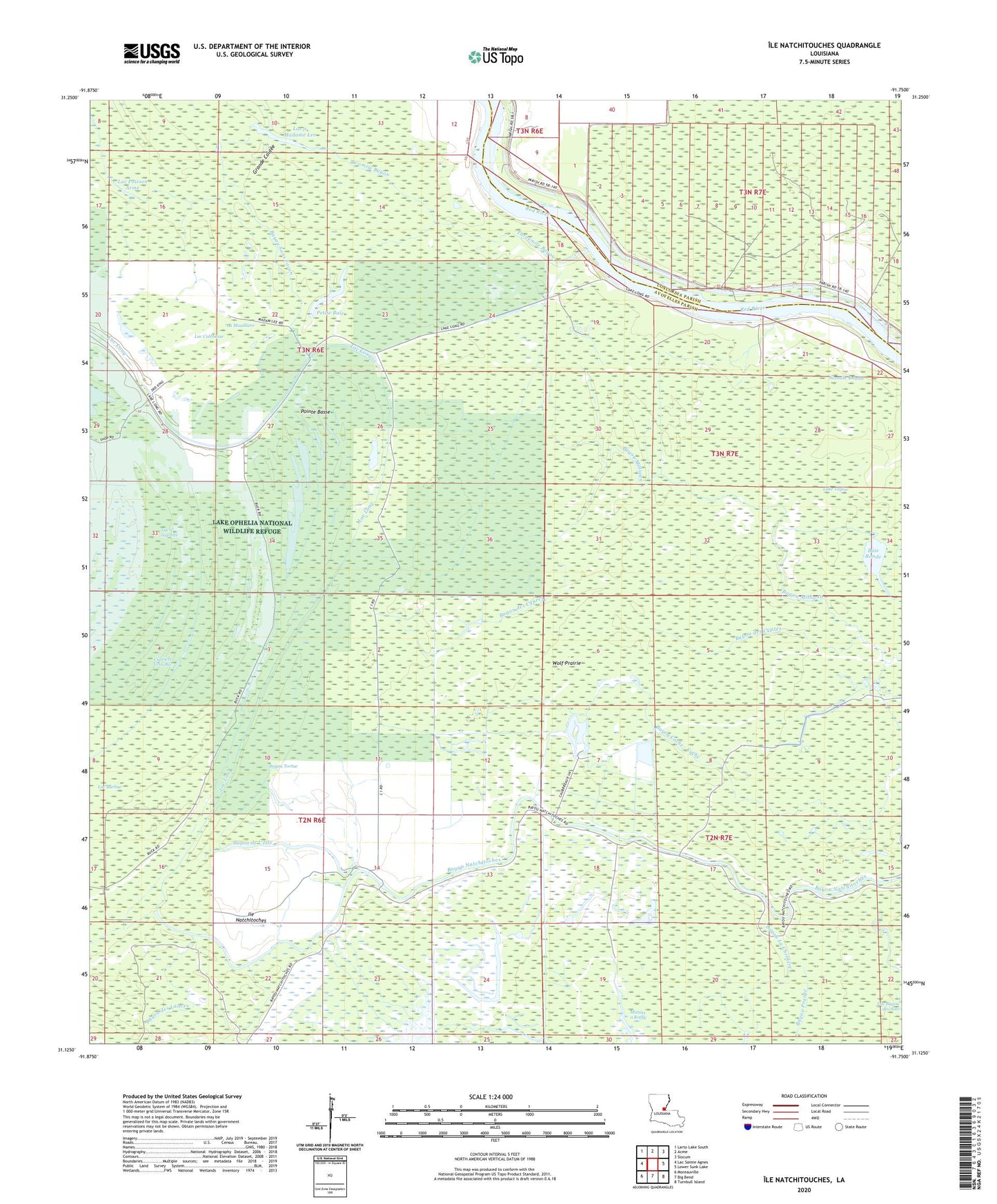
2024 topographic map quadrangle Ile Natchitoches in the state of Louisiana. Scale: 1:24000. Based on the newly updated USGS 7.5' US Topo map series, this map is in the following counties: Avoyelles, Concordia. The map contains contour data, water features, and other items you are used to seeing on USGS maps, but also has updated roads and other features. This is the next generation of topographic maps. Printed on high-quality waterproof paper with UV fade-resistant inks.
Quads adjacent to this one:
West: Lac Sainte Agnes
Northwest: Larto Lake South
North: Acme
Northeast: Slocum
East: Lower Sunk Lake
Southeast: Turnbull Island
South: Big Bend
Southwest: Moreauville
This map covers the same area as the classic USGS quad with code o31091b7.
Contains the following named places: Baie Ronde, Bayou de L'Isle, Bayou des Cypres, Bayou des Lances, Bayou Jeansonne, Bayou La Cheniere, Bayou Prairie, Bayou Sans Facon, Bayou Tortue, Catfish Bayou Oil Field, Cypriere Gros Bec, Five Mile Bayou Oil Field, Grand Bayou, Grande Coulee, Grassy Lake State Wildlife Management Area, Ile Natchitoches, La Mouilliere, Lac a Madame Lee, Lac Calebasse, Lac d' Aigrette, Lac Long, Lac Poisson Arme, Lac Volee, Lake Taylor, Mauvais Lac, Milligan Bayou Oil Field, Natchitoches Bayou Oil Field, Natchitoches Island Oil Field, Petite Baie, Pointe Basse, Sixmile Bayou, Three Mile Bayou Oil Field, Threemile Bayou, Twomile Bayou, Wolf Prairie