MyTopo
Acme Louisiana US Topo Map
Couldn't load pickup availability
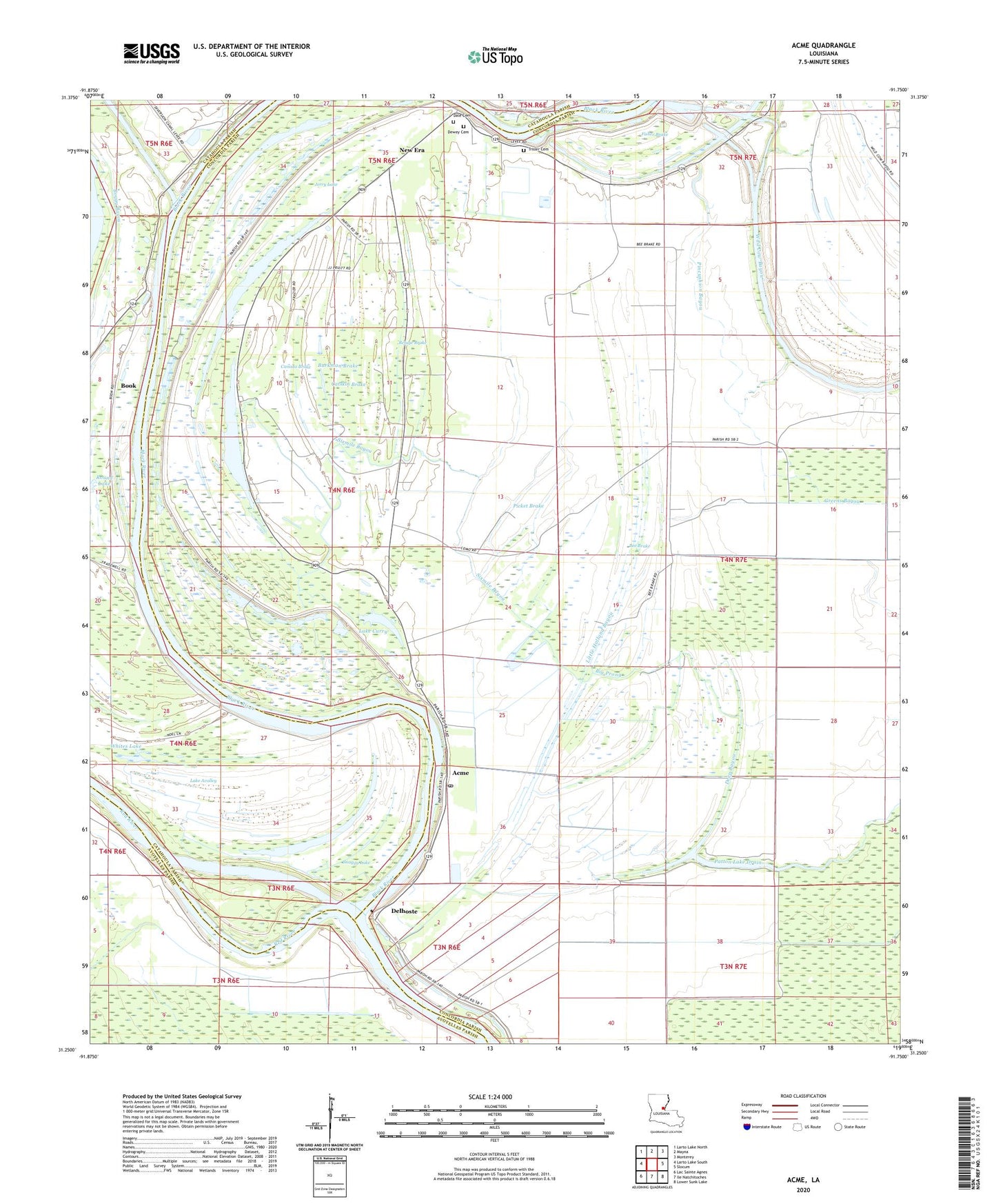
2024 topographic map quadrangle Acme in the state of Louisiana. Scale: 1:24000. Based on the newly updated USGS 7.5' US Topo map series, this map is in the following counties: Concordia, Catahoula, Avoyelles. The map contains contour data, water features, and other items you are used to seeing on USGS maps, but also has updated roads and other features. This is the next generation of topographic maps. Printed on high-quality waterproof paper with UV fade-resistant inks.
Quads adjacent to this one:
West: Larto Lake South
Northwest: Larto Lake North
North: Mayna
Northeast: Monterey
East: Slocum
Southeast: Lower Sunk Lake
South: Ile Natchitoches
Southwest: Lac Sainte Agnes
This map covers the same area as the classic USGS quad with code o31091c7.
Contains the following named places: Acme, Acme Church, Acme Post Office, Bee Brake, Bee Brake Oil Field, Big Prong, Black River, Book, Brewer Bayou, Buckston Bayou, Burkman Brake, Buttonwood Slough, Canada Brake, Catskin Brake, Dale Cemetery, Deep Bayou, Delhoste, Dewey Cemetery, Donnelly Lake, Fisher Brake, Jerry Lake, Lake Avolley, Lake Curry, Lake Curry Oil Field, Little Holland Bayou, Lorran Lake, Lorran Lake Oil Field, New Era, New Era School, North Bee Brake Oil Field, Parker Lake Oil Field, Patton Lake, Patton Lake Oil Field, Picket Brake, Pincushion Bayou, Refuge Brake, Sixmile Bayou, Snaggy Lake, Trisler Cemetery, Welsh Lake, Whites Lake, Widow Lake, Wild Cow Bayou, Williams Lake, Williams Landing Strip