MyTopo
Jamestown Louisiana US Topo Map
Couldn't load pickup availability
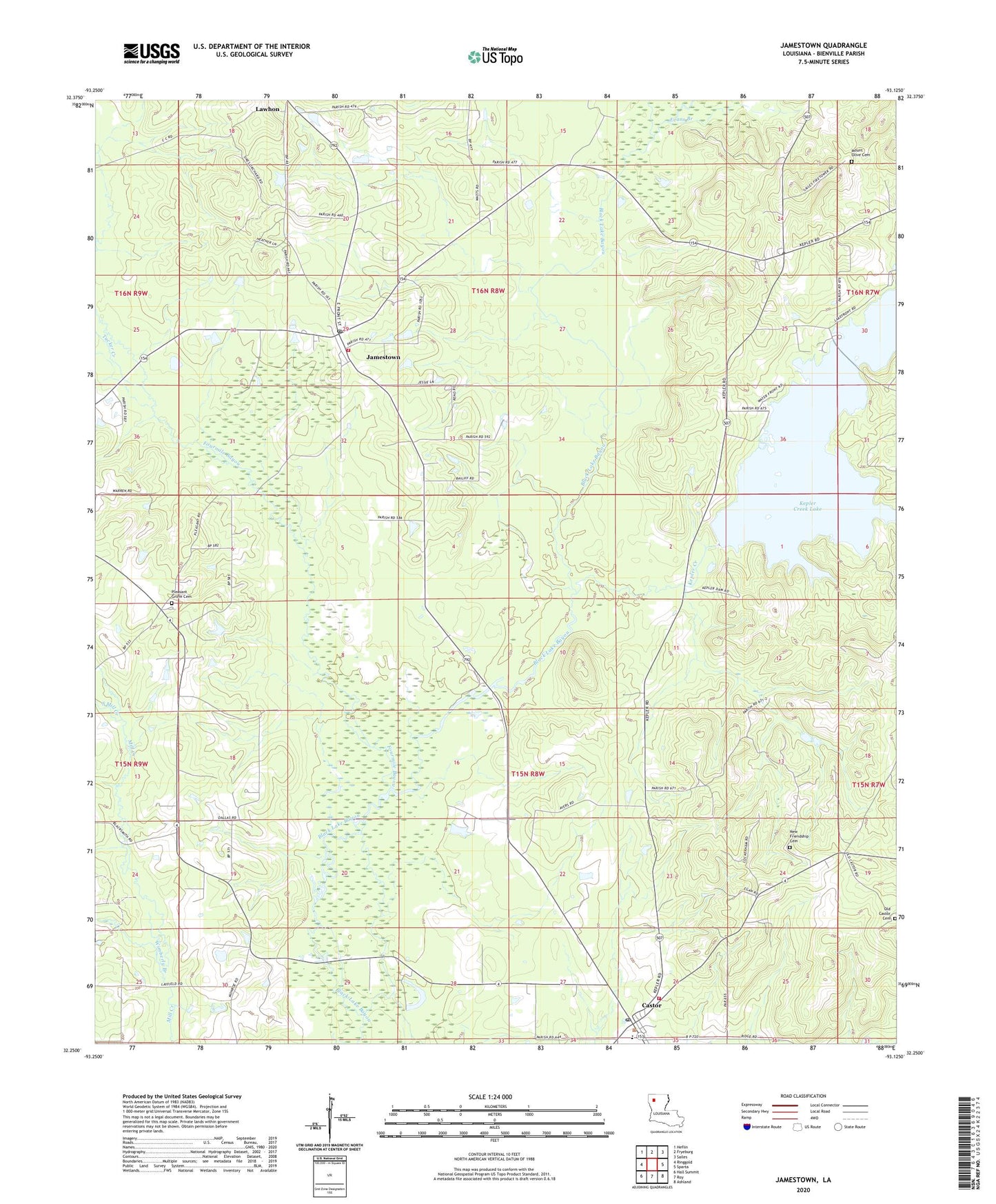
2024 topographic map quadrangle Jamestown in the state of Louisiana. Scale: 1:24000. Based on the newly updated USGS 7.5' US Topo map series, this map is in the following counties: Bienville. The map contains contour data, water features, and other items you are used to seeing on USGS maps, but also has updated roads and other features. This is the next generation of topographic maps. Printed on high-quality waterproof paper with UV fade-resistant inks.
Quads adjacent to this one:
West: Ringgold
Northwest: Heflin
North: Fryeburg
Northeast: Sailes
East: Sparta
Southeast: Ashland
South: Roy
Southwest: Hall Summit
This map covers the same area as the classic USGS quad with code o32093c2.
Contains the following named places: Anderson, Bienville Fire District 6, Bienville Parish Fire Protection District Wards 4 and 5 Station 3, Castor, Castor High School, Castor Post Office, Ebenezer School, Evans Branch, Evergreen Church, Jamestown, Jamestown Post Office, Kepler Creek, Kepler Creek Dam, Madden Mill Creek, Mount Olive Church, New Friendship Church Number 1, Old Castor, Old Castor Church, Pleasant Grove Cemetery, Pleasant Grove Church, Rosenwald School, Sailes Lookout Tower, South Mill Creek, Village of Castor, Village of Jamestown, Wimberly Branch, ZIP Code: 71045