MyTopo
Ringgold Louisiana US Topo Map
Couldn't load pickup availability
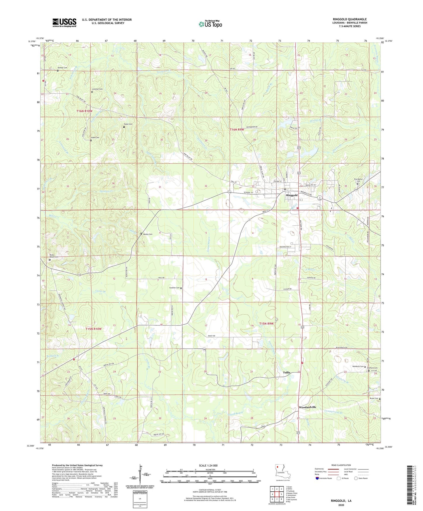
2024 topographic map quadrangle Ringgold in the state of Louisiana. Scale: 1:24000. Based on the newly updated USGS 7.5' US Topo map series, this map is in the following counties: Bienville. The map contains contour data, water features, and other items you are used to seeing on USGS maps, but also has updated roads and other features. This is the next generation of topographic maps. Printed on high-quality waterproof paper with UV fade-resistant inks.
Quads adjacent to this one:
West: Bossier Point
Northwest: Koran
North: Heflin
Northeast: Fryeburg
East: Jamestown
Southeast: Roy
South: Hall Summit
Southwest: East Point
This map covers the same area as the classic USGS quad with code o32093c3.
Contains the following named places: Armistead Branch, Bible Memory Association Camp Dam, Bienville Parish Fire Protection District 4 and 5 Station 5, Bienville Parish Fire Protection District Wards 4 and 5 Station 1, Bienville Parish Fire Protection District Wards 4 and 5 Station 4, Bienville Parish Fire Protection District Wards 4 and 5 Station 6, Bryan Cemetery, Carter Branch, Coleman Cemetery, Davis Creek, Fourmile Bayou, Grand Bayou Church, Hall Summit Lookout Tower, Hebrew Church, Israelite Church, Manning, Miracle Camp, Mosley Cemetery, Myers Temple, Nornside Church, Parish Governing Authority District 4, Parish Governing Authority District 5, Providence Church, Ringgold, Ringgold Elementary School, Ringgold Gas Field, Ringgold High School, Rocky Mount Cemetery, Rocky Mount Church, Saint Lukes Branch, Saint Lukes Church, Saint Marys Church, Shehee Cemetery, Spring Hill Church, Stafford Cemetery, Tennyson Creek, Thomas Branch, Thomas Branch Gas Field, Tooke Cemetery, Town of Ringgold, Tucker Creek, Tullis, Union Church, Ward Five, Ward Four, West Ringgold Gas Field, Wimberly Cemetery, Woodardville, Woodardville Gas Field, ZIP Code: 71068