MyTopo
West of Greens Bayou Texas US Topo Map
Couldn't load pickup availability
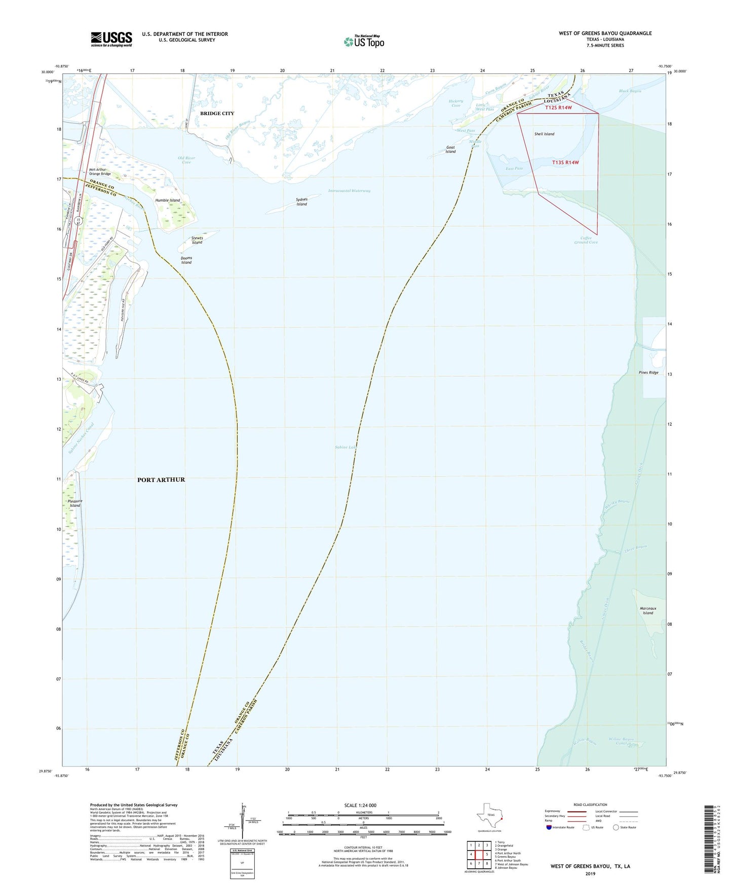
2022 topographic map quadrangle West of Greens Bayou in the states of Texas, Louisiana. Scale: 1:24000. Based on the newly updated USGS 7.5' US Topo map series, this map is in the following counties: Orange, Cameron, Jefferson. The map contains contour data, water features, and other items you are used to seeing on USGS maps, but also has updated roads and other features. This is the next generation of topographic maps. Printed on high-quality waterproof paper with UV fade-resistant inks.
Quads adjacent to this one:
West: Port Arthur North
Northwest: Terry
North: Orangefield
Northeast: Orange
East: Greens Bayou
Southeast: Johnson Bayou
South: West of Johnson Bayou
Southwest: Port Arthur South
This map covers the same area as the classic USGS quad with code o29093h7.
Contains the following named places: Bland Canal, Bridge Bayou, Coffee Ground Cove, Coon Bayou, Dooms Island, East Pass, Goat Island, Grays Canal, Grays Ditch, Hickory Cove, Humble Island, Little West Pass, Marceaux Island, Middle Pass, Neches River, Old River Bayou, Old River Cove, Port Arthur-Orange Bridge, Rainbow Marina, Sabine Lake, Sabine River, Shell Island, Stewts Island, Sydnes Island, Three Bayou, West Pass, Whisky Bayou