MyTopo
Koran Louisiana US Topo Map
Couldn't load pickup availability
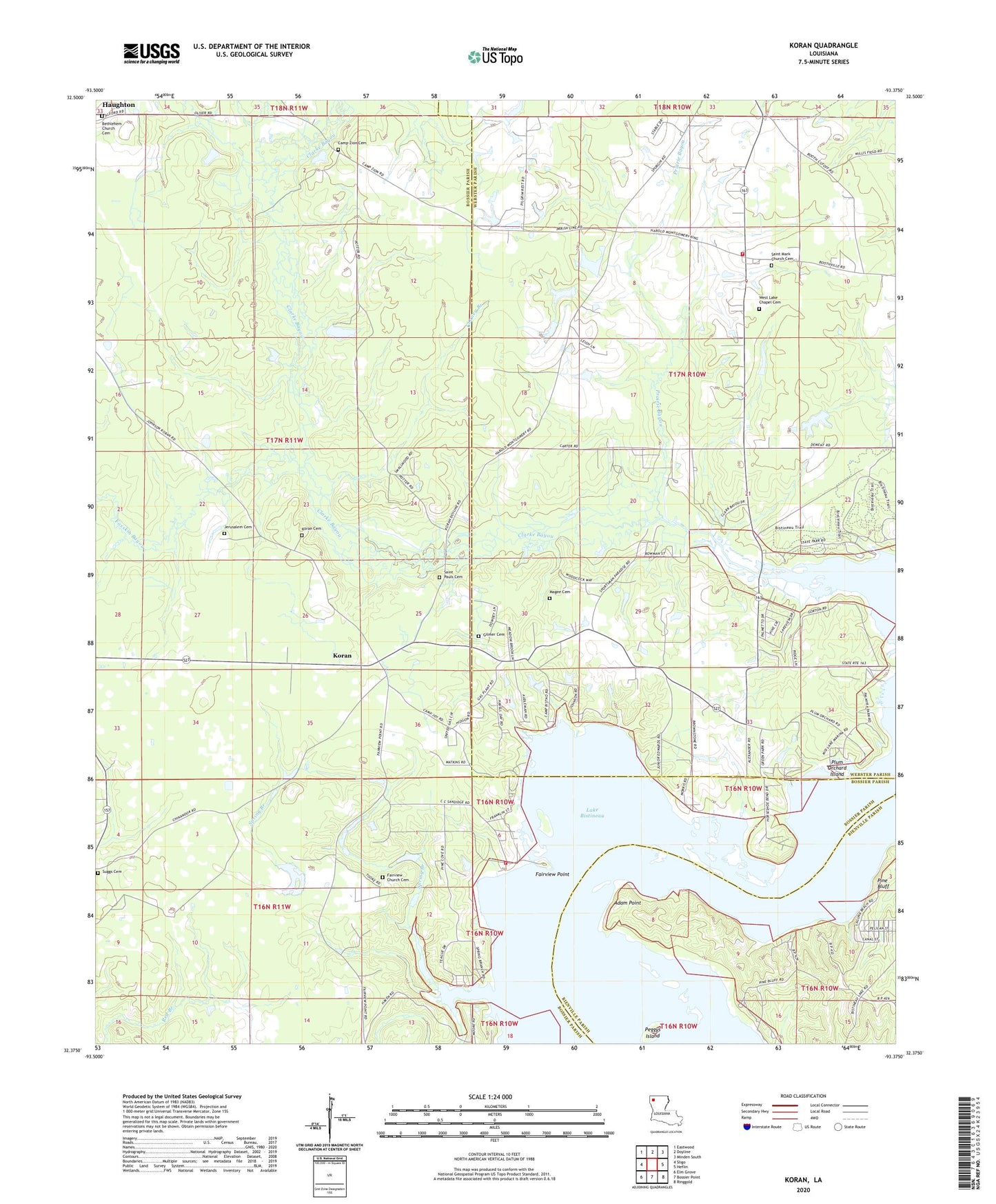
2024 topographic map quadrangle Koran in the state of Louisiana. Scale: 1:24000. Based on the newly updated USGS 7.5' US Topo map series, this map is in the following counties: Bossier, Webster, Bienville. The map contains contour data, water features, and other items you are used to seeing on USGS maps, but also has updated roads and other features. This is the next generation of topographic maps. Printed on high-quality waterproof paper with UV fade-resistant inks.
Quads adjacent to this one:
West: Sligo
Northwest: Eastwood
North: Doyline
Northeast: Minden South
East: Heflin
Southeast: Ringgold
South: Bossier Point
Southwest: Elm Grove
This map covers the same area as the classic USGS quad with code o32093d4.
Contains the following named places: Adam Point, Bethlehem Church, Bracks Chapel, Camp Zion Cemetery, Camp Zion Church, Chaney Branch, Clarke Bayou, Fairview Church Cemetery, Fairview Landing, Fairview Point, Foxskin Bayou, Gilmer Cemetery, Jerusalem Cemetery, Jerusalem Church, Koran, Koran Cemetery, Lake Bistineau, Lake Bistineau State Park, McDowell Pond Dam, Parish Governing Authority District 1, Parish Governing Authority District 12, Peggys Island, Pine Bluff, Plum Orchard Island, Plum Orchard Landing, Prairie Bayou, Saint Marks Church, Saint Marys Church, Saint Pauls Cemetery, Shirley Willis Pond Dam, South Bossier Volunteer Fire Department Station 3, Spring Branch, Suggs Cemetery, Tadpole Lake, Webster Parish Fire District 3 Doyline Fire Department, ZIP Codes: 71023, 71037