MyTopo
Latania Lake Louisiana US Topo Map
Couldn't load pickup availability
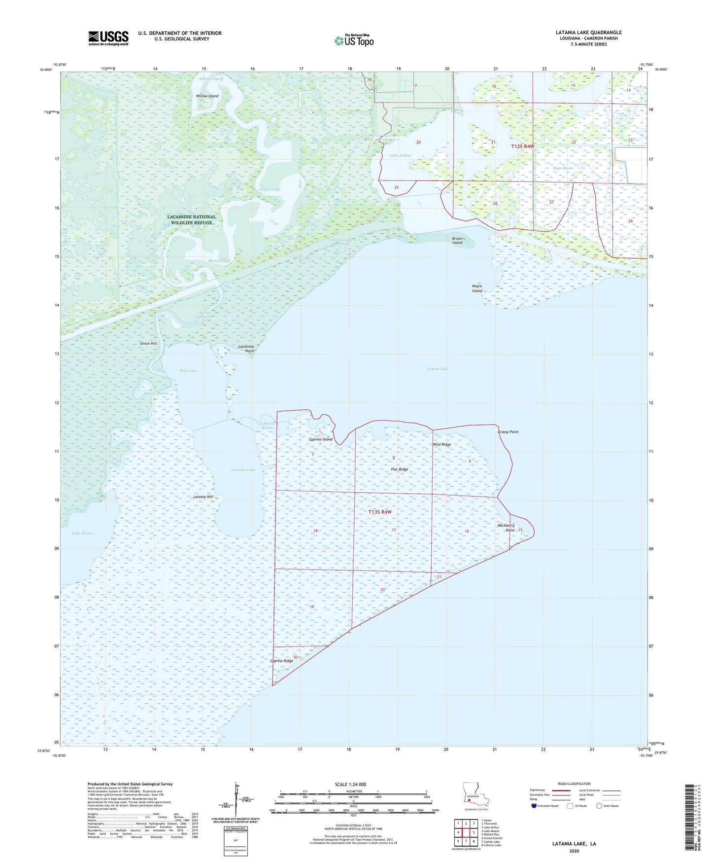
2024 topographic map quadrangle Latania Lake in the state of Louisiana. Scale: 1:24000. Based on the newly updated USGS 7.5' US Topo map series, this map is in the following counties: Cameron. The map contains contour data, water features, and other items you are used to seeing on USGS maps, but also has updated roads and other features. This is the next generation of topographic maps. Printed on high-quality waterproof paper with UV fade-resistant inks.
Quads adjacent to this one:
West: Lake Misere
Northwest: Hayes
North: Thornwell
Northeast: Lake Arthur
East: Mallard Bay
Southeast: Collicon Lake
South: Catfish Lake
Southwest: Grand Chenier
This map covers the same area as the classic USGS quad with code o29092h7.
Contains the following named places: Bayou Lacassine, Bayou Misere, Brown Island, Cypress Island, Cypress Ridge, Flat Ridge, Floating Lake, Grand Lake, Grassy Point, Hackberry Point, Lacassine Point, Lakeside Oil and Gas Field, Latania Bayou, Latania Hill, Latania Lake, Long Cutoff, Mermentau Lake, Mud Lake, Negro Island, Onion Hill, Perreau Island Oil Field, Pirogue Trail, Short Cutoff, South Grand Lake Gas Field, Wild Ridge, Willow Cutoff, Willow Island