MyTopo
Hayes Louisiana US Topo Map
Couldn't load pickup availability
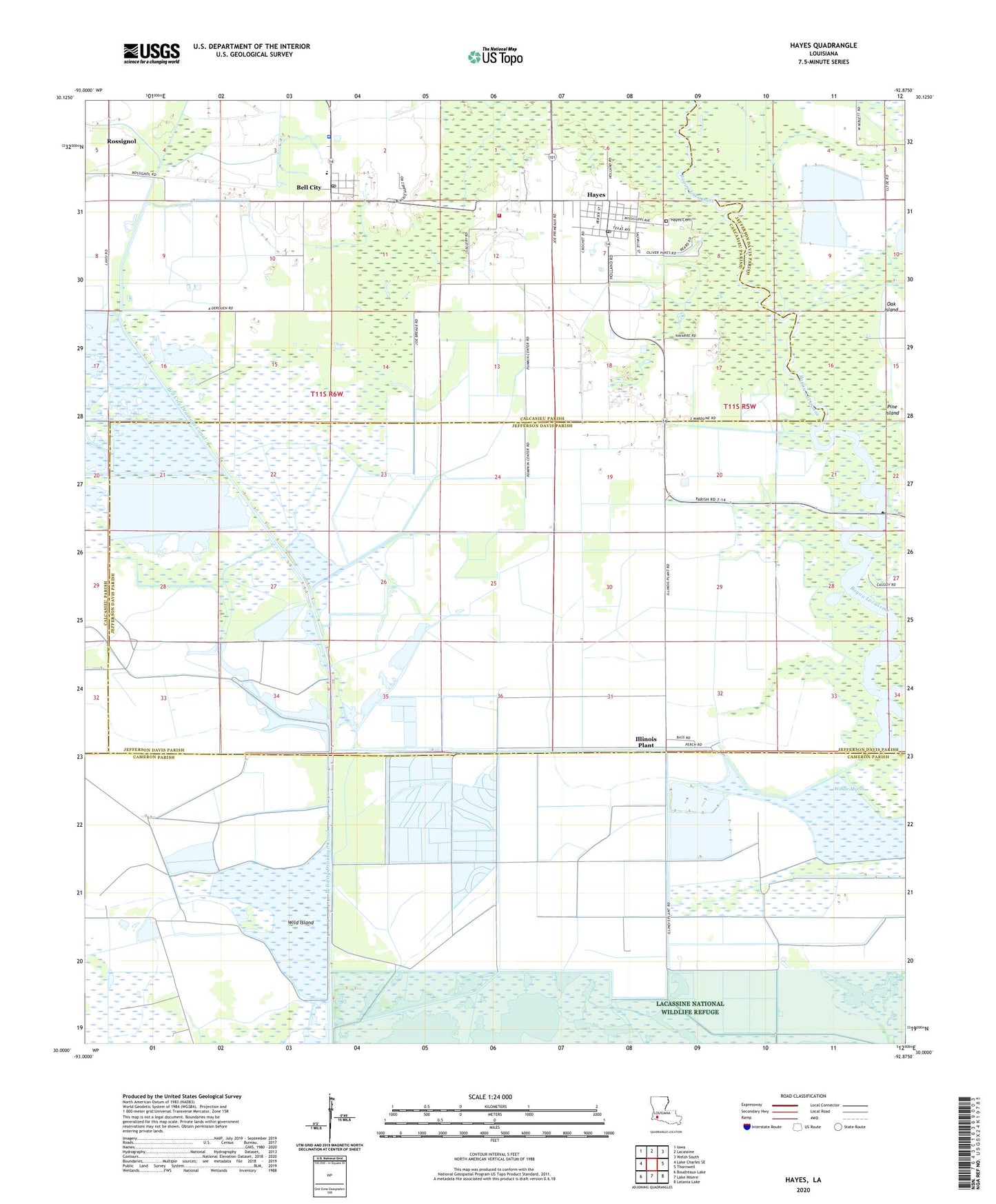
2024 topographic map quadrangle Hayes in the state of Louisiana. Scale: 1:24000. Based on the newly updated USGS 7.5' US Topo map series, this map is in the following counties: Cameron, Jefferson Davis, Calcasieu. The map contains contour data, water features, and other items you are used to seeing on USGS maps, but also has updated roads and other features. This is the next generation of topographic maps. Printed on high-quality waterproof paper with UV fade-resistant inks.
Quads adjacent to this one:
West: Lake Charles SE
Northwest: Iowa
North: Lacassine
Northeast: Welsh South
East: Thornwell
Southeast: Latania Lake
South: Lake Misere
Southwest: Boudreaux Lake
This map covers the same area as the classic USGS quad with code o30092a8.
Contains the following named places: Bell City, Bell City Drainage Canal, Bell City High School, Calcasieu Parish Library Bell City Branch, Calcasieu Parish Library Hayes Branch, Calcasieu Parish Ward 2 District 1 Volunteer Fire Department, Chalkey Oil and Gas Field, Faith Christian Fellowship Church, First Baptist Church, Hayes, Hayes Census Designated Place, Hayes Gas Field, Hayes Post Office, Illinois Plant, Jacques Coulee, Lacassine Refuge Gas Field, Lacassine Refuge Oil Field, Morgan Canal, North Chalkey Gas Field, Oak Island, Rossignol, Saint John Vianney Catholic Church, South Bell City Gas Field, South Hayes Gas Field, Ward Two, Wild Island, Willow Marsh, ZIP Code: 70646