MyTopo
Thornwell Louisiana US Topo Map
Couldn't load pickup availability
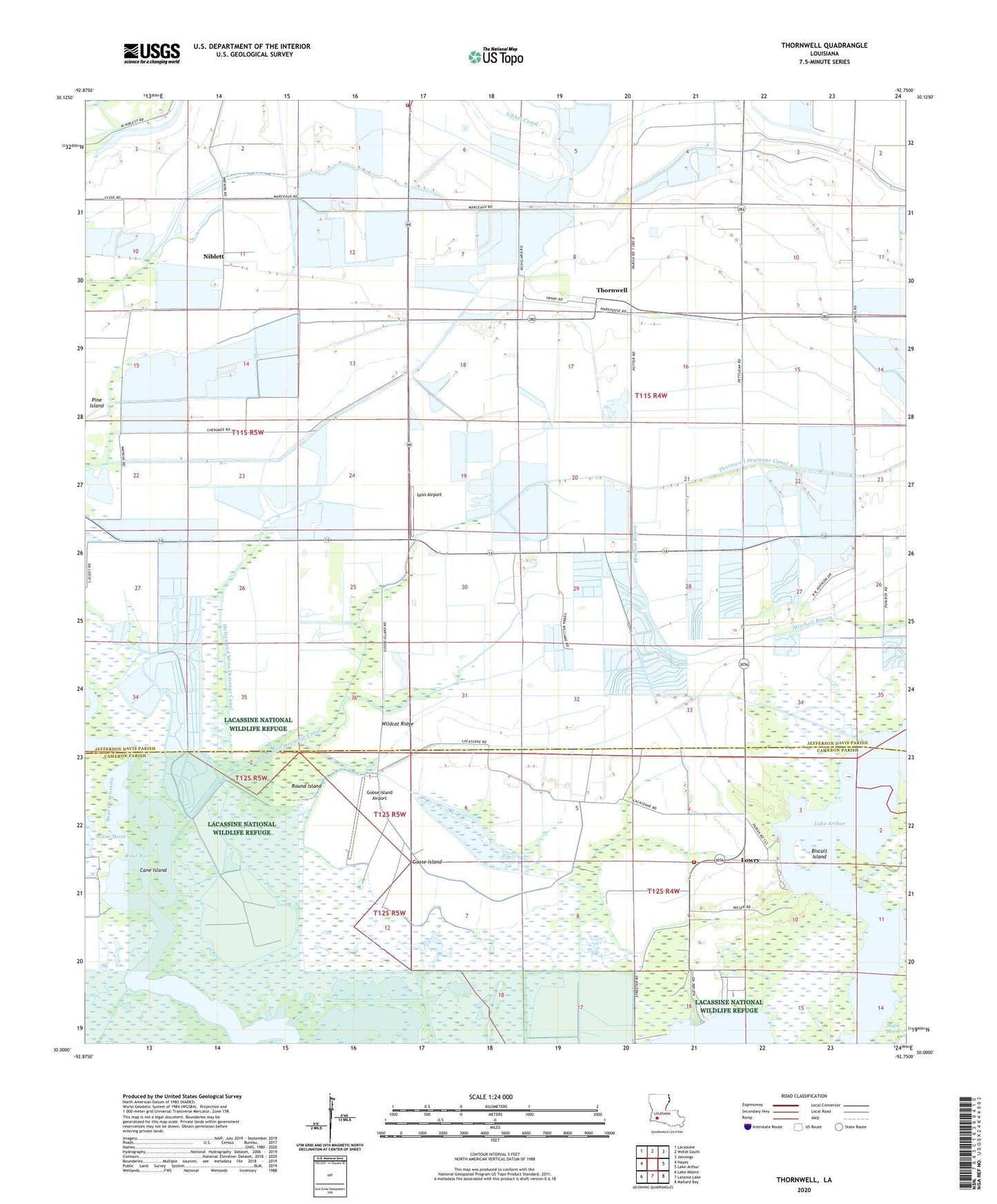
2024 topographic map quadrangle Thornwell in the state of Louisiana. Scale: 1:24000. Based on the newly updated USGS 7.5' US Topo map series, this map is in the following counties: Jefferson Davis, Cameron. The map contains contour data, water features, and other items you are used to seeing on USGS maps, but also has updated roads and other features. This is the next generation of topographic maps. Printed on high-quality waterproof paper with UV fade-resistant inks.
Quads adjacent to this one:
West: Hayes
Northwest: Lacassine
North: Welsh South
Northeast: Jennings
East: Lake Arthur
Southeast: Mallard Bay
South: Latania Lake
Southwest: Lake Misere
This map covers the same area as the classic USGS quad with code o30092a7.
Contains the following named places: Bayou Chene Volunteer Fire Department, Biscuit Island, Cane Island, Coto Plot, Four Rivers, Goose Island, Goose Island Airport, Great Quelqueshoe Prairie, Holton and Winn Drainage Canal, KJEF-FM (Jennings), Louisiana Noname 111 Dam, Lowery Fire Station, Lowry, Lyon Airport, Niblett, Niblett Canal, Parish Governing Authority District 1, Pine Island, Round Island, South Thornwell Gas Field, Southwest Lake Arthur Gas Field, Southwestern Canal, Thornwell, Thornwell Drainage Canal, Wildcat Ridge, ZIP Code: 70549