MyTopo
Lake Arthur Louisiana US Topo Map
Couldn't load pickup availability
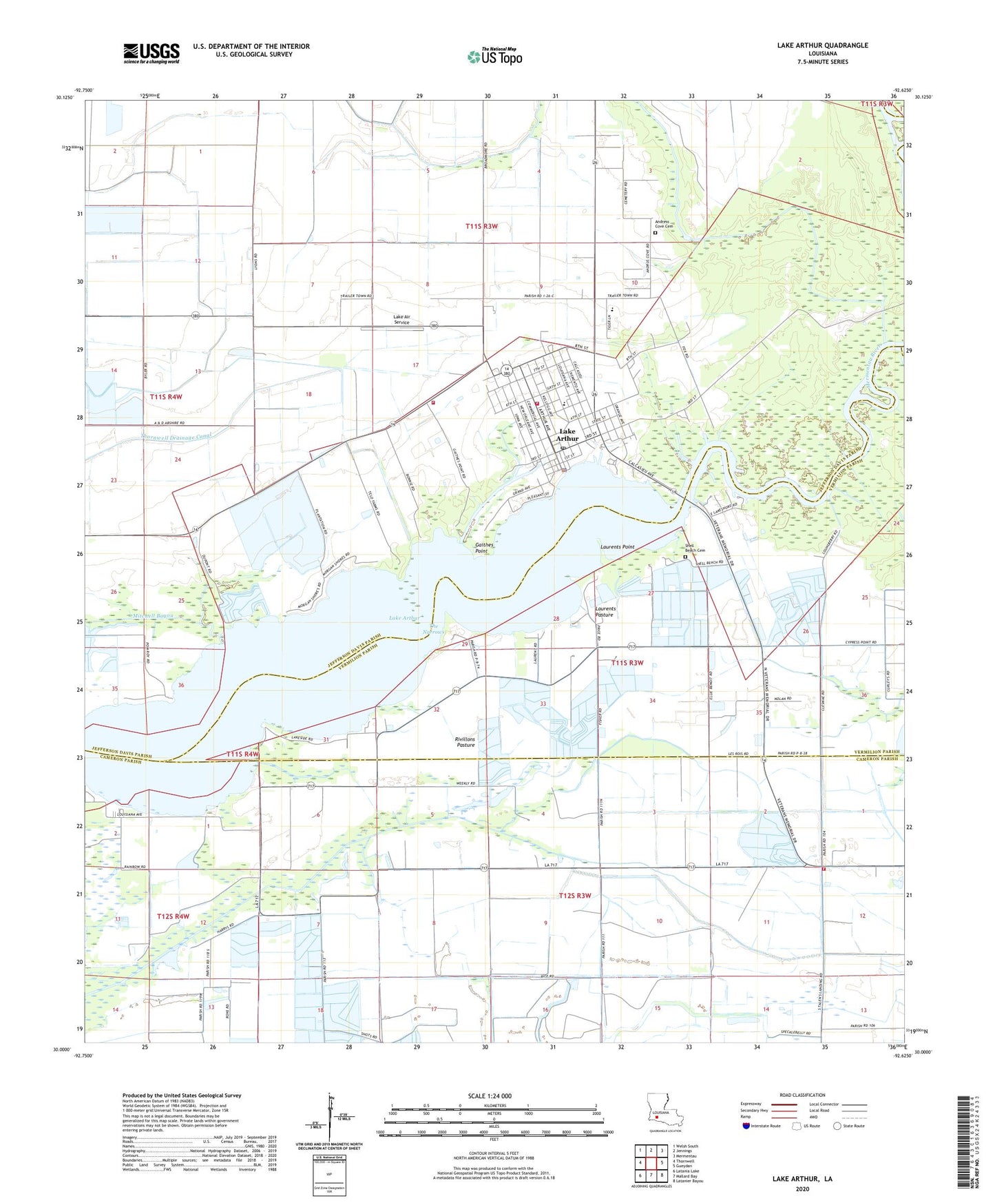
2024 topographic map quadrangle Lake Arthur in the state of Louisiana. Scale: 1:24000. Based on the newly updated USGS 7.5' US Topo map series, this map is in the following counties: Jefferson Davis, Cameron, Vermilion, Acadia. The map contains contour data, water features, and other items you are used to seeing on USGS maps, but also has updated roads and other features. This is the next generation of topographic maps. Printed on high-quality waterproof paper with UV fade-resistant inks.
Quads adjacent to this one:
West: Thornwell
Northwest: Welsh South
North: Jennings
Northeast: Mermentau
East: Gueydan
Southeast: Latanier Bayou
South: Mallard Bay
Southwest: Latania Lake
This map covers the same area as the classic USGS quad with code o30092a6.
Contains the following named places: Andress Cove, Andress Cove Cemetery, Antioch Baptist Church, Bayou Queue de Tortue, First Baptist Church, First United Methodist Church, Gaithes Point, Jefferson Davis Fire District 4, Jefferson Davis Parish Library Lake Arthur Branch, Klondike Canal, Klondike School, Klondike Volunteer Fire Department, Lake Air Service, Lake Arthur, Lake Arthur Elementary School, Lake Arthur High School, Lake Arthur Police Station, Lake Arthur Post Office, Lake Arthur Volunteer Fire Department, Laurents Pasture, Laurents Point, Mitchell Bayou, Our Lady of the Lake Church, Rivillons Pasture, Rivillons Wharf, Saint Theresa Church, South Lake Arthur Gas Field, Talens Marine and Fuel Lake Arthur Dock, The Narrows, Town of Lake Arthur, Ward One, West Lake Arthur Gas Field, West Lake Arthur Oil Field