MyTopo
Lawtell Louisiana US Topo Map
Couldn't load pickup availability
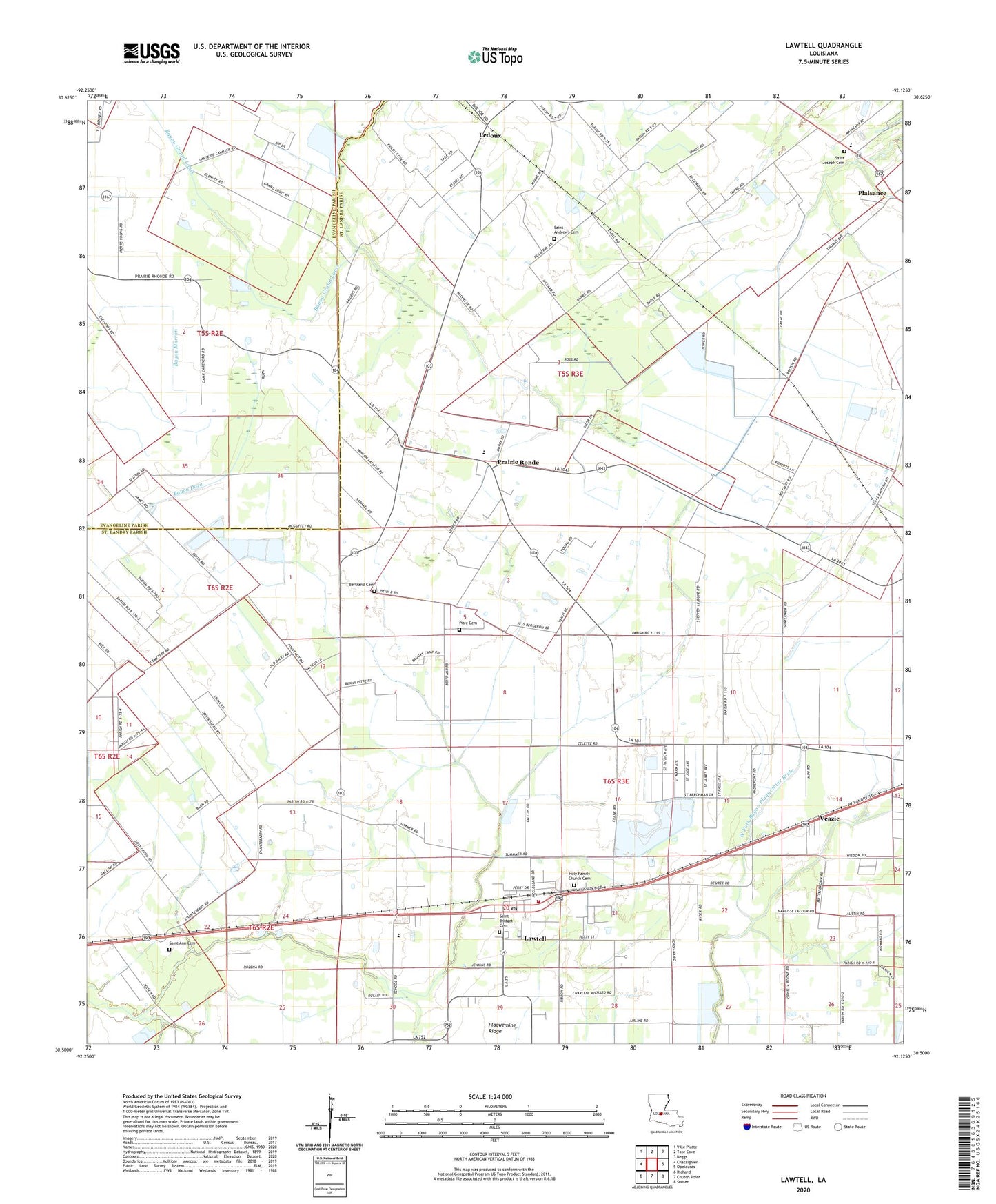
2024 topographic map quadrangle Lawtell in the state of Louisiana. Scale: 1:24000. Based on the newly updated USGS 7.5' US Topo map series, this map is in the following counties: St. Landry, Evangeline. The map contains contour data, water features, and other items you are used to seeing on USGS maps, but also has updated roads and other features. This is the next generation of topographic maps. Printed on high-quality waterproof paper with UV fade-resistant inks.
Quads adjacent to this one:
West: Chataignier
Northwest: Ville Platte
North: Tate Cove
Northeast: Beggs
East: Opelousas
Southeast: Sunset
South: Church Point
Southwest: Richard
This map covers the same area as the classic USGS quad with code o30092e2.
Contains the following named places: Bertrand Cemetery, Holy Family Church, Lawtell, Lawtell Census Designated Place, Lawtell Elementary School, Lawtell Gas Field, Lawtell Head Start Center School, Lawtell High School, Lawtell Post Office, Ledoux, Mount Hope Church, Mount Triumphant Church, Mount Zion Church, New Bethel Church, Northwest High School, Parish Governing Authority District 1, Parish Governing Authority District 3, Pitre Cemetery, Plaisance, Plaisance High School, Plaisance Middle School, Prairie Ronde, Prairie Ronde Church, Prairie School, Sacred Heart Church, Saint Andrews Cemetery, Saint Anns Catholic Church, Saint Anthony Church, Saint Bridget Church, Saint Joseph Church, Saint Landry Parish Fire District 3 Station 2, Saint Marks Church, True Fellowship Missionary Baptist Church, Veazie, West Fork Bayou Plaquemine Brule, Whitaker Ultralight Flightpark, ZIP Code: 70550