MyTopo
Lone Pine Louisiana US Topo Map
Couldn't load pickup availability
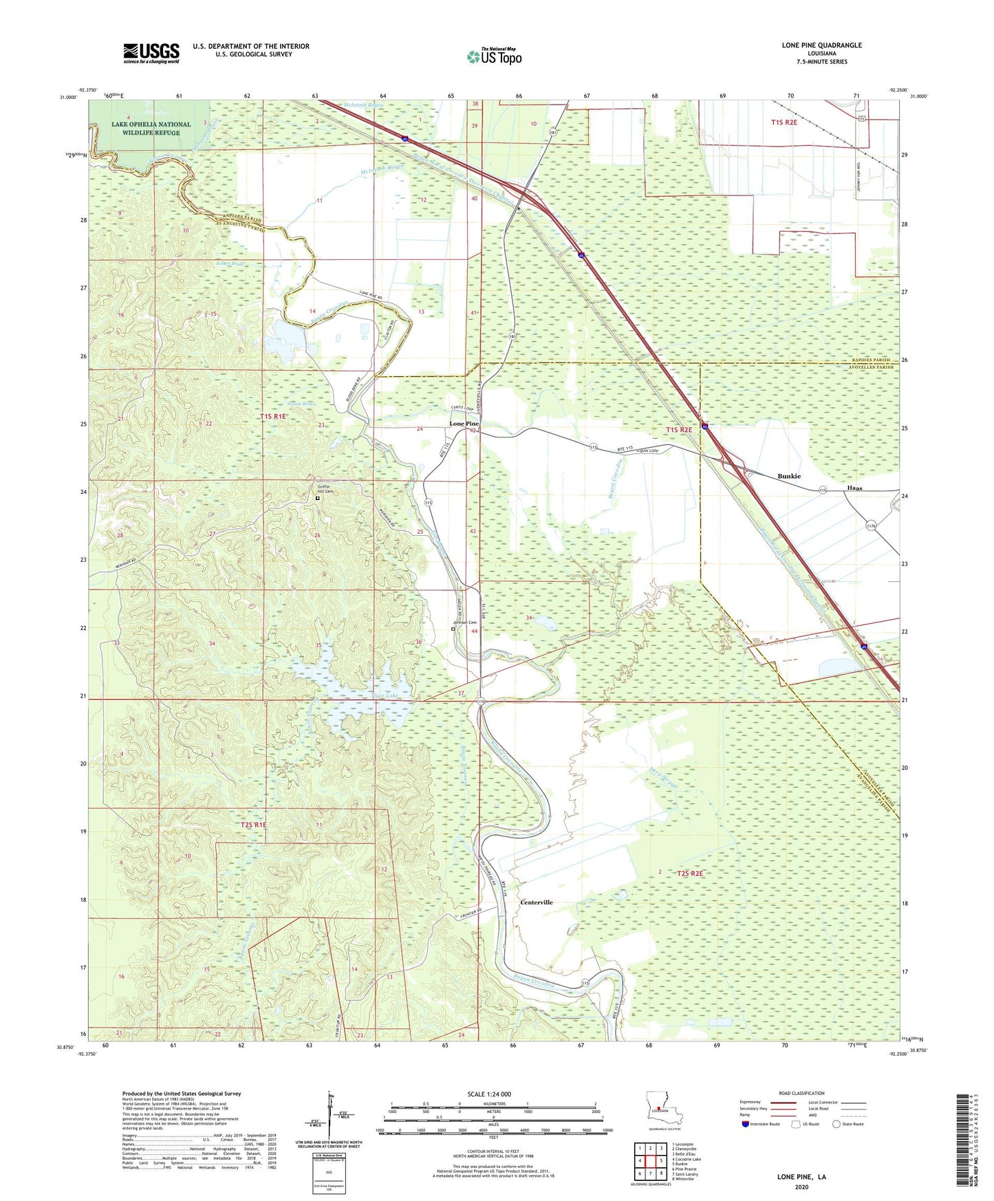
2024 topographic map quadrangle Lone Pine in the state of Louisiana. Scale: 1:24000. Based on the newly updated USGS 7.5' US Topo map series, this map is in the following counties: Evangeline, Rapides, Avoyelles. The map contains contour data, water features, and other items you are used to seeing on USGS maps, but also has updated roads and other features. This is the next generation of topographic maps. Printed on high-quality waterproof paper with UV fade-resistant inks.
Quads adjacent to this one:
West: Cocodrie Lake
Northwest: Lecompte
North: Cheneyville
East: Bunkie
Southeast: Whiteville
South: Saint Landry
Southwest: Pine Prairie
This map covers the same area as the classic USGS quad with code o30092h3.
Contains the following named places: Barstaw Spur, Bayou Taureau, Centerville, Centerville Church, Elm Bayou, Griffin Hill Cemetery, Haas, Johnson Cemetery, Jordan Spur, Lone Pine, Lone Pine Church, McIntosh Bayou, Morgans Bayou, Morning Glory Church, Robert Brake, Stewart, Tiger Lake, Townsend Lake, Turtle Bayou, Wilson Brake, ZIP Codes: 71325, 71367