MyTopo
Cheneyville Louisiana US Topo Map
Couldn't load pickup availability
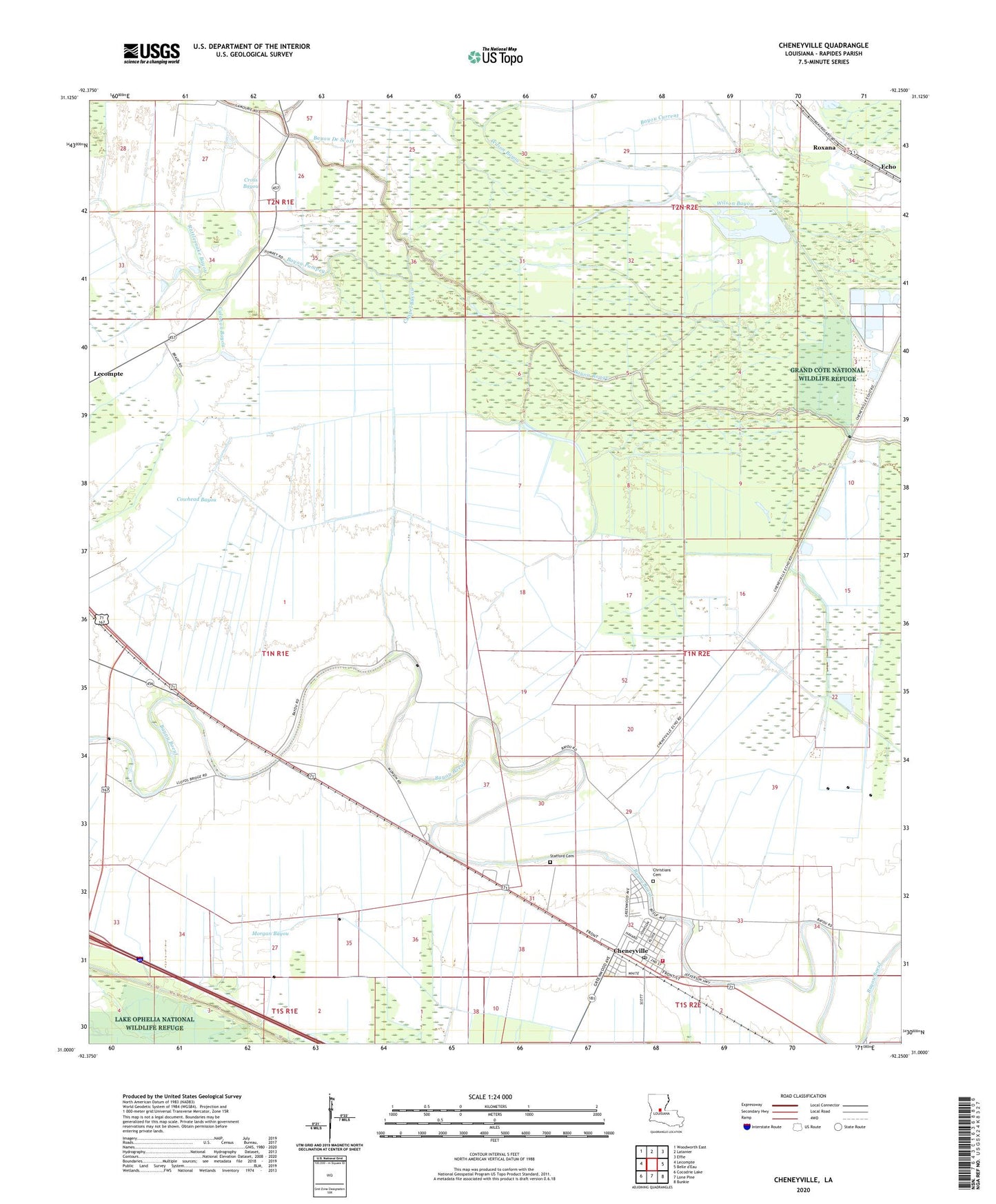
2024 topographic map quadrangle Cheneyville in the state of Louisiana. Scale: 1:24000. Based on the newly updated USGS 7.5' US Topo map series, this map is in the following counties: Rapides. The map contains contour data, water features, and other items you are used to seeing on USGS maps, but also has updated roads and other features. This is the next generation of topographic maps. Printed on high-quality waterproof paper with UV fade-resistant inks.
Quads adjacent to this one:
West: Lecompte
Northwest: Woodworth East
North: Latanier
Northeast: Effie
Southeast: Bunkie
South: Lone Pine
Southwest: Cocodrie Lake
This map covers the same area as the classic USGS quad with code o31092a3.
Contains the following named places: Bayou Current, Bayou De Scott, Bayou Pompey, Bayou Rouge, Bayou Sans, Beulah Baptist Church, Bird Pond, Calahan Bayou, Cappel Bayou, Cheneyville, Cheneyville Landing Strip, Cheneyville Post Office, Christians Cemetery, Cowhead Bayou, Cross Bayou, Edgefield Baptist Church, First Christian Church, Fish Lake, KRBG-FM (Bunkie), Loyd, Lyles, Morgan Bayou, New Hope Plantation, Rapides Parish Fire District 12, Rattlesnake Bayou, Roxana, Saint Samuel Church, Second Edgefield Baptist Church, Stafford Cemetery, Town of Cheneyville, Union Chapel, Vaughan Landing Strip, Wilson Lake, Witchwood, Wytchwood Plantation, ZIP Code: 71346