MyTopo
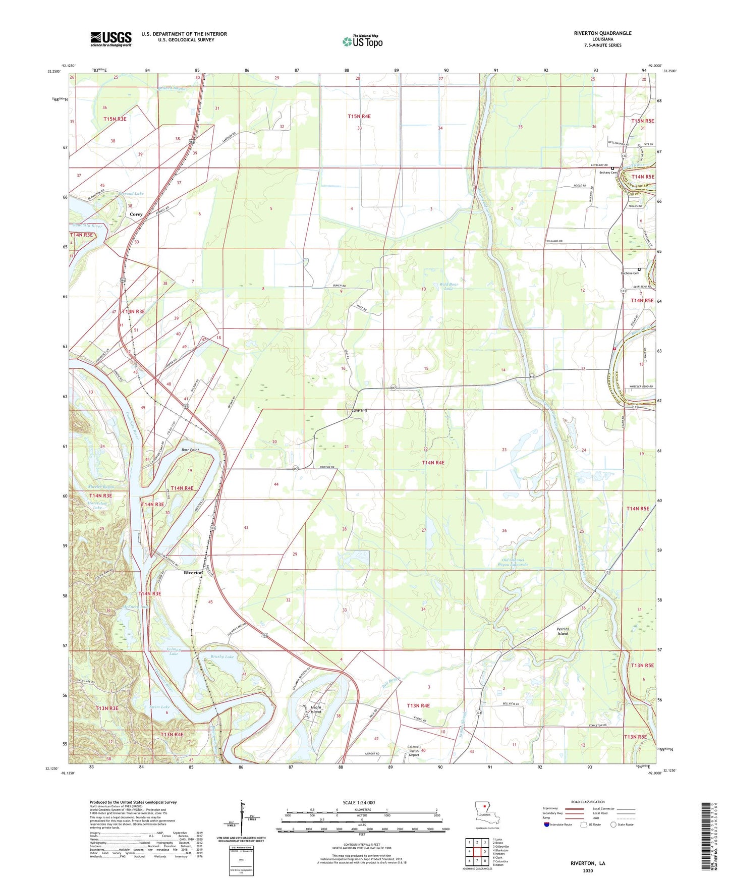
Riverton Louisiana US Topo Map
Couldn't load pickup availability
2024 topographic map quadrangle Riverton in the state of Louisiana. Scale: 1:24000. Based on the newly updated USGS 7.5' US Topo map series, this map is in the following counties: Caldwell, Richland. The map contains contour data, water features, and other items you are used to seeing on USGS maps, but also has updated roads and other features. This is the next generation of topographic maps. Printed on high-quality waterproof paper with UV fade-resistant inks.
Quads adjacent to this one:
West: Blankston
Northwest: Luna
North: Bosco
Northeast: Gilleyville
East: Hebert
Southeast: Mason
South: Columbia
Southwest: Clark
This map covers the same area as the classic USGS quad with code o32092b1.
Contains the following named places: Ballard Bayou, Barr Point, Barr Point Landing, Bayou deChene, Bell Bayou, Bellevue Baptist Church, Bethany Baptist Church, Bethany Cemetery, Brushy Lake, Brushy Lake Dam, Caldwell Parish Airport, Call Landing, Cane Hill, Cane Hill Gas Field, Columbia Closure Dam, Columbia Lock and Dam, Corey, Davis Lake, Duchene Cemetery, Eagle Lake, Ferrand Lake, Good Hope School, Hearn Island, Hebert School, Hebert Volunteer Fire Department, Horseshoe Lake, Indian Slough, Joe Powell Landing, Kenneys Airstrip, KLTM-TV (Monroe), KNoe-FM (Monroe), KNoe-TV (Monroe), Lock and Dam Number Three, Marsh Landing, McEnery Lake, Old Channel Bayou Lafourche, Parish Governing Authority District 1, Perrins Island, Riverton, Riverton Lake, Saint Alban Landing, Sinope Landing, Smithland Landing, Swim Lake, Volman Lake, Wheeler Bayou, Wild Boar Lake, ZIP Code: 71418