MyTopo
Madewood Louisiana US Topo Map
Couldn't load pickup availability
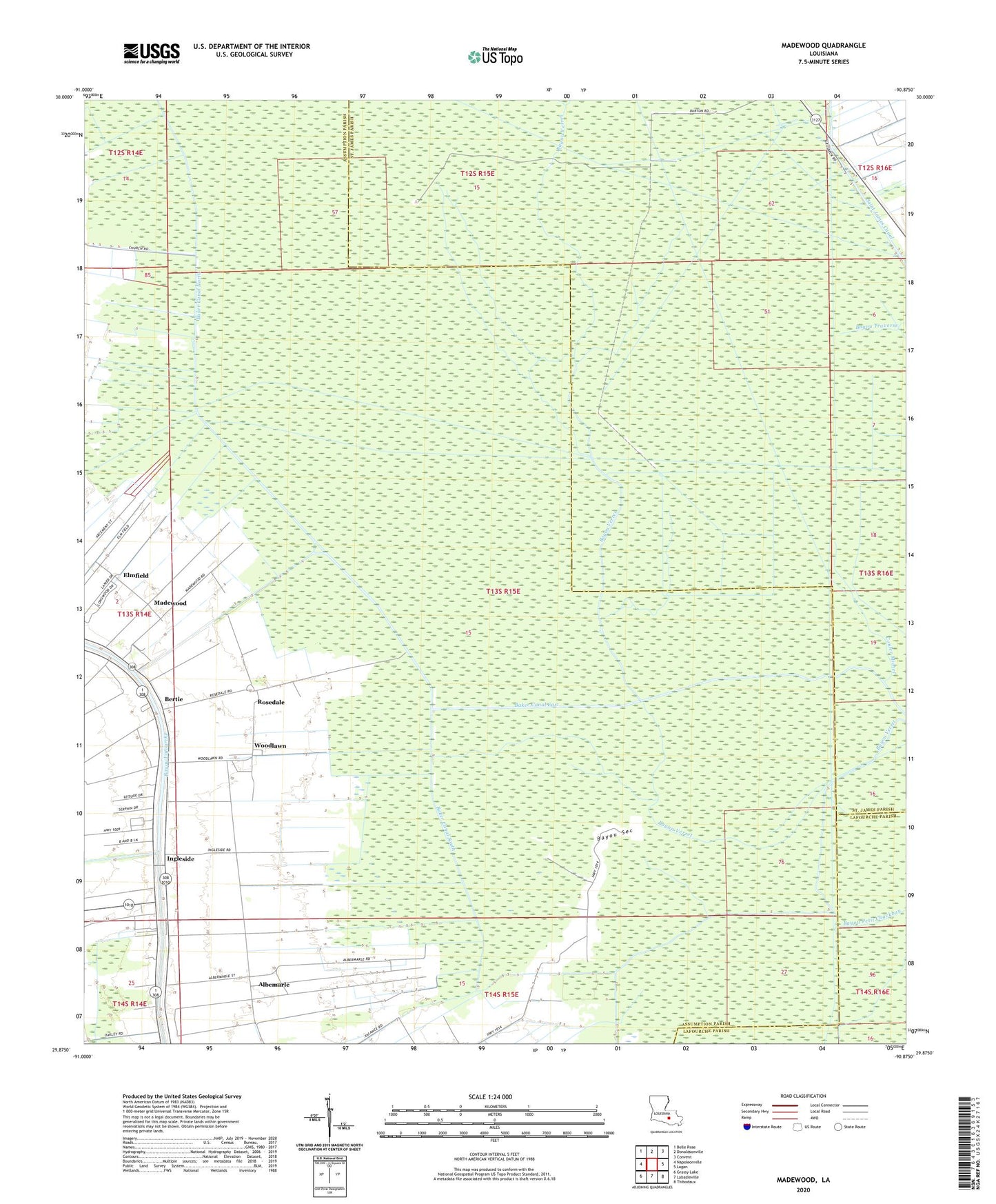
2024 topographic map quadrangle Madewood in the state of Louisiana. Scale: 1:24000. Based on the newly updated USGS 7.5' US Topo map series, this map is in the following counties: Assumption, St. James, Lafourche. The map contains contour data, water features, and other items you are used to seeing on USGS maps, but also has updated roads and other features. This is the next generation of topographic maps. Printed on high-quality waterproof paper with UV fade-resistant inks.
Quads adjacent to this one:
West: Napoleonville
Northwest: Belle Rose
North: Donaldsonville
Northeast: Convent
East: Lagan
Southeast: Thibodaux
South: Labadieville
Southwest: Grassy Lake
This map covers the same area as the classic USGS quad with code o29090h8.
Contains the following named places: Albemarle, Baker Canal East, Baker Canal North, Baker Canal South, Bayou Sec, Bertie, Burton Gas Field, Cedar Grove Plantation Pond, Cedar Grove Plantation Pond Dam, Coteau Frene, Coteau Frene Oil and Gas Field, Coulee Michel, Dons Flying Service Airport, Elmfield, Ingleside, Madewood, Mount Carmel Church, Parish Governing Authority District 1, Parish Governing Authority District 2, Rosedale, Saint James Canal, Ward Two, West Burton Gas Field, Woodlawn, Woodlawn Church