MyTopo
Convent Louisiana US Topo Map
Couldn't load pickup availability
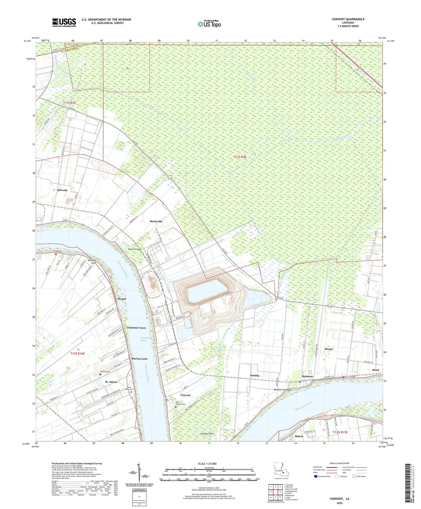
2024 topographic map quadrangle Convent in the state of Louisiana. Scale: 1:24000. Based on the newly updated USGS 7.5' US Topo map series, this map is in the following counties: St. James, Ascension. The map contains contour data, water features, and other items you are used to seeing on USGS maps, but also has updated roads and other features. This is the next generation of topographic maps. Printed on high-quality waterproof paper with UV fade-resistant inks.
Quads adjacent to this one:
West: Donaldsonville
Northwest: Gonzales
North: Sorrento
Northeast: Mount Airy NW
East: Lutcher
Southeast: Lower Vacherie
South: Lagan
Southwest: Madewood
This map covers the same area as the classic USGS quad with code o30090a7.
Contains the following named places: Bayou des Acadiens, Belmont, Belmont Crevasse, Belmont Revetment, Bend, Bon Esperance Plantation, Brilliant Point, Burton, Burton Lane, Burton Lane Church, Burton Lane School, Cantrelle Reach, Caribo Landing, Celestin Cemetery, Celestine Plantation, Chatman Town, Colomb Park, Columbia Plantation, Convent, Convent Census Designated Place, Convent Landing, Convent Post Office, Convent Station, Dubon Spur, Elevation Plantation, Feitel, Forstall, Free Town, Grand Point, Greater Evergreen Baptist Church, Helvetia, Helvetial Landing, Hester Census Designated Place, Hester Plantation, Hester Post Office, Hester Station, Hestor Oil and Gas Field, Hymel, Jamestown Landing, Lilly Plantation, Lily Landing, Malarcher, Malarcher Plantation, Mount Olive Church, Nicholle, Nita Crevasse, Oak Alley Foundation, Oak Alley Landing, Oak Alley Plantation, Olga Landing, Oneida, Parish Governing Authority District 4, Paulina Grand Point Belmont Volunteer Fire Department Hester Station, Rapidan Plantation, Romeville, Romeville Census Designated Place, Romeville Gas Field, Romeville Revetment, Sacred Heart Convent, Saint Amelia Gas Field, Saint Cecil Landing, Saint Cecile Plantation, Saint Clair Landing, Saint Claire Plantation, Saint James Cemetery, Saint James Census Designated Place, Saint James Church, Saint James Parish, Saint James Parish Canal, Saint James Plantation, Saint James School, Saint James Volunteer Fire Department Welcome Station, Saint Joseph Plantation, Saint Michael Cemetery, Saint Michael Plantation, Saint Michael School, Saint Michaels Church, Saint Michaels Church Historic District, Saint Trisca Plantation, Science and Math Academy School, Sixth Ward Elementary School, Sweet View Church, Theriot Plantation, Timberton, Uncle Sam, Uncle Sam Landing, Uncle Sam Plantation, Vacherie Head Start Center Number 1 School, Vacherie Head Start Center Number 2 School, Ward Five, Ward Four, Welcome, Welham Landing, Welham Plantation, Wilton Landing, Wilton Plantation, Wilton Station, ZIP Codes: 70086, 70723, 70743