MyTopo
Mount Airy NE Louisiana US Topo Map
Couldn't load pickup availability
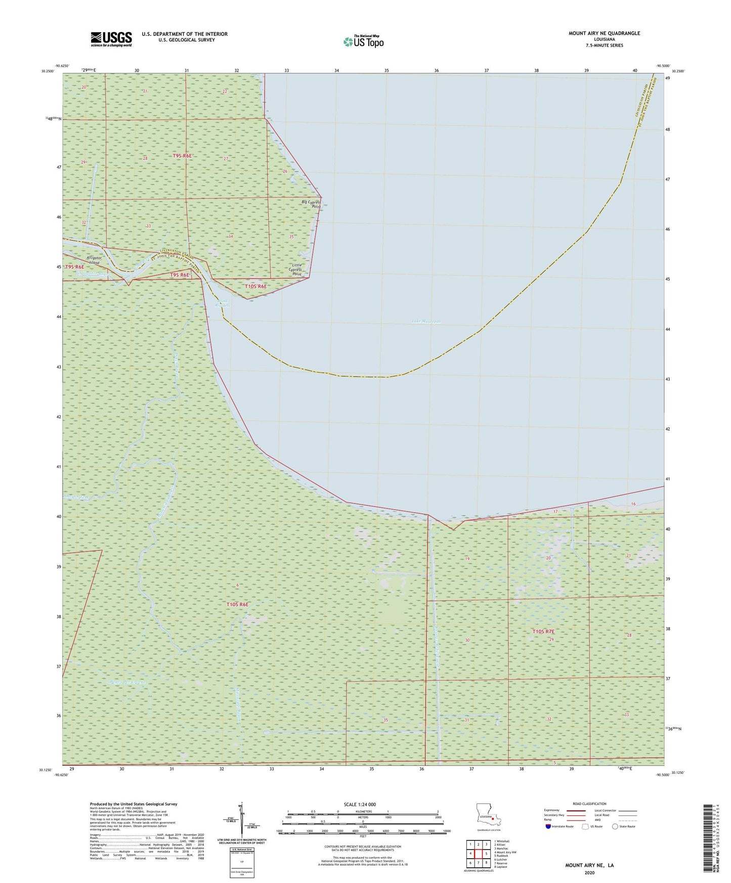
2024 topographic map quadrangle Mount Airy NE in the state of Louisiana. Scale: 1:24000. Based on the newly updated USGS 7.5' US Topo map series, this map is in the following counties: St. John the Baptist, Livingston. The map contains contour data, water features, and other items you are used to seeing on USGS maps, but also has updated roads and other features. This is the next generation of topographic maps. Printed on high-quality waterproof paper with UV fade-resistant inks.
Quads adjacent to this one:
West: Mount Airy NW
Northwest: Whitehall
North: Killian
Northeast: Manchac
East: Ruddock
Southeast: Laplace
South: Reserve
Southwest: Lutcher
This map covers the same area as the classic USGS quad with code o30090b5.
Contains the following named places: Alligator Bayou, Bayou Bec Croche, Bayou Tent, Big Cypress Point, Blind Rigolets, Blind River, Dutch Bayou, Lake Maurepas Oil Field, Little Cypress Point, Mississippi Bayou, Parish Governing Authority District 2, South Lake Maurepas Gas Field