MyTopo
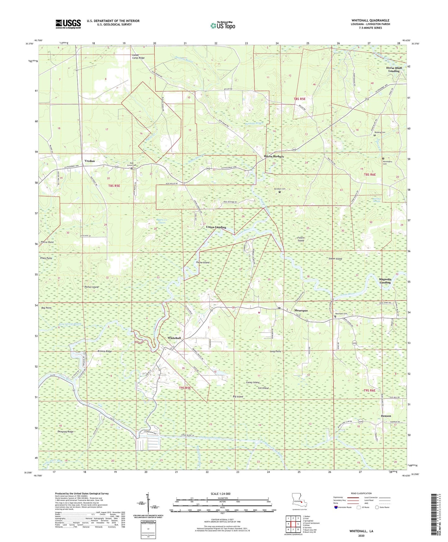
Whitehall Louisiana US Topo Map
Couldn't load pickup availability
2024 topographic map quadrangle Whitehall in the state of Louisiana. Scale: 1:24000. Based on the newly updated USGS 7.5' US Topo map series, this map is in the following counties: Livingston. The map contains contour data, water features, and other items you are used to seeing on USGS maps, but also has updated roads and other features. This is the next generation of topographic maps. Printed on high-quality waterproof paper with UV fade-resistant inks.
Quads adjacent to this one:
West: French Settlement
Northwest: Walker
North: Frost
Northeast: Springfield
East: Killian
Southeast: Mount Airy NE
South: Mount Airy NW
Southwest: Sorrento
This map covers the same area as the classic USGS quad with code o30090c6.
Contains the following named places: Arthur Slough, Bay Point, Bayou Barbary, Bayou Barbary School, Bayou La Glaise, Beaver Creek, Big Island, Black Lake, Browns Ridge, Bull Run Swamp, Caney Island, Cat Island, Catfish Landing, Chinquapin Canal, Church Branch, Davidson Cemetery, Dempsey Ridge, Denson, Dunham Bayou, Ficklin Island, Fundamental Baptist Church, Gunboat Landing, Horse Bluff Landing, King George Bayou, King George Island, Long Point, Magnolia Landing, Maurepas, Maurepas Cemetery, Maurepas Fire Department, Maurepas Post Office, Maurepas School, Maurepas United Methodist Church, Neal Landing, Old River, Pennington Cemetery, Pine Grove Baptist Church, Pine Grove Baptist Church Cemetery, Poche Island, Pocket Island, Redding Cemetery, Saint Stephen Catholic Church, Second Zion Traveler Baptist Church, Steam Island, Sweet Kingdom Church, Tiger Bluff Landing, Union Landing, Verdun, Wall Bayou, Whitehall, Whitehall Coteau, ZIP Code: 70449