MyTopo
Mount Airy NW Louisiana US Topo Map
Couldn't load pickup availability
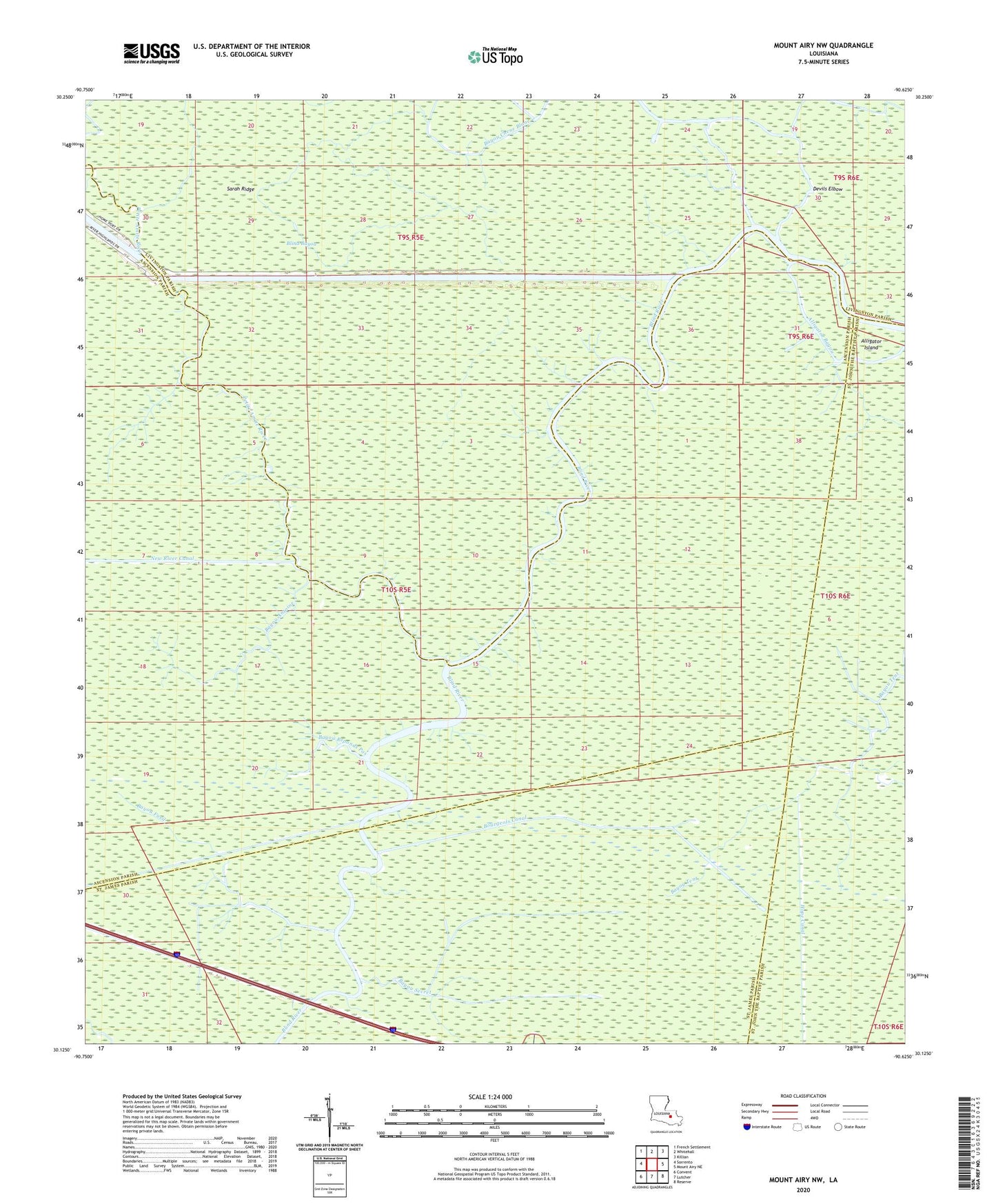
2024 topographic map quadrangle Mount Airy NW in the state of Louisiana. Scale: 1:24000. Based on the newly updated USGS 7.5' US Topo map series, this map is in the following counties: Ascension, Livingston, St. James, St. John the Baptist. The map contains contour data, water features, and other items you are used to seeing on USGS maps, but also has updated roads and other features. This is the next generation of topographic maps. Printed on high-quality waterproof paper with UV fade-resistant inks.
Quads adjacent to this one:
West: Sorrento
Northwest: French Settlement
North: Whitehall
Northeast: Killian
East: Mount Airy NE
Southeast: Reserve
South: Lutcher
Southwest: Convent
This map covers the same area as the classic USGS quad with code o30090b6.
Contains the following named places: Alligator Island, Bayou Antoine, Bayou Chene Blanc, Bayou Fusil, Bayou Reponds Pas, Bayou Secret, Black Bayou, Blind Bayou, Bourgeois Canal, Coteau Chene Blanc, Coteau Chene Verde, Coteau Feivin, Devils Elbow, Fiebleman Lake, Little Bayou Chene Blanc, Number Twelve Canal, Petite Amite River, Sarah Ridge