MyTopo
Mount Hermon Louisiana US Topo Map
Couldn't load pickup availability
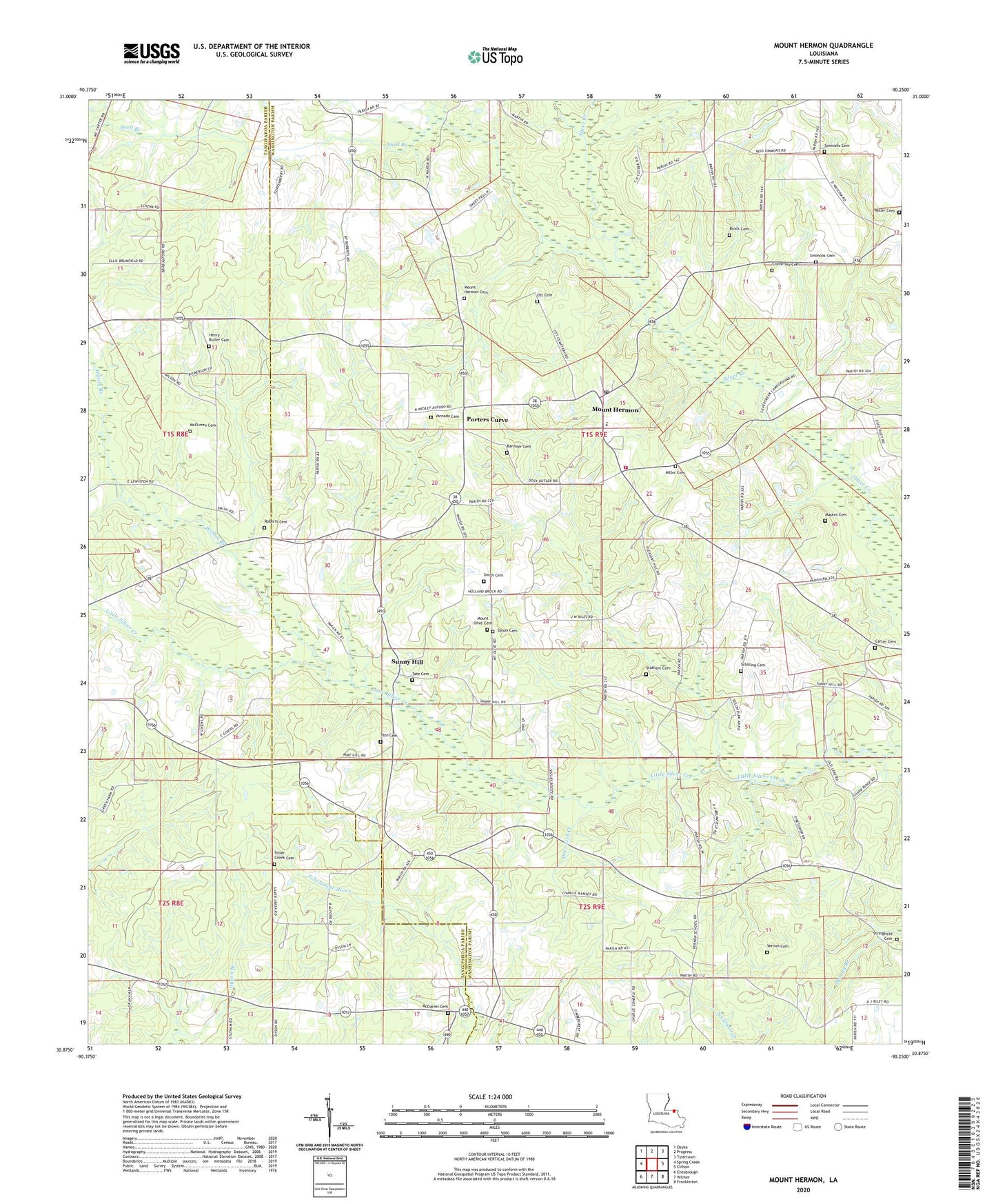
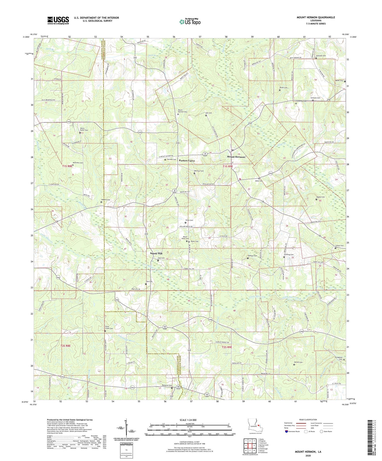
2024 topographic map quadrangle Mount Hermon in the state of Louisiana. Scale: 1:24000. Based on the newly updated USGS 7.5' US Topo map series, this map is in the following counties: Washington, Tangipahoa. The map contains contour data, water features, and other items you are used to seeing on USGS maps, but also has updated roads and other features. This is the next generation of topographic maps. Printed on high-quality waterproof paper with UV fade-resistant inks.
Quads adjacent to this one:
West: Spring Creek
Northwest: Osyka
North: Progress
Northeast: Tylertown
East: Clifton
Southeast: Franklinton
South: Wilmer
Southwest: Chesbrough
Contains the following named places: Bailey, Banister Cemetery, Bladefield Church of God in Christ, Brock Cemetery, Carter Cemetery, Connerley Cemetery, Deer Lick Creek, Dyson Cemetery, Henry Butler Cemetery, Jackson Store, James Chapel, Maples Cemetery, McDaniel Cemetery, McElveen Cemetery, Midway Church, Miller Cemetery, Mount Hermon, Mount Hermon Cemetery, Mount Hermon Post Office, Mount Hermon School, Mount Hermon United Methodist Church, Mount Olive Cemetery, Mount Olive Church, New Zion Church, Ott Cemetery, Parish Governing Authority District 11, Plainview Church, Pleasant Hill Church, Porters Curve, Roberts Cemetery, Schilling Cemetery, Silver Creek Cemetery, Silver Creek Church, Simmons Cemetery, Simmons Pond Dam, Smith Cemetery, Snell Branch, Statham Cemetery, Stringfield Cemetery, Sunlight Church, Sunny Hill, Sunny Hill Baptist Church, Sunny Hill Lookout Tower, Tate Cemetery, Union Chapel African Methodist Episcopal Church, Union Church, Varnado Cemetery, Vernon Cemetery, Vernon School, Ward Two, Washington Parish Fire Protection District 9, Wilson Branch, ZIP Code: 70450