MyTopo
Clifton Louisiana US Topo Map
Couldn't load pickup availability
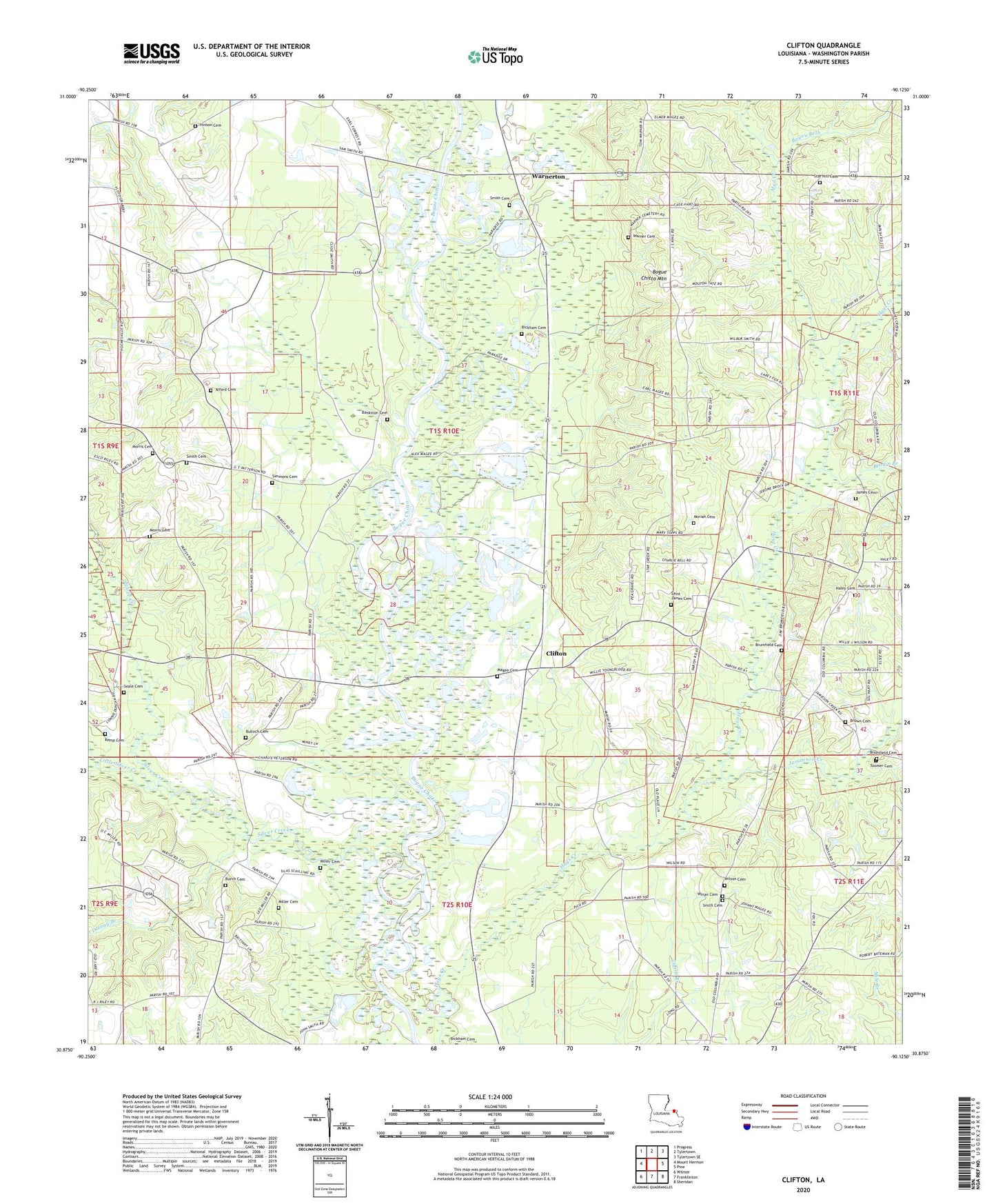
2024 topographic map quadrangle Clifton in the state of Louisiana. Scale: 1:24000. Based on the newly updated USGS 7.5' US Topo map series, this map is in the following counties: Washington. The map contains contour data, water features, and other items you are used to seeing on USGS maps, but also has updated roads and other features. This is the next generation of topographic maps. Printed on high-quality waterproof paper with UV fade-resistant inks.
Quads adjacent to this one:
West: Mount Hermon
Northwest: Progress
North: Tylertown
Northeast: Tylertown SE
East: Pine
Southeast: Sheridan
South: Franklinton
Southwest: Wilmer
This map covers the same area as the classic USGS quad with code o30090h2.
Contains the following named places: Alford Cemetery, Bankston Cemetery, Bayou Beth, Bethel Church, Bickham Cemetery, Bogue Chitto Baptist Church, Bogue Chitto Mountain, Bridges Mill, Brockdale Church, Brown Branch, Brown Cemetery, Brumfield Cemetery, Bulloch Cemetery, Burch Cemetery, Clifton, Clifton Church, Clifton Post Office, Cumnock, Delany Branch, Dyson, Haley Cemetery, Hays Creek, Hays Creek Church, Hays Creek School, Hinson Cemetery, James Cemetery, Jamieson Creek, Jerusalem Church, Jimson Creek School, Kemp Cemetery, Lear Hill Church, Lighthouse Church, Little Silver Creek, Magee Cemetery, Miller Cemetery, Moriah Cemetery, Morris Cemetery, Mount Pisgah Church, Mount Point School, Mud Creek, Oak Grove School, Pierces Mill, Saint James Cemetery, Seale Cemetery, Silver Creek, Simmons Cemetery, Smith Cemetery, Star Creek School, Star Hill Baptist Church, Star Hill Cemetery, Toomer Cemetery, Ward Nine, Warner Cemetery, Warnerton, Washington Parish Fire District 3 Hays Creek Volunteer Fire Department, Wildblood Branch, Wilson Cemetery, Winan Memorial Cemetery