MyTopo
Napoleonville Louisiana US Topo Map
Couldn't load pickup availability
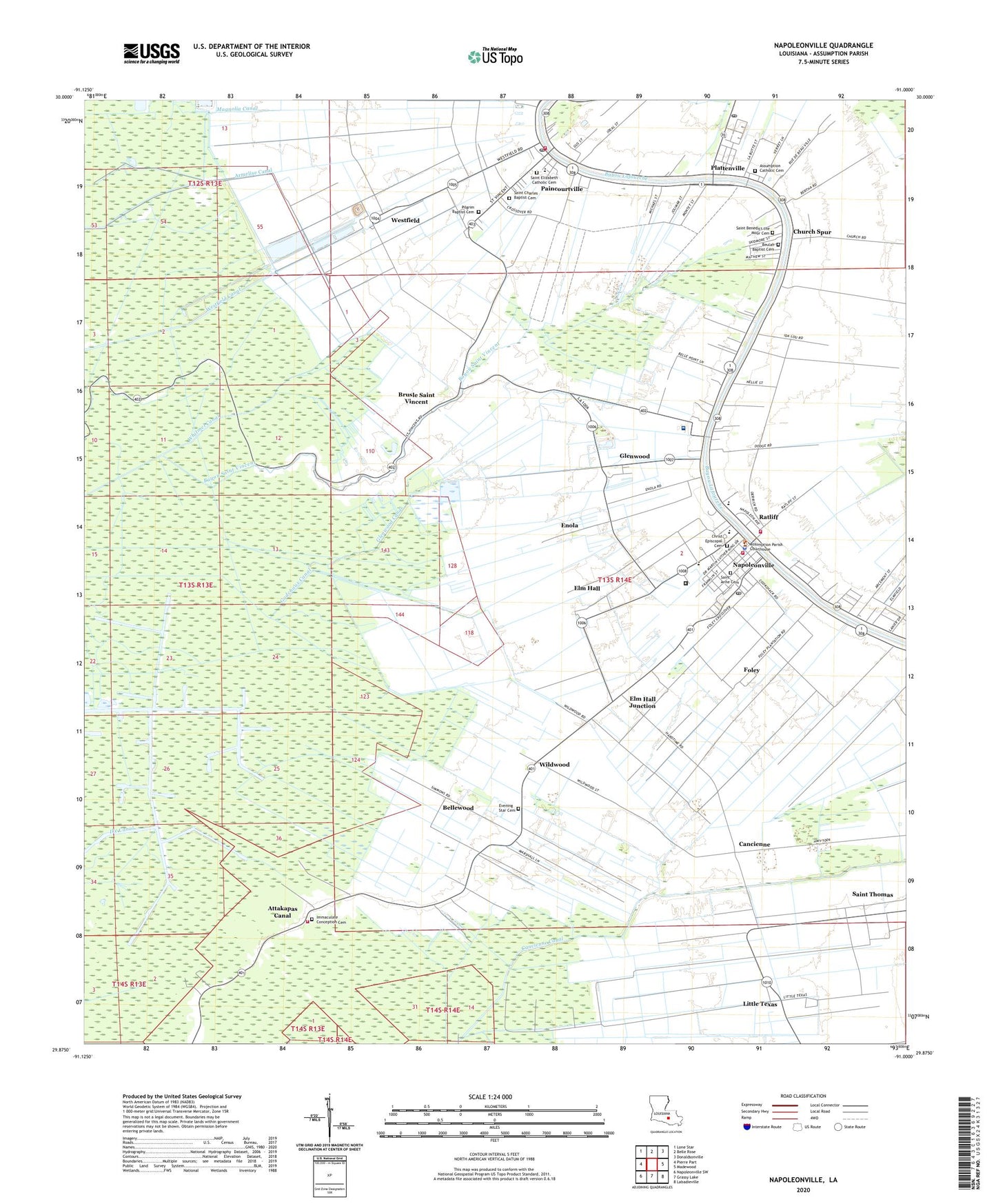
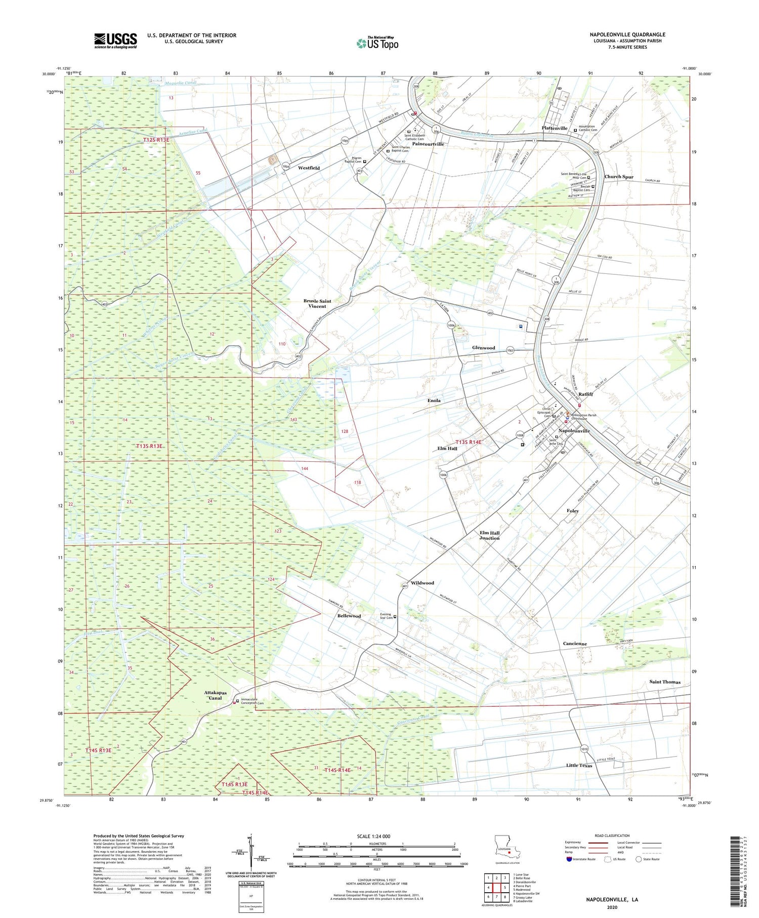
2020 topographic map quadrangle Napoleonville in the state of Louisiana. Scale: 1:24000. Based on the newly updated USGS 7.5' US Topo map series, this map is in the following counties: Assumption. The map contains contour data, water features, and other items you are used to seeing on USGS maps, but also has updated roads and other features. This is the next generation of topographic maps. Printed on high-quality waterproof paper with UV fade-resistant inks.
Quads adjacent to this one:
West: Pierre Part
Northwest: Lone Star
North: Belle Rose
Northeast: Donaldsonville
East: Madewood
Southeast: Labadieville
South: Grassy Lake
Southwest: Napoleonville SW
Contains the following named places: Armelise Canal, Assumption Area Chamber of Commerce, Assumption Community Hospital, Assumption General Heliport, Assumption High School, Assumption Middle Magnet School, Assumption Parish, Assumption Parish Agricultural Building, Assumption Parish Courthouse, Assumption Parish Library, Assumption Parish Police Jury, Assumption Parish Sheriff's Office, Assumption Parish Waterworks, Attakapas Canal, Bayou Saint Vincent, Bayou Side Golf Course, Beautiful Zion Baptist Church, Belle Wood Plantation, Bellewood, Bright Morning Star Baptist Church, Brusle Saint Vincent, Cancienne, Cancienne Canal, Canne Church, Christ Episcopal Cemetery, Christ Episcopal Church, Church of the Assumption of the Blessed Virgin, Church Spur, East Lake Verret Gas and Oil Field, Elm Hall, Elm Hall Junction, Enola, Evening Star Cemetery, First Baptist Church, First Pentecostal Church, Foley, Glenwood, Glenwood Canal, Godchaux Canal, Hard Times Plantation, Heritage Manor of Napoleonville, Les Petits Amis Childcare and Early Learning Center, Little Texas, Locust Grove Plantation, Louisiana State University Agricultural Complex, Magnolia Canal, Mount Pilgrim Church, Munsons, Napoleonville, Napoleonville Head Start School, Napoleonville Middle School, Napoleonville Post Office, Napoleonville Primary School, Napoleonville Volunteer Fire Department, Napoleonville Volunteer Fire Department Station 1, Napoleonville Volunteer Fire Department Station 3, Napoleonville Wastewater Treatment Plant, Nelson Chapel African Methodist Episcopal Church, Northwest Oakley Gas Field, Paincourtville, Paincourtville Census Designated Place, Paincourtville Post Office, Paincourtville Volunteer Fire Department Main Station, Parish Governing Authority District 5, Parish Governing Authority District 6, Plaincourtville, Plattenville, Plattenville Post Office, Ratcliff Oil and Gas Field, Ratliff, Saint Anns Catholic Church, Saint Benedict School, Saint Benedict the Moor Catholic Church, Saint Elizabeth Catholic Church, Saint Elizabeth School, Saint Thomas, Village of Napoleonville, Ward Five, Ward Six, Wesley United Methodist Church, Westfield, Westfield Canal, Whitmel Canal, Wildwood, ZIP Codes: 70390, 70391, 70393