MyTopo
Nickel Louisiana US Topo Map
Couldn't load pickup availability
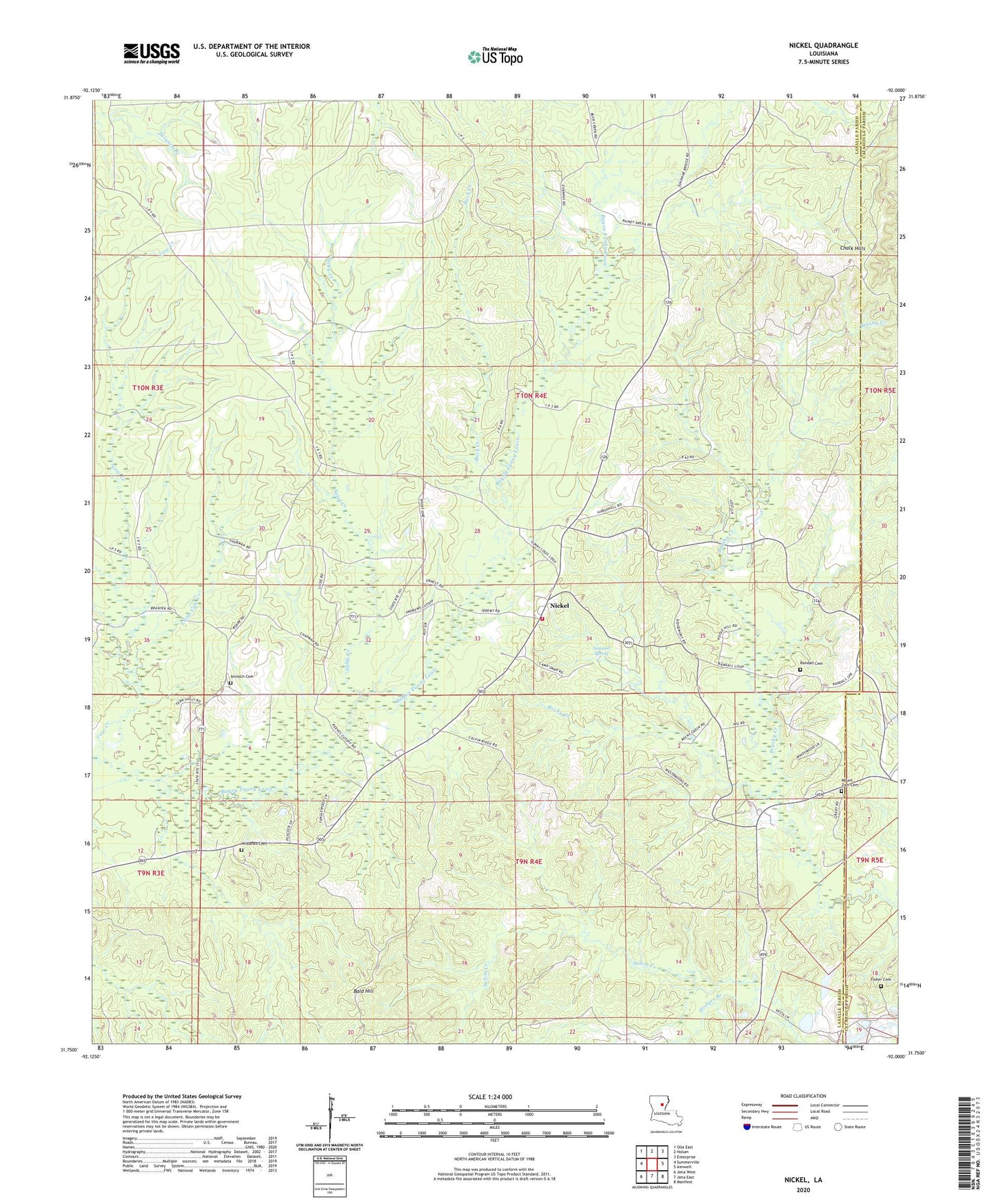
2024 topographic map quadrangle Nickel in the state of Louisiana. Scale: 1:24000. Based on the newly updated USGS 7.5' US Topo map series, this map is in the following counties: LaSalle, Catahoula. The map contains contour data, water features, and other items you are used to seeing on USGS maps, but also has updated roads and other features. This is the next generation of topographic maps. Printed on high-quality waterproof paper with UV fade-resistant inks.
Quads adjacent to this one:
West: Summerville
Northwest: Olla East
North: Holum
Northeast: Enterprise
East: Aimwell
Southeast: Manifest
South: Jena East
Southwest: Jena West
This map covers the same area as the classic USGS quad with code o31092g1.
Contains the following named places: Aimoch Baptist Church, Aimoch School, Aimwell Spring, Antioch Cemetery, Antioch Free Methodist Church, Antioch School, Bald Hill, Buck Creek, Cow Creek, Fisher Cemetery, Hodges Branch, Little Brushley Church, Little Cow Creek, Little Creek, Mount Zion Cemetery, Mount Zion Church, Nickel, Parish Governing Authority District 1, Randall Cemetery, Rocky Creek, Rosefield School, Salty Creek, Summerville - Rosefield Volunteer Fire Department, Ward One, Wilbanks Cemetery