MyTopo
Pine Prairie Louisiana US Topo Map
Couldn't load pickup availability
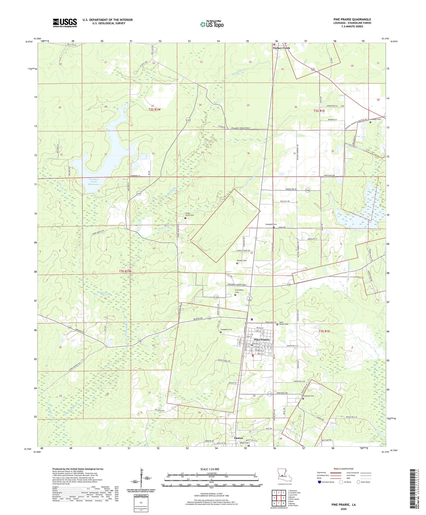
2020 topographic map quadrangle Pine Prairie in the state of Louisiana. Scale: 1:24000. Based on the newly updated USGS 7.5' US Topo map series, this map is in the following counties: Evangeline. The map contains contour data, water features, and other items you are used to seeing on USGS maps, but also has updated roads and other features. This is the next generation of topographic maps. Printed on high-quality waterproof paper with UV fade-resistant inks.
Quads adjacent to this one:
West: Beaver
Northwest: Glenmora
North: Cocodrie Lake
Northeast: Lone Pine
East: Saint Landry
Southeast: Ville Platte
South: Mamou
Southwest: Bond
Contains the following named places: Ardoin Cemetery, Bayou Nezpique, Beale, Beaver Creek, Campbell Cemetery, Carps Bayou, Cedar Grove Cemetery, Church of Christ, Crooked Creek Reservoir, Cypress Creek, Danahy Cemetery, Easton, Evangeline Parish Library Pine Prairie Branch, Evangeline Parish Library Turkey Creek Branch, Evangeline Parish Ward 5 Fire Protection District, First Baptist Church, Fontenot Cemetery, Friendship Baptist Church, Johnson Cemetery, Parish Governing Authority District 4, Pentecost Church, Pine Prairie, Pine Prairie Elementary School, Pine Prairie High School, Pine Prairie Police Department, Pine Prairie Post Office, Pine Prarie Wastewater Treatment Plant, Prairie Manor Nursing Home, Saint Peters Catholic Church, Saint Peters Cemetery, Trinity Baptist Church, Upper Bayou Nezpique Number Seven Dam, Upper Bayou Nezpique Number Six Dam, Upper Bayou Nezpique Number Three Dam, Village of Pine Prairie, Village of Turkey Creek, Ward Four, ZIP Code: 70576