MyTopo
Point Chevreuil Louisiana US Topo Map
Couldn't load pickup availability
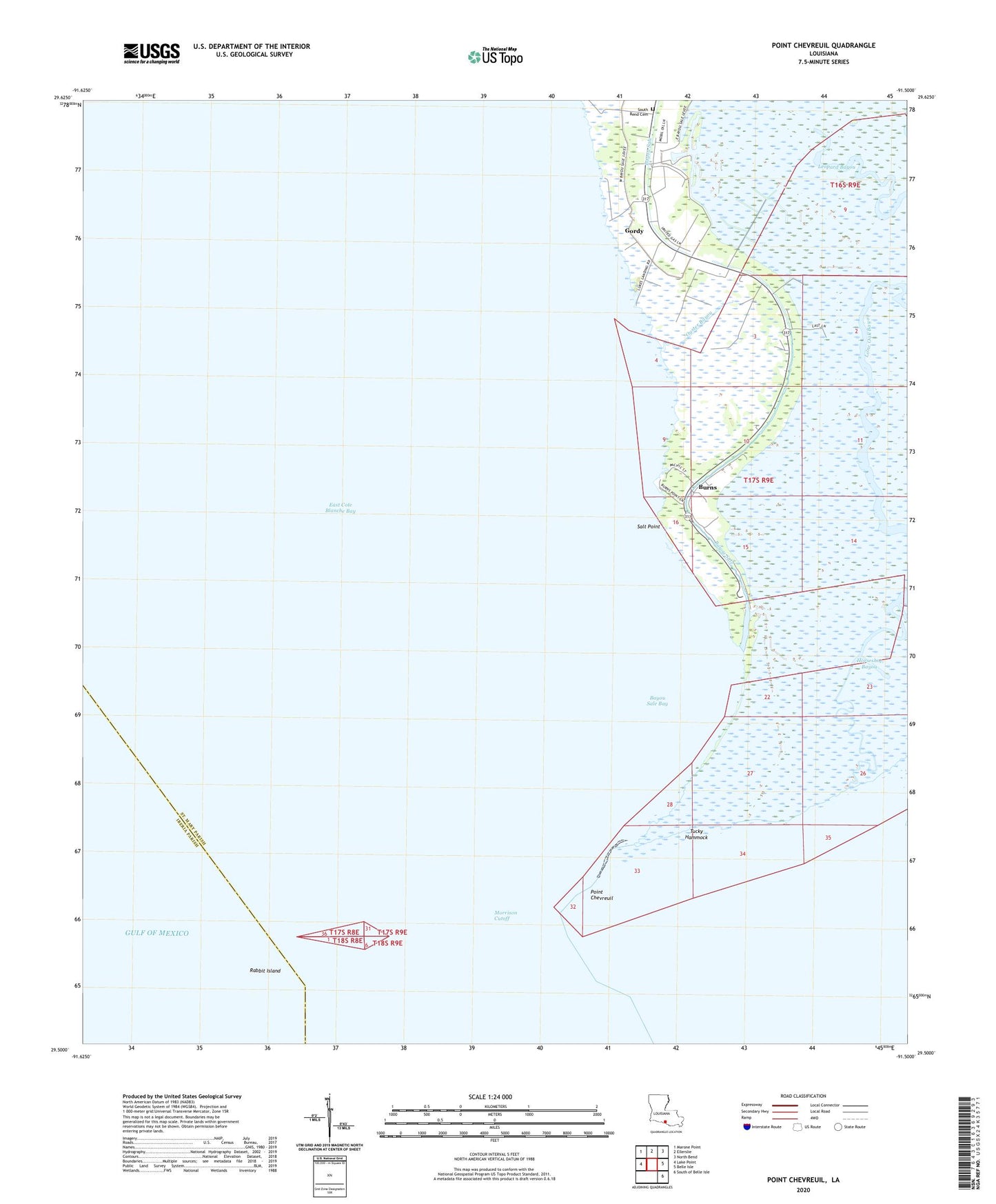
2025 topographic map quadrangle Point Chevreuil in the state of Louisiana. Scale: 1:24000. Based on the newly updated USGS 7.5' US Topo map series, this map is in the following counties: St. Mary, Iberia. The map contains contour data, water features, and other items you are used to seeing on USGS maps, but also has updated roads and other features. This is the next generation of topographic maps. Printed on high-quality waterproof paper with UV fade-resistant inks.
Quads adjacent to this one:
West: Lake Point
Northwest: Marone Point
North: Ellerslie
Northeast: North Bend
East: Belle Isle
Southeast: South of Belle Isle
This map covers the same area as the classic USGS quad with code o29091e5.
Contains the following named places: Bayou Sale, Bayou Sale Bay, Bayou Sale Oil and Gas Field, Burns, Burns Point Plant Heliport, East Cote Blanche Bay Oil and Gas Field, Gordy, Lone Oak Bayou, Luke Landing, Morrison Cutoff, Oyster Bayou, Point Chevreuil, Rabbit Island, Saint Mary Parish Police Jury, Salt Point, Shrimp Bayou, South Bend Cemetery, Tucky Hammock