MyTopo
Ellerslie Louisiana US Topo Map
Couldn't load pickup availability
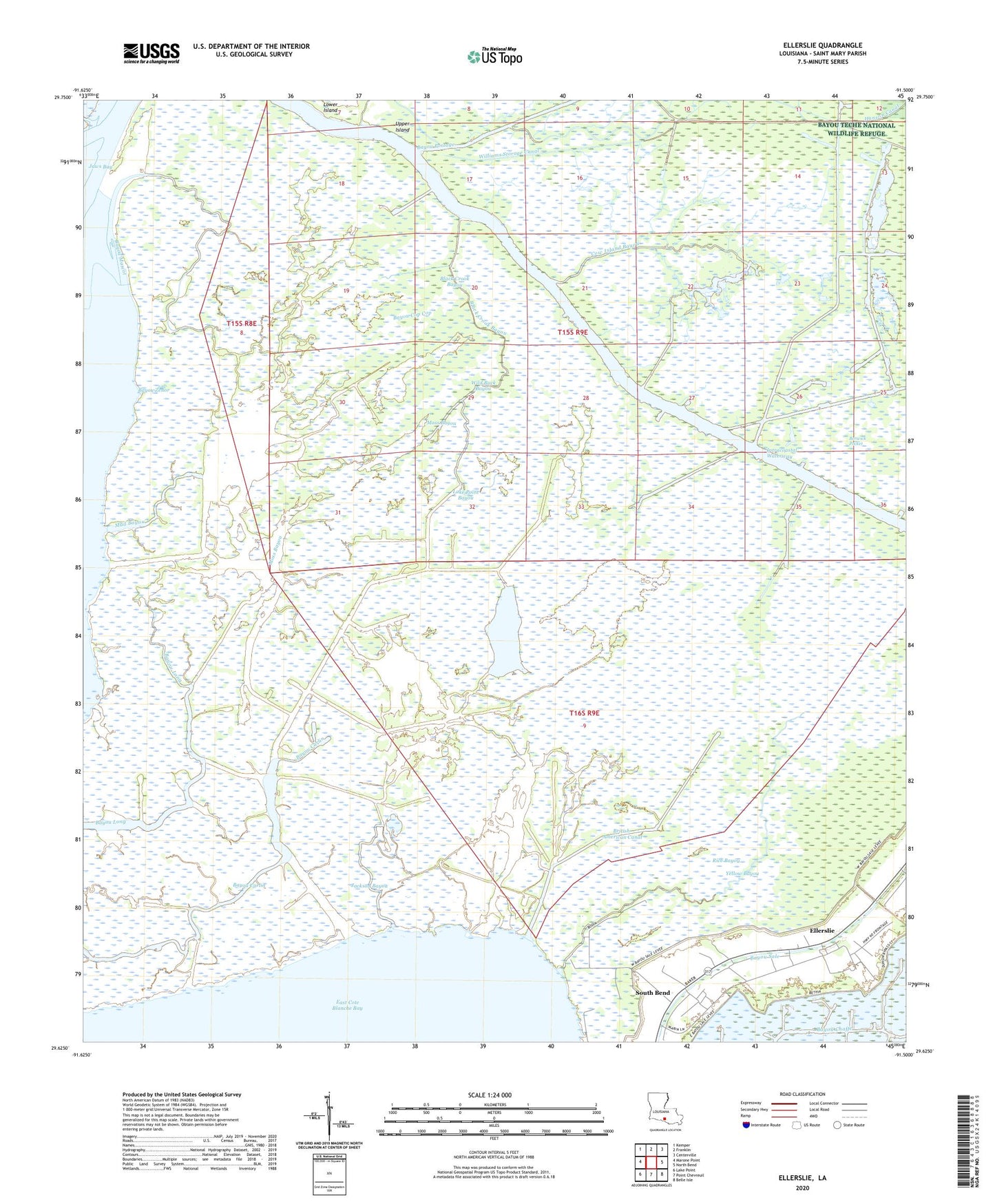
2024 topographic map quadrangle Ellerslie in the state of Louisiana. Scale: 1:24000. Based on the newly updated USGS 7.5' US Topo map series, this map is in the following counties: St. Mary. The map contains contour data, water features, and other items you are used to seeing on USGS maps, but also has updated roads and other features. This is the next generation of topographic maps. Printed on high-quality waterproof paper with UV fade-resistant inks.
Quads adjacent to this one:
West: Marone Point
Northwest: Kemper
North: Franklin
Northeast: Centerville
East: North Bend
Southeast: Belle Isle
South: Point Chevreuil
Southwest: Lake Point
This map covers the same area as the classic USGS quad with code o29091f5.
Contains the following named places: Bayou Carlin, Bayou Carlin Oil and Gas Field, Bayou Cop Cop, Bayou Long, Bayou Mascot, Bayou Portage, Bayou Zenor, Black Crook Bayou, British-American Canal, Cow Island Bayou, Ellerslie, Fresh Water Lake, Hanson Canal, Jackson Bayou, Jaws Bay, Lake Point Bayou, Moss Bayou, Mud Bayou, Rice Bayou, South Bend, Thorguson Canal, Upper Island, Wild Buck Bayou, Williams Storage Canal, Yellow Bayou