MyTopo
Pointe aux Marchettes Louisiana US Topo Map
Couldn't load pickup availability
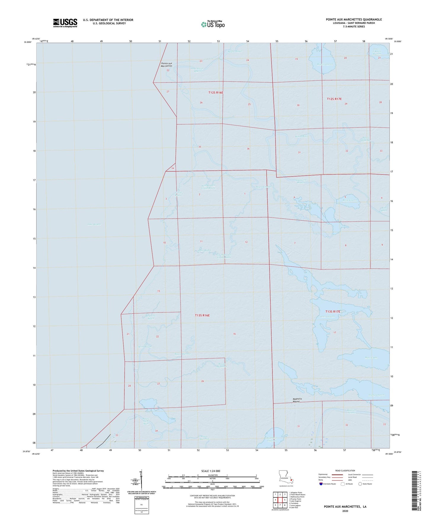
2024 topographic map quadrangle Pointe aux Marchettes in the state of Louisiana. Scale: 1:24000. Based on the newly updated USGS 7.5' US Topo map series, this map is in the following counties: St. Bernard. The map contains contour data, water features, and other items you are used to seeing on USGS maps, but also has updated roads and other features. This is the next generation of topographic maps. Printed on high-quality waterproof paper with UV fade-resistant inks.
Quads adjacent to this one:
West: Proctor Point
Northwest: Alligator Point
North: False Mouth Bayou
Northeast: Malheureux Point
East: Lake Eugenie
Southeast: Lake Eloi
South: Lena Lagoon
Southwest: Yscloskey
This map covers the same area as the classic USGS quad with code o29089h5.
Contains the following named places: Bayou Biloxi, Bayou Biloxi Gas Field, Bayou Grande, Bayou Hasouse, Bayou Magnolia, Bayou Muscelini, Bayou No Bayou, Biloxi Lagoon, Blind Bayou, Brick Lagoon, Cutoff Bayou, Cutoff Lagoon, Grand Lagoon, Lake Shore Bayou, Magill Lagoon, Magnolia Lagoon, Magnolia Mound, Mount Saint Malo, Muscle Bay, Negro Lagoon, Padre Bayou, Petes Lagoon, Pointe aux Marchettes, Saint Malo, South Branch Grand Bayou, Southwest Branch, Stump Lagoon, West Branch Grand Bayou